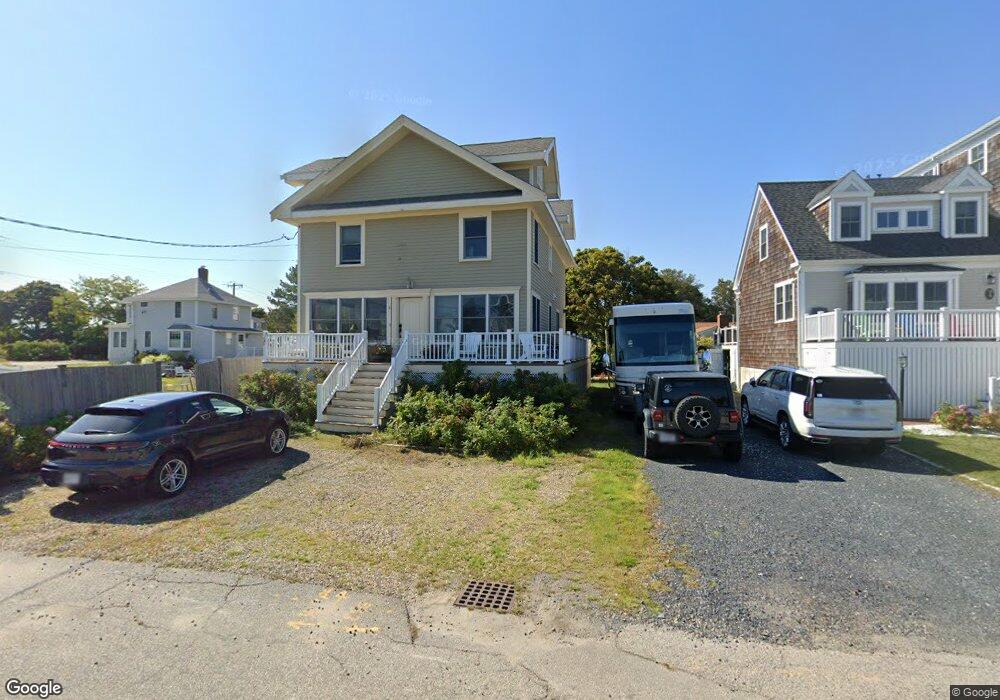
5 Otis Rd Unit 1 Scituate, MA 02066
Estimated Value: $1,294,000 - $1,485,563
4
Beds
3
Baths
2,492
Sq Ft
$561/Sq Ft
Est. Value
About This Home
This home is located at 5 Otis Rd Unit 1, Scituate, MA 02066 and is currently estimated at $1,397,891, approximately $560 per square foot. 5 Otis Rd Unit 1 is a home located in Plymouth County with nearby schools including Jenkins Elementary School, Lester J. Gates Middle School, and Scituate High School.
Ownership History
Date
Name
Owned For
Owner Type
Purchase Details
Closed on
Sep 1, 2020
Sold by
Garrity Joel and Garrity Jennifer
Bought by
Mulvey Thomas P and Mulvey Elizabeth N
Current Estimated Value
Purchase Details
Closed on
Jun 18, 2018
Sold by
Oconnell Paul D and Oconnell Patricia A
Bought by
Garrity Joel and Garrity Jennifer
Home Financials for this Owner
Home Financials are based on the most recent Mortgage that was taken out on this home.
Original Mortgage
$594,000
Interest Rate
4.5%
Mortgage Type
New Conventional
Purchase Details
Closed on
Apr 1, 2011
Sold by
Otis Rt and Wallace Robert V
Bought by
Oconnell Paul D and Oconnell Patricia A
Home Financials for this Owner
Home Financials are based on the most recent Mortgage that was taken out on this home.
Original Mortgage
$493,659
Interest Rate
5.25%
Mortgage Type
FHA
Purchase Details
Closed on
Aug 31, 2009
Sold by
Wallace Robert V and Wallace Katherine D
Bought by
Otis Rt
Purchase Details
Closed on
Oct 8, 2008
Sold by
Wallace Prop Co Inc
Bought by
Otis Rt
Purchase Details
Closed on
Jul 18, 2008
Sold by
Doherty Thomas J
Bought by
Wallace Prop Co Inc
Purchase Details
Closed on
Aug 18, 2006
Sold by
Wood Dexter E and Wood Joanne S
Bought by
Doherty Thomas J
Purchase Details
Closed on
Feb 24, 2006
Sold by
Groton Michele W
Bought by
Wood Dexter E and Wood Joanne S
Purchase Details
Closed on
Aug 6, 2003
Sold by
Gorton Andrew S and Gorton Michele W
Bought by
Gorton Michele W
Purchase Details
Closed on
Oct 23, 1998
Sold by
Thornton Paul B and Thornton Mary
Bought by
Gorton Andrew S and Gorton Michele W
Home Financials for this Owner
Home Financials are based on the most recent Mortgage that was taken out on this home.
Original Mortgage
$126,000
Interest Rate
6.74%
Mortgage Type
Purchase Money Mortgage
Create a Home Valuation Report for This Property
The Home Valuation Report is an in-depth analysis detailing your home's value as well as a comparison with similar homes in the area
Home Values in the Area
Average Home Value in this Area
Purchase History
| Date | Buyer | Sale Price | Title Company |
|---|---|---|---|
| Mulvey Thomas P | $800,000 | None Available | |
| Garrity Joel | $660,000 | -- | |
| Oconnell Paul D | $506,500 | -- | |
| Otis Rt | -- | -- | |
| Wallace Robert | -- | -- | |
| Otis Rt | -- | -- | |
| Wallace Prop Co Inc | -- | -- | |
| Doherty Thomas J | $349,100 | -- | |
| Wood Dexter E | $325,000 | -- | |
| Gorton Michele W | -- | -- | |
| Gorton Andrew S | $140,000 | -- |
Source: Public Records
Mortgage History
| Date | Status | Borrower | Loan Amount |
|---|---|---|---|
| Previous Owner | Garrity Joel | $594,000 | |
| Previous Owner | Oconnell Paul D | $493,659 | |
| Previous Owner | Gorton Andrew S | $68,962 | |
| Previous Owner | Gorton Andrew S | $31,757 | |
| Previous Owner | Gorton Andrew S | $126,000 | |
| Closed | Wood Dexter E | $0 |
Source: Public Records
Tax History Compared to Growth
Tax History
| Year | Tax Paid | Tax Assessment Tax Assessment Total Assessment is a certain percentage of the fair market value that is determined by local assessors to be the total taxable value of land and additions on the property. | Land | Improvement |
|---|---|---|---|---|
| 2025 | $10,903 | $1,091,400 | $380,400 | $711,000 |
| 2024 | $10,808 | $1,043,200 | $345,800 | $697,400 |
| 2023 | $9,777 | $934,800 | $314,400 | $620,400 |
| 2022 | $9,777 | $774,700 | $254,200 | $520,500 |
| 2021 | $9,136 | $685,400 | $242,100 | $443,300 |
| 2020 | $8,186 | $606,400 | $232,800 | $373,600 |
| 2019 | $23,249 | $539,600 | $228,200 | $311,400 |
| 2018 | $6,897 | $494,400 | $235,400 | $259,000 |
| 2017 | $6,828 | $484,600 | $225,600 | $259,000 |
| 2016 | $6,441 | $455,500 | $206,000 | $249,500 |
| 2015 | $5,837 | $445,600 | $196,100 | $249,500 |
Source: Public Records
Map
Nearby Homes
- 32 Barker Rd Unit 3
- 105 Turner Rd
- 12 Richfield Rd
- 50 Oceanside Dr
- 23 Lois Ann Ct Unit 23
- 23 Sunset Rd
- 21 Circuit Ave
- 148 Tilden Rd
- 91 Front St Unit 106
- 74 Tilden Rd
- 76 A Brook St
- 76 A Brook St Unit 1
- 209 Hatherly Rd
- 30 Irving Rd
- 50 First Parish Rd
- 12 Meeting House Ln Unit 308
- 18 James Way
- 55 Seaside Rd
- 7 Borden Rd
- 355 Tilden Rd
- 5 Otis Rd
- 9 Otis Rd
- 6 Foam Rd
- 133 Jericho Rd
- 16 Foam Rd Winter Rental
- 8 Foam Rd
- 4 Meadow Rd
- 10 Foam Rd
- 140 Jericho Rd (Harborfront)
- 13 Otis Rd
- 12 Foam Rd
- 143 Jericho Rd
- 14 Foam Road - Winter Rental Only
- 14 Foam Road - Winter Rental Only
- 5 Foam Rd
- 10 Meadow Rd
- 22 Spaulding Ave
- 7 Foam Rd
- 14 Foam Rd
- 14 Foam Rd