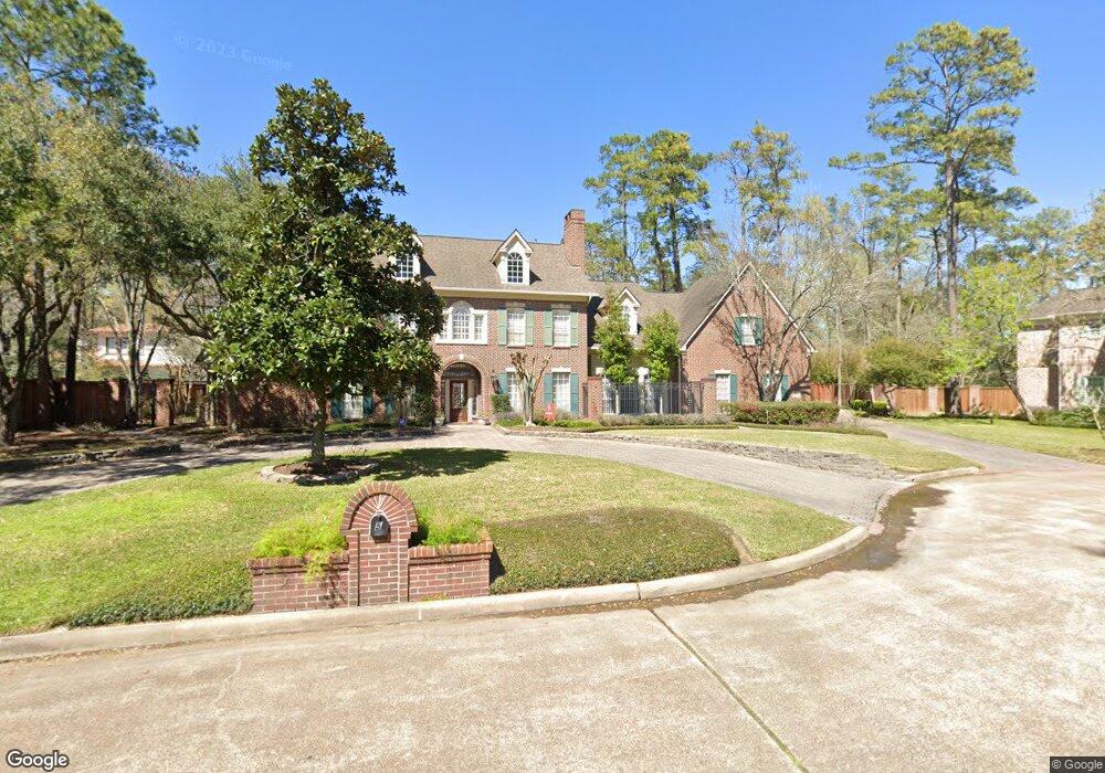
5 Patrick Ct Houston, TX 77024
Estimated Value: $2,450,000 - $2,612,000
5
Beds
7
Baths
5,634
Sq Ft
$446/Sq Ft
Est. Value
About This Home
This home is located at 5 Patrick Ct, Houston, TX 77024 and is currently estimated at $2,512,769, approximately $446 per square foot. 5 Patrick Ct is a home located in Harris County with nearby schools including Bunker Hill Elementary School, Memorial Middle, and Memorial High School.
Ownership History
Date
Name
Owned For
Owner Type
Purchase Details
Closed on
May 19, 2009
Sold by
Beasley Craig J and Beasley Betsy A
Bought by
Goodwin Weir R and Goodwin Cynthia C
Current Estimated Value
Home Financials for this Owner
Home Financials are based on the most recent Mortgage that was taken out on this home.
Original Mortgage
$750,000
Outstanding Balance
$473,612
Interest Rate
4.84%
Mortgage Type
Purchase Money Mortgage
Estimated Equity
$2,039,157
Purchase Details
Closed on
Apr 19, 2002
Sold by
Mercer Timothy D and Mercer Evelyn Allison
Bought by
Beasley Craig J and Beasley Betsy A
Home Financials for this Owner
Home Financials are based on the most recent Mortgage that was taken out on this home.
Original Mortgage
$300,000
Interest Rate
5.37%
Create a Home Valuation Report for This Property
The Home Valuation Report is an in-depth analysis detailing your home's value as well as a comparison with similar homes in the area
Home Values in the Area
Average Home Value in this Area
Purchase History
| Date | Buyer | Sale Price | Title Company |
|---|---|---|---|
| Goodwin Weir R | -- | Charter Title Company | |
| Beasley Craig J | -- | Stewart Title |
Source: Public Records
Mortgage History
| Date | Status | Borrower | Loan Amount |
|---|---|---|---|
| Open | Goodwin Weir R | $750,000 | |
| Previous Owner | Beasley Craig J | $300,000 | |
| Closed | Beasley Craig J | $200,000 |
Source: Public Records
Tax History
| Year | Tax Paid | Tax Assessment Tax Assessment Total Assessment is a certain percentage of the fair market value that is determined by local assessors to be the total taxable value of land and additions on the property. | Land | Improvement |
|---|---|---|---|---|
| 2025 | $28,403 | $2,210,969 | $1,237,650 | $973,319 |
| 2024 | $28,403 | $2,177,178 | $1,196,395 | $980,783 |
| 2023 | $28,403 | $2,147,616 | $1,134,513 | $1,013,103 |
| 2022 | $41,396 | $2,100,000 | $1,134,513 | $965,487 |
| 2021 | $39,196 | $1,866,549 | $1,072,630 | $793,919 |
| 2020 | $36,439 | $1,645,351 | $1,072,630 | $572,721 |
| 2019 | $40,971 | $1,776,209 | $1,072,630 | $703,579 |
| 2018 | $8,457 | $1,664,271 | $1,072,630 | $591,641 |
| 2017 | $38,389 | $1,664,271 | $1,072,630 | $591,641 |
| 2016 | $38,389 | $1,664,271 | $1,072,630 | $591,641 |
| 2015 | $26,051 | $1,745,000 | $1,072,630 | $672,370 |
| 2014 | $26,051 | $1,567,700 | $928,238 | $639,462 |
Source: Public Records
Map
Nearby Homes
- 5 Rip Van Winkle Ln
- 11840 Stuckey Ln
- 11910 Heritage Ln
- 345 Knipp Rd
- 26 Valley Forge Dr
- 318 Knipp Rd
- 12331 Beauregard Dr
- 711 Timber Hill Dr
- 727 Bunker Hill Rd Unit 43
- 12330 Boheme Dr
- 230 Gessner Rd
- 12 Gage Ct
- 358 Tealwood Dr
- 354 Tealwood Dr
- 11640 Greenbay St
- 7 Leisure Ln
- 12126 Kimberley Ln
- 11710 Wendover Ln
- 150 Gessner Rd Unit 4A
- 242 Vanderpool Ln
- 4 Rip Van Winkle Ln
- 7 Patrick Ct
- 3 Patrick Ct
- 6 Rip Van Winkle Ln
- 6 Patrick Ct
- 8 Patrick Ct
- 4 Patrick Ct
- 11919 Churchill Ct
- 1 Patrick Ct
- 2 Rip Van Winkle Ln
- 11923 Churchill Ct
- 3 Rip Van Winkle Ln
- 11926 Surrey Ln
- 11930 Surrey Ln
- 2 Patrick Ct
- 11922 Surrey Ln
- 11915 Churchill Ct
- 11927 Churchill Ct
- 11910 Mcleods Ln
- 1 Rip Van Winkle Ln
Your Personal Tour Guide
Ask me questions while you tour the home.