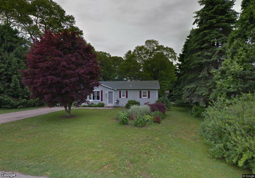
5 Paupock Run Westerly, RI 02891
Estimated Value: $488,000 - $637,000
3
Beds
2
Baths
1,080
Sq Ft
$494/Sq Ft
Est. Value
About This Home
This home is located at 5 Paupock Run, Westerly, RI 02891 and is currently estimated at $533,487, approximately $493 per square foot. 5 Paupock Run is a home located in Washington County with nearby schools including Westerly High School.
Ownership History
Date
Name
Owned For
Owner Type
Purchase Details
Closed on
Aug 31, 2015
Sold by
Derosa Daniel R
Bought by
Tripp Joanne R
Current Estimated Value
Purchase Details
Closed on
Feb 6, 2013
Sold by
Derosa Daniel R and Derosa Rose Z
Bought by
Derosa Daniel R
Purchase Details
Closed on
Jan 4, 2008
Sold by
Wells Fargo Bank Na
Bought by
Derosa Daniel R and Derosa Rose Z
Purchase Details
Closed on
Sep 26, 2007
Sold by
Romeo Stacee K and Romeo Sebastian J
Bought by
Option One Mortgage Co
Purchase Details
Closed on
Dec 5, 1995
Sold by
Mcgouran Norma H
Bought by
Romeo Sebastian J and Romeo Stacee
Create a Home Valuation Report for This Property
The Home Valuation Report is an in-depth analysis detailing your home's value as well as a comparison with similar homes in the area
Home Values in the Area
Average Home Value in this Area
Purchase History
| Date | Buyer | Sale Price | Title Company |
|---|---|---|---|
| Tripp Joanne R | $275,000 | -- | |
| Derosa Daniel R | -- | -- | |
| Derosa Daniel R | -- | -- | |
| Derosa Daniel R | $192,000 | -- | |
| Derosa Daniel R | $192,000 | -- | |
| Option One Mortgage Co | $211,000 | -- | |
| Option One Mortgage Co | $211,000 | -- | |
| Romeo Sebastian J | $105,000 | -- | |
| Romeo Sebastian J | $105,000 | -- |
Source: Public Records
Mortgage History
| Date | Status | Borrower | Loan Amount |
|---|---|---|---|
| Previous Owner | Romeo Sebastian J | $243,000 | |
| Previous Owner | Romeo Sebastian J | $162,000 |
Source: Public Records
Tax History
| Year | Tax Paid | Tax Assessment Tax Assessment Total Assessment is a certain percentage of the fair market value that is determined by local assessors to be the total taxable value of land and additions on the property. | Land | Improvement |
|---|---|---|---|---|
| 2025 | $3,035 | $426,900 | $196,300 | $230,600 |
| 2024 | $3,258 | $332,100 | $140,700 | $191,400 |
| 2023 | $3,195 | $332,100 | $140,700 | $191,400 |
| 2022 | $3,175 | $332,100 | $140,700 | $191,400 |
| 2021 | $3,106 | $269,600 | $122,400 | $147,200 |
| 2020 | $3,049 | $269,600 | $122,400 | $147,200 |
| 2019 | $3,020 | $269,600 | $122,400 | $147,200 |
| 2018 | $2,902 | $244,300 | $122,400 | $121,900 |
| 2017 | $2,831 | $244,300 | $122,400 | $121,900 |
| 2016 | $2,853 | $244,300 | $122,400 | $121,900 |
| 2015 | $2,565 | $237,100 | $125,000 | $112,100 |
| 2014 | $2,523 | $237,100 | $125,000 | $112,100 |
Source: Public Records
Map
Nearby Homes
- 5 Robin Hollow Ln
- 11 Bucks Trail
- 342 Post Rd
- 30 Clifford Dr
- 13 Plateau Rd
- 14 Evergreen Ln
- 46 Salt Pond Way
- 37 Urso Dr
- 20 Snowberry Ln
- 22 Breach Dr
- 15 Breach Dr
- 7 Fenway Rd
- 118 Dunns Corner Rd
- 597 Atlantic Ave
- 112 Noyes Neck Rd
- 54 Sherwood Dr
- 137 Cove Point Rd E
- 19 Wicklow Rd
- 446 Atlantic Ave
- 135 Ross Hill Rd
- 5 Tonkawa Ave
- 0 Tonkawa Ave
- 4 Tonkawa Ave
- 7 Tonkawa Ave
- 6 Tonkawa Ave
- 117 Quannacut Rd
- 131 Quannacut Rd
- 7 Paupock Run
- 9 Tonkawa Ave
- 115 Quannacut Rd
- 6 Paupock Run
- 9 Paupock Run
- 109 Quannacut Rd
- 11 Tonkawa Ave
- 10 Tonkawa Ave
- 5 Sunnyside Dr
- 116 Quannacut Rd
- 8 Paupock Run
- 3 Sunnyside Dr
- 105 Quannacut Rd
Your Personal Tour Guide
Ask me questions while you tour the home.