Estimated Value: $633,000 - $729,000
2
Beds
3
Baths
2,063
Sq Ft
$337/Sq Ft
Est. Value
About This Home
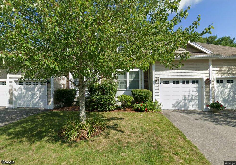
This home is located at 5 Preston Way Unit 37, Acton, MA 01720 and is currently estimated at $695,355, approximately $337 per square foot. 5 Preston Way Unit 37 is a home located in Middlesex County with nearby schools including Acton-Boxborough Regional High School and Oak Meadow Montessori School.
Ownership History
Date
Name
Owned For
Owner Type
Purchase Details
Closed on
May 6, 2011
Sold by
Davis Alliance Llc
Bought by
Marchand Ft
Current Estimated Value
Purchase Details
Closed on
Dec 10, 2010
Sold by
Nic Realty Llc
Bought by
Davis Alliance Llc
Home Financials for this Owner
Home Financials are based on the most recent Mortgage that was taken out on this home.
Original Mortgage
$247,500
Interest Rate
4.24%
Mortgage Type
Purchase Money Mortgage
Create a Home Valuation Report for This Property
The Home Valuation Report is an in-depth analysis detailing your home's value as well as a comparison with similar homes in the area
Home Values in the Area
Average Home Value in this Area
Purchase History
| Date | Buyer | Sale Price | Title Company |
|---|---|---|---|
| Marchand Ft | $357,375 | -- | |
| Davis Alliance Llc | $152,500 | -- |
Source: Public Records
Mortgage History
| Date | Status | Borrower | Loan Amount |
|---|---|---|---|
| Previous Owner | Davis Alliance Llc | $247,500 |
Source: Public Records
Tax History Compared to Growth
Tax History
| Year | Tax Paid | Tax Assessment Tax Assessment Total Assessment is a certain percentage of the fair market value that is determined by local assessors to be the total taxable value of land and additions on the property. | Land | Improvement |
|---|---|---|---|---|
| 2025 | $10,978 | $640,100 | $0 | $640,100 |
| 2024 | $10,367 | $621,900 | $0 | $621,900 |
| 2023 | $9,786 | $557,300 | $0 | $557,300 |
| 2022 | $9,894 | $508,700 | $0 | $508,700 |
| 2021 | $9,449 | $467,100 | $0 | $467,100 |
| 2020 | $8,610 | $447,500 | $0 | $447,500 |
| 2019 | $8,201 | $423,400 | $0 | $423,400 |
| 2018 | $7,988 | $412,200 | $0 | $412,200 |
| 2017 | $6,692 | $351,100 | $0 | $351,100 |
| 2016 | $6,869 | $357,200 | $0 | $357,200 |
| 2015 | $6,538 | $343,200 | $0 | $343,200 |
| 2014 | $6,391 | $328,600 | $0 | $328,600 |
Source: Public Records
Map
Nearby Homes
- 927 Main St
- 875 Acton St
- 17 Northbriar Rd
- 1 Quarry Rd
- 407 Great Rd Unit 9
- 403 Great Rd Unit 5
- 601 Old Stone Brook
- 428 Great Rd Unit 10
- 420 Great Rd Unit B3
- 517 Tumbling Hawk
- 390 Great Rd Unit A2
- 386 Great Rd Unit A8
- 484 Great Rd
- 484 Great Rd
- 237 Brown Bear Crossing Unit 237
- 140 Butternut Hollow Unit 140
- 484 Great Road -3
- 484 Great Road -4
- 484 Great Road -6
- 16 Wampus Ave Unit 32
- 7 Preston Way
- 5 Preston Way
- 7 Preston Way Unit 7
- 7 Preston Way Unit 38
- 1 Preston Way
- 1 Preston Way Unit 35
- 3 Preston Way
- 3 Preston Way Unit 3
- 3 Preston Way Unit 36
- 15 Preston Way
- 15 Preston Way Unit 41
- 11 Preston Way
- 9 Preston Way
- 9 Preston Way Unit 39
- 11 Preston Way Unit 40
- 6 Preston Way
- 8 Preston Way
- 2 Preston Way
- 2 Preston Way Unit 2
- 2 Preston Way Unit 63