A
Seller's Agent in 2019
Amy King
Keller Williams Realty Evolution

Estimated Value: $939,000 - $1,202,000
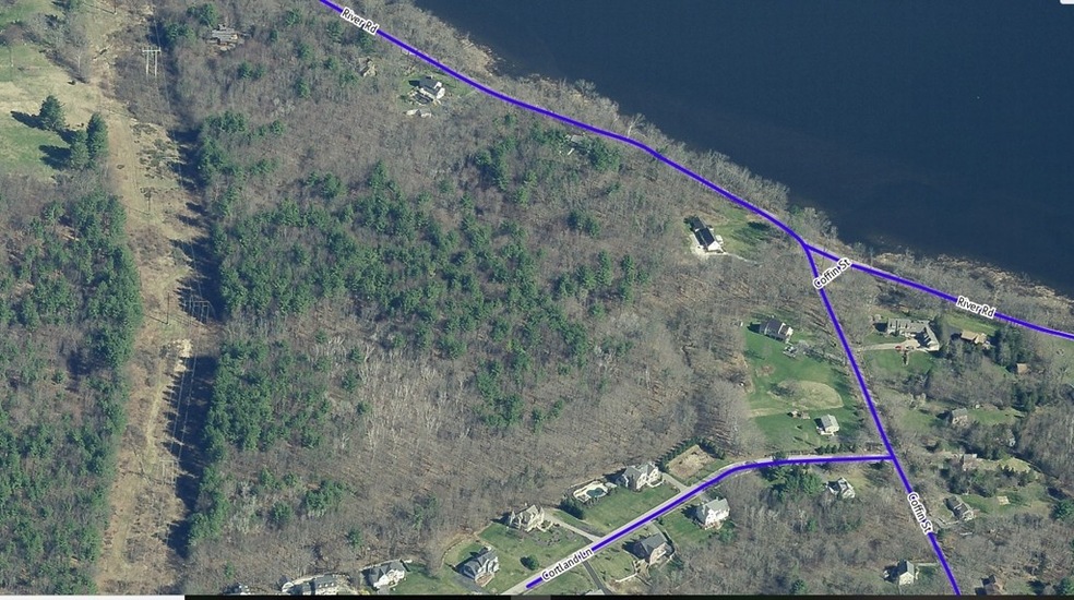
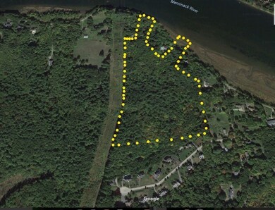
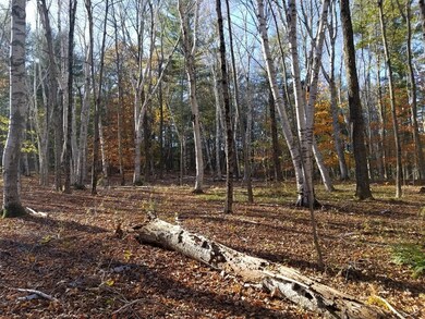
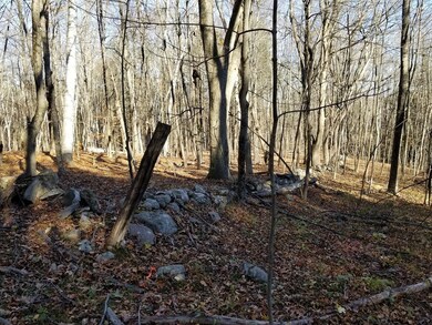
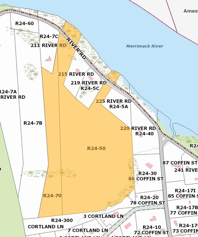
New price on this potential residential parcel. Prime opportunity for the right buyer. Picturesque estate setting with over 31 acres of private land in a highly desirable area. This beautiful, wooded parcel features towering pine trees, meandering stone walls and direct access to the Merrimack River. Take advantage of this rare land offering to build in scenic West Newbury. Enjoy views, nature trails, and quiet, all minutes away from the amenities of downtown Newburyport as well as Route 95 and train/bus to Boston. Permits and engineering are responsibility of buyer, but seller will assist as needed. This sale is for 2 adjacent lots: Assessor's reference: Lot R24-50 and R24-70 with approximately .75 acre that borders the river and is separated from the rest of the parcel by River Road. This could be the perfect spring project.
Last Agent to Sell the Property
Amy King
Keller Williams Realty Evolution License #452001522 Listed on: 11/10/2017

Last Buyer's Agent
Amy King
Keller Williams Realty Evolution License #452001522 Listed on: 11/10/2017
| Date | Buyer | Sale Price | Title Company |
|---|---|---|---|
| Una Lily T | -- | None Available | |
| Una Lily T | -- | None Available |
| Date | Event | Price | List to Sale | Price per Sq Ft |
|---|---|---|---|---|
| 09/30/2019 09/30/19 | Sold | $215,000 | -52.2% | -- |
| 01/05/2019 01/05/19 | Pending | -- | -- | -- |
| 12/29/2018 12/29/18 | Price Changed | $450,000 | -21.7% | -- |
| 09/20/2018 09/20/18 | Price Changed | $575,000 | -27.7% | -- |
| 08/17/2018 08/17/18 | For Sale | $795,000 | 0.0% | -- |
| 07/27/2018 07/27/18 | Pending | -- | -- | -- |
| 07/18/2018 07/18/18 | For Sale | $795,000 | 0.0% | -- |
| 06/29/2018 06/29/18 | Pending | -- | -- | -- |
| 05/30/2018 05/30/18 | Price Changed | $795,000 | -19.3% | -- |
| 11/10/2017 11/10/17 | For Sale | $985,000 | -- | -- |
| Year | Tax Paid | Tax Assessment Tax Assessment Total Assessment is a certain percentage of the fair market value that is determined by local assessors to be the total taxable value of land and additions on the property. | Land | Improvement |
|---|---|---|---|---|
| 2025 | $10,276 | $951,500 | $399,800 | $551,700 |
| 2024 | $10,039 | $927,800 | $471,100 | $456,700 |
| 2023 | $9,396 | $851,900 | $437,000 | $414,900 |
| 2022 | $10,547 | $810,700 | $441,700 | $369,000 |
| 2021 | $10,173 | $683,700 | $373,100 | $310,600 |
| 2020 | $9,943 | $689,500 | $373,100 | $316,400 |
| 2019 | $10,141 | $696,000 | $373,100 | $322,900 |
| 2018 | $9,420 | $647,000 | $343,700 | $303,300 |
| 2017 | $9,414 | $647,000 | $343,700 | $303,300 |
| 2016 | $8,835 | $603,900 | $300,600 | $303,300 |
| 2015 | $8,868 | $565,200 | $300,600 | $264,600 |
A
Seller's Agent in 2019
Amy King
Keller Williams Realty Evolution
Source: MLS Property Information Network (MLS PIN)
MLS Number: 72254397
APN: WNEW-000012-000000-000015B
Disclaimer: Certain information contained herein is derived from information provided by parties other than Homes.com. All information provided is deemed reliable, but is not guaranteed to be accurate and should be independently verified.
![]() The property listing data and information, or the Images, set forth herein were provided to MLS Property Information Network, Inc. from third party sources, including sellers, lessors and public records, and were compiled by MLS Property Information Network, Inc. The property listing data and information, and the Images, are for the personal, non-commercial use of consumers having a good faith interest in purchasing or leasing listed properties of the type displayed to them and may not be used for any purpose other than to identify prospective properties which such consumers may have a good faith interest in purchasing or leasing. MLS Property Information Network, Inc. and its subscribers disclaim any and all representations and warranties as to the accuracy of the property listing data and information, or as to the accuracy of any of the Images, set forth herein.
The property listing data and information, or the Images, set forth herein were provided to MLS Property Information Network, Inc. from third party sources, including sellers, lessors and public records, and were compiled by MLS Property Information Network, Inc. The property listing data and information, and the Images, are for the personal, non-commercial use of consumers having a good faith interest in purchasing or leasing listed properties of the type displayed to them and may not be used for any purpose other than to identify prospective properties which such consumers may have a good faith interest in purchasing or leasing. MLS Property Information Network, Inc. and its subscribers disclaim any and all representations and warranties as to the accuracy of the property listing data and information, or as to the accuracy of any of the Images, set forth herein.