Estimated Value: $502,036 - $536,000
2
Beds
4
Baths
960
Sq Ft
$537/Sq Ft
Est. Value
About This Home
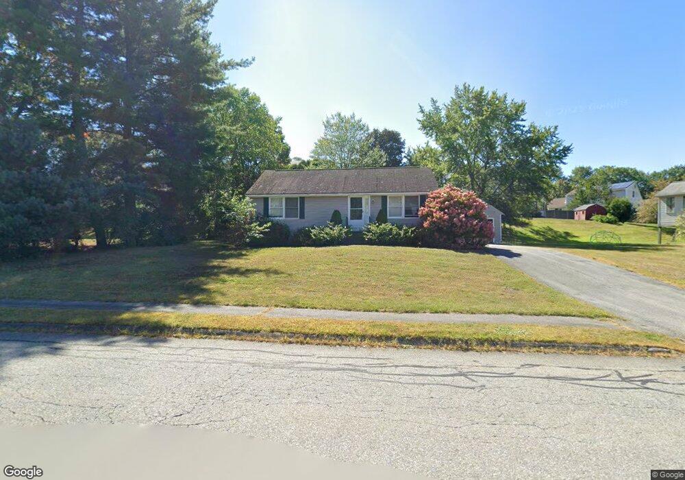
This home is located at 5 Robbins Rd, Ayer, MA 01432 and is currently estimated at $515,759, approximately $537 per square foot. 5 Robbins Rd is a home located in Middlesex County with nearby schools including Page Hilltop School, Lura A. White Elementary School, and Ayer Shirley Regional Middle School.
Ownership History
Date
Name
Owned For
Owner Type
Purchase Details
Closed on
Jun 9, 2005
Sold by
Scannell-Stolitzka Joyce
Bought by
Norton Jodi and Norton Michael
Current Estimated Value
Home Financials for this Owner
Home Financials are based on the most recent Mortgage that was taken out on this home.
Original Mortgage
$212,000
Outstanding Balance
$110,890
Interest Rate
5.79%
Mortgage Type
Purchase Money Mortgage
Estimated Equity
$404,869
Purchase Details
Closed on
Dec 27, 1995
Sold by
Bruce Home Inc
Bought by
Scannell William J
Home Financials for this Owner
Home Financials are based on the most recent Mortgage that was taken out on this home.
Original Mortgage
$20,000
Interest Rate
7.33%
Mortgage Type
Purchase Money Mortgage
Create a Home Valuation Report for This Property
The Home Valuation Report is an in-depth analysis detailing your home's value as well as a comparison with similar homes in the area
Home Values in the Area
Average Home Value in this Area
Purchase History
| Date | Buyer | Sale Price | Title Company |
|---|---|---|---|
| Norton Jodi | $265,000 | -- | |
| Scannell William J | $139,000 | -- |
Source: Public Records
Mortgage History
| Date | Status | Borrower | Loan Amount |
|---|---|---|---|
| Open | Norton Jodi | $212,000 | |
| Previous Owner | Scannell William J | $20,000 |
Source: Public Records
Tax History
| Year | Tax Paid | Tax Assessment Tax Assessment Total Assessment is a certain percentage of the fair market value that is determined by local assessors to be the total taxable value of land and additions on the property. | Land | Improvement |
|---|---|---|---|---|
| 2025 | $5,103 | $426,700 | $174,000 | $252,700 |
| 2024 | $4,862 | $396,900 | $174,000 | $222,900 |
| 2023 | $4,574 | $368,300 | $163,100 | $205,200 |
| 2022 | $4,425 | $329,700 | $142,300 | $187,400 |
| 2021 | $4,392 | $310,600 | $133,600 | $177,000 |
| 2020 | $4,110 | $291,500 | $128,300 | $163,200 |
| 2019 | $3,816 | $280,000 | $122,300 | $157,700 |
| 2018 | $10,651 | $262,300 | $118,600 | $143,700 |
| 2017 | $7,715 | $251,000 | $115,200 | $135,800 |
| 2016 | $3,462 | $238,300 | $114,900 | $123,400 |
| 2015 | $3,427 | $234,400 | $114,900 | $119,500 |
| 2014 | $3,268 | $232,100 | $114,900 | $117,200 |
Source: Public Records
Map
Nearby Homes
- 55 Littleton Rd Unit 8B
- 78 Shaker Rd
- 17 Chestnut Ln
- 75 Sandy Pond Rd Unit 41
- 239 Ayer Rd Unit 16
- 239 Ayer Rd Unit 46
- 37 Willard St
- 4 Spectacle Pond Rd
- 7 Baldwin Ct Unit 7
- 0 Ayer Rd
- 100 Central Ave Unit 4
- 0 Ayer & Old Mill Rd
- 18A S Shaker Rd
- 63 E Main St
- 3 Taylor St
- 21 High St
- 38 Norwood Ave
- 23 Nashua St
- 9 (Lt 44) Darrell Dr
- 98 Pleasant St
Your Personal Tour Guide
Ask me questions while you tour the home.