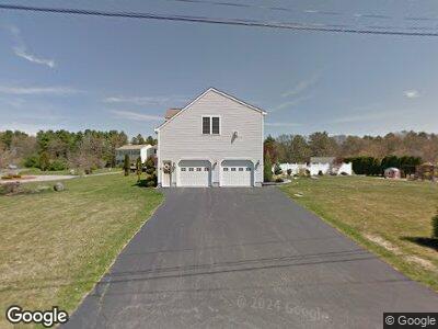
5 Rose Way Taunton, MA 02780
Wades Corner NeighborhoodEstimated Value: $674,568 - $751,000
3
Beds
3
Baths
2,656
Sq Ft
$268/Sq Ft
Est. Value
About This Home
This home is located at 5 Rose Way, Taunton, MA 02780 and is currently estimated at $712,892, approximately $268 per square foot. 5 Rose Way is a home located in Bristol County with nearby schools including Edmund Hatch Bennett School, Benjamin Friedman Middle School, and Taunton High School.
Ownership History
Date
Name
Owned For
Owner Type
Purchase Details
Closed on
Apr 15, 2003
Sold by
Lundberg Eric M and Lundberg Wendy H
Bought by
Gravel David A and Gravel Kimberly A
Current Estimated Value
Home Financials for this Owner
Home Financials are based on the most recent Mortgage that was taken out on this home.
Original Mortgage
$255,000
Interest Rate
5.86%
Mortgage Type
Purchase Money Mortgage
Purchase Details
Closed on
Dec 1, 1998
Sold by
Mann Associates Lp and Mann David B
Bought by
Lundberg Eric M and Lundberg Wendy H
Home Financials for this Owner
Home Financials are based on the most recent Mortgage that was taken out on this home.
Original Mortgage
$151,120
Interest Rate
6.83%
Mortgage Type
Purchase Money Mortgage
Create a Home Valuation Report for This Property
The Home Valuation Report is an in-depth analysis detailing your home's value as well as a comparison with similar homes in the area
Home Values in the Area
Average Home Value in this Area
Purchase History
| Date | Buyer | Sale Price | Title Company |
|---|---|---|---|
| Gravel David A | $380,000 | -- | |
| Lundberg Eric M | $65,000 | -- |
Source: Public Records
Mortgage History
| Date | Status | Borrower | Loan Amount |
|---|---|---|---|
| Open | Gravel David A | $344,000 | |
| Closed | Gravel David A | $360,000 | |
| Closed | Lundberg Eric M | $359,209 | |
| Closed | Gravel David A | $375,000 | |
| Closed | Gravel David A | $25,000 | |
| Closed | Gravel David A | $255,000 | |
| Previous Owner | Lundberg Eric M | $165,000 | |
| Previous Owner | Lundberg Eric M | $200,000 | |
| Previous Owner | Lundberg Eric M | $151,120 |
Source: Public Records
Tax History Compared to Growth
Tax History
| Year | Tax Paid | Tax Assessment Tax Assessment Total Assessment is a certain percentage of the fair market value that is determined by local assessors to be the total taxable value of land and additions on the property. | Land | Improvement |
|---|---|---|---|---|
| 2025 | $6,711 | $613,400 | $143,700 | $469,700 |
| 2024 | $6,045 | $540,200 | $143,700 | $396,500 |
| 2023 | $5,921 | $491,400 | $137,200 | $354,200 |
| 2022 | $5,894 | $447,200 | $125,200 | $322,000 |
| 2021 | $5,768 | $406,200 | $113,900 | $292,300 |
| 2020 | $5,648 | $380,100 | $113,900 | $266,200 |
| 2019 | $5,789 | $367,300 | $117,800 | $249,500 |
| 2018 | $5,645 | $359,100 | $119,000 | $240,100 |
| 2017 | $5,415 | $344,700 | $113,100 | $231,600 |
| 2016 | $5,278 | $336,600 | $109,700 | $226,900 |
| 2015 | $5,136 | $342,200 | $111,400 | $230,800 |
| 2014 | $5,057 | $346,100 | $111,400 | $234,700 |
Source: Public Records
Map
Nearby Homes
- 0 Rocky Woods St
- 130 N Walker St
- 1 N Walker St
- 368 Tremont St
- 365 Tremont St
- 382 Winthrop St
- 15 Floyd Ave
- 39 Thayer Dr
- 424 Winthrop St
- 1381 Cohannet St
- 0 Norton Ave Unit 73362595
- 31 Thayer Dr
- 464 Tremont St
- 25 Thayer Dr
- 26 Thayer Dr
- 482 Tremont St
- 28 Anawan St
- 1 Upland Rd
- 48 Twin Brook Ln
- 1 Thayer Dr