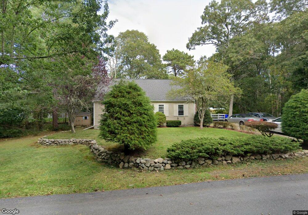
5 Sanderling Dr Cataumet, MA 02534
Cataumet NeighborhoodEstimated Value: $629,315 - $845,000
3
Beds
2
Baths
1,596
Sq Ft
$449/Sq Ft
Est. Value
About This Home
This home is located at 5 Sanderling Dr, Cataumet, MA 02534 and is currently estimated at $716,079, approximately $448 per square foot. 5 Sanderling Dr is a home located in Barnstable County with nearby schools including Bourne High School, Cadence Academy Preschool - Bourne, and Heritage Christian Academy.
Ownership History
Date
Name
Owned For
Owner Type
Purchase Details
Closed on
Jan 15, 2010
Sold by
Deutsche Bank Natl T C
Bought by
Mcnamara Gail R
Current Estimated Value
Home Financials for this Owner
Home Financials are based on the most recent Mortgage that was taken out on this home.
Original Mortgage
$130,000
Outstanding Balance
$83,617
Interest Rate
4.71%
Mortgage Type
Purchase Money Mortgage
Estimated Equity
$632,462
Purchase Details
Closed on
Mar 26, 2009
Sold by
Abbe Linda E and Deutsche Bank Natl T C
Bought by
Deutsche Bank Natl T C
Purchase Details
Closed on
Aug 27, 2004
Sold by
5 Sanderling Drive Rt and Decoste
Bought by
Abbe Linda E
Purchase Details
Closed on
Feb 19, 1998
Sold by
Clymer Kevin B and Clymer Sarah J
Bought by
Decoste Bryan J and Decoste Monique T
Create a Home Valuation Report for This Property
The Home Valuation Report is an in-depth analysis detailing your home's value as well as a comparison with similar homes in the area
Home Values in the Area
Average Home Value in this Area
Purchase History
| Date | Buyer | Sale Price | Title Company |
|---|---|---|---|
| Mcnamara Gail R | $230,900 | -- | |
| Mcnamara Gail R | $230,900 | -- | |
| Deutsche Bank Natl T C | $226,000 | -- | |
| Deutsche Bank Natl T C | $226,000 | -- | |
| Abbe Linda E | $383,000 | -- | |
| Abbe Linda E | $383,000 | -- | |
| Decoste Bryan J | $118,000 | -- | |
| Decoste Bryan J | $118,000 | -- |
Source: Public Records
Mortgage History
| Date | Status | Borrower | Loan Amount |
|---|---|---|---|
| Open | Mcnamara Gail R | $130,000 | |
| Closed | Decoste Bryan J | $130,000 | |
| Previous Owner | Decoste Bryan J | $49,750 |
Source: Public Records
Tax History
| Year | Tax Paid | Tax Assessment Tax Assessment Total Assessment is a certain percentage of the fair market value that is determined by local assessors to be the total taxable value of land and additions on the property. | Land | Improvement |
|---|---|---|---|---|
| 2025 | $4,243 | $543,300 | $233,700 | $309,600 |
| 2024 | $4,149 | $517,300 | $222,500 | $294,800 |
| 2023 | $4,032 | $457,700 | $196,900 | $260,800 |
| 2022 | $3,875 | $384,000 | $174,300 | $209,700 |
| 2021 | $3,764 | $349,500 | $158,600 | $190,900 |
| 2020 | $3,560 | $331,500 | $157,100 | $174,400 |
| 2019 | $3,380 | $321,600 | $157,100 | $164,500 |
| 2018 | $3,228 | $306,300 | $149,600 | $156,700 |
| 2017 | $3,083 | $299,300 | $154,100 | $145,200 |
| 2016 | $3,009 | $296,200 | $154,100 | $142,100 |
| 2015 | $2,923 | $290,300 | $148,200 | $142,100 |
Source: Public Records
Map
Nearby Homes
- 31 Baxendale Rd
- 15 Oak Ave
- 1234 Route 28a
- 289 Old Main Rd
- 1234 Route 28a
- 250 Scraggy Neck Rd
- 48 Red Brook Harbor Rd
- 75 Winsor Rd
- 393 N Falmouth Hwy Unit 8
- 14 Ryder Rd
- 10 Rockledge Dr
- 209 Waterside Dr
- 267 N Falmouth Hwy
- 91 Wickertree Rd
- 213 N Falmouth Hwy Unit 5A
- 16 Michael Rd
- 41 Braeburn Ct
- 7 4th Ave
- 3 4th Ave
- 75 Streeter Hill Rd
- 5 Sanderling Dr
- 5 Sanderling Dr
- 8 Whimbrel Dr
- 9 Sanderling Dr
- 30 Baxendale Rd
- 10 Whimbrel Dr
- 11 Sanderling Dr
- 12 Whimbrel Dr
- 3 Pintail Cir
- 2 Pintail Cir
- 1379 Rt 28a Unit 4
- 1379 Rt 28a
- 7 Sanderling Dr
- 7 Sanderling Dr
- 2 Whimbrel Dr
- 1379 Route 28a Unit 4
- 1379 Route 28a
- 1379 Massachusetts 28a
- 1379 Route 28a
- 1379 Route 28a
Your Personal Tour Guide
Ask me questions while you tour the home.