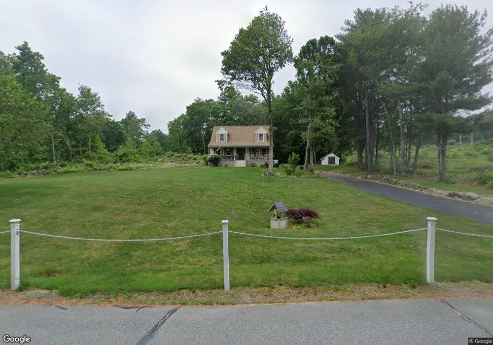
5 Shelly Dr Pelham, NH 03076
Estimated Value: $597,592 - $666,000
3
Beds
2
Baths
1,685
Sq Ft
$373/Sq Ft
Est. Value
About This Home
This home is located at 5 Shelly Dr, Pelham, NH 03076 and is currently estimated at $628,898, approximately $373 per square foot. 5 Shelly Dr is a home with nearby schools including Pelham Elementary School, Pelham Memorial School, and Pelham High School.
Ownership History
Date
Name
Owned For
Owner Type
Purchase Details
Closed on
Jul 14, 2022
Sold by
Mcadam Philip B and Mcadam Theresa A
Bought by
Mcadam Philip B
Current Estimated Value
Home Financials for this Owner
Home Financials are based on the most recent Mortgage that was taken out on this home.
Original Mortgage
$231,000
Outstanding Balance
$217,276
Interest Rate
3.88%
Mortgage Type
Adjustable Rate Mortgage/ARM
Estimated Equity
$411,622
Purchase Details
Closed on
Jan 15, 2021
Sold by
Leccese Ft and Leccese
Bought by
Galiatsatos Nikolas and Leccese Stephanie L
Create a Home Valuation Report for This Property
The Home Valuation Report is an in-depth analysis detailing your home's value as well as a comparison with similar homes in the area
Home Values in the Area
Average Home Value in this Area
Purchase History
| Date | Buyer | Sale Price | Title Company |
|---|---|---|---|
| Mcadam Philip B | -- | None Available | |
| Mcadam Philip B | -- | None Available | |
| Galiatsatos Nikolas | $560,000 | None Available | |
| Galiatsatos Nikolas | $560,000 | None Available |
Source: Public Records
Mortgage History
| Date | Status | Borrower | Loan Amount |
|---|---|---|---|
| Open | Mcadam Philip B | $231,000 | |
| Closed | Mcadam Philip B | $231,000 |
Source: Public Records
Tax History Compared to Growth
Tax History
| Year | Tax Paid | Tax Assessment Tax Assessment Total Assessment is a certain percentage of the fair market value that is determined by local assessors to be the total taxable value of land and additions on the property. | Land | Improvement |
|---|---|---|---|---|
| 2024 | $7,285 | $397,200 | $157,900 | $239,300 |
| 2023 | $7,225 | $397,200 | $157,900 | $239,300 |
| 2022 | $6,919 | $397,200 | $157,900 | $239,300 |
| 2021 | $6,317 | $395,800 | $157,900 | $237,900 |
| 2020 | $6,323 | $313,000 | $126,400 | $186,600 |
| 2019 | $6,072 | $313,000 | $126,400 | $186,600 |
| 2018 | $6,226 | $290,100 | $126,400 | $163,700 |
| 2017 | $6,223 | $290,100 | $126,400 | $163,700 |
| 2016 | $6,078 | $290,100 | $126,400 | $163,700 |
| 2015 | $5,980 | $257,100 | $120,300 | $136,800 |
| 2014 | $5,880 | $257,100 | $120,300 | $136,800 |
| 2013 | $5,880 | $257,100 | $120,300 | $136,800 |
Source: Public Records
Map
Nearby Homes
- 1119 Mammoth Rd
- 11 Venus Way
- 7 Venus Way Unit 22
- 2 Cypress Ln
- 7 Cypress Ln Unit 5
- 4 Cypress Ln Unit 10
- 23 Ryan Farm Rd
- 96 Simpson Rd
- 24 Del Ray Dr Unit 25
- 24 Del Ray Dr
- 138 Castle Hill Rd
- 6 Lancaster Rd
- 29 Rock Pond Rd
- 1 Redwood Rd
- 11 Teloian Dr
- 63 Mammoth Rd
- 1 Alpine Rd
- 45 Sharon Rd
- 219 Range Rd
- 6 Lund Dr