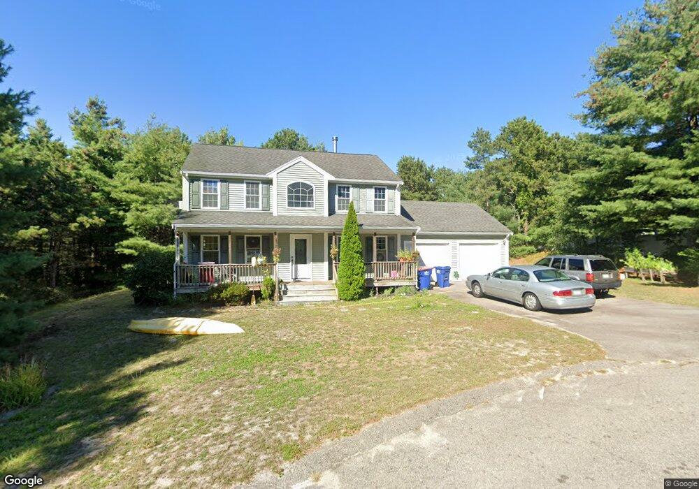
5 Sloop Ln Wareham, MA 02571
Estimated Value: $613,889 - $694,000
3
Beds
3
Baths
1,632
Sq Ft
$406/Sq Ft
Est. Value
About This Home
This home is located at 5 Sloop Ln, Wareham, MA 02571 and is currently estimated at $662,472, approximately $405 per square foot. 5 Sloop Ln is a home located in Plymouth County.
Ownership History
Date
Name
Owned For
Owner Type
Purchase Details
Closed on
Dec 2, 2019
Sold by
Churchill John L
Bought by
Jas Realty Llc
Current Estimated Value
Purchase Details
Closed on
Mar 23, 2009
Sold by
Sarajon Realty Llc and Churchill
Bought by
Churchill John L
Home Financials for this Owner
Home Financials are based on the most recent Mortgage that was taken out on this home.
Original Mortgage
$255,000
Interest Rate
5.25%
Mortgage Type
Purchase Money Mortgage
Purchase Details
Closed on
Nov 6, 2007
Sold by
Churchill John L
Bought by
Sarajon Realty Llc
Purchase Details
Closed on
Sep 26, 2007
Sold by
Sloop Lane Rt and Smith
Bought by
Churchill John L
Purchase Details
Closed on
Jul 24, 2007
Sold by
Sarajon Realty Llc and Churchill John L
Bought by
Sloop Lane Rt and Smith Christopher
Create a Home Valuation Report for This Property
The Home Valuation Report is an in-depth analysis detailing your home's value as well as a comparison with similar homes in the area
Purchase History
| Date | Buyer | Sale Price | Title Company |
|---|---|---|---|
| Jas Realty Llc | -- | -- | |
| Jas Realty Llc | -- | -- | |
| Churchill John L | -- | -- | |
| Churchill John L | -- | -- | |
| Sarajon Realty Llc | -- | -- | |
| Sarajon Realty Llc | -- | -- | |
| Churchill John L | -- | -- | |
| Churchill John L | -- | -- | |
| Sloop Lane Rt | -- | -- | |
| Sloop Lane Rt | -- | -- |
Source: Public Records
Mortgage History
| Date | Status | Borrower | Loan Amount |
|---|---|---|---|
| Previous Owner | Sloop Lane Rt | $255,000 |
Source: Public Records
Tax History
| Year | Tax Paid | Tax Assessment Tax Assessment Total Assessment is a certain percentage of the fair market value that is determined by local assessors to be the total taxable value of land and additions on the property. | Land | Improvement |
|---|---|---|---|---|
| 2025 | $5,434 | $521,500 | $110,800 | $410,700 |
| 2024 | $5,485 | $488,400 | $86,900 | $401,500 |
| 2023 | $4,784 | $432,400 | $78,900 | $353,500 |
| 2022 | $4,784 | $363,000 | $78,900 | $284,100 |
| 2021 | $4,689 | $348,600 | $78,900 | $269,700 |
| 2020 | $4,368 | $329,400 | $78,900 | $250,500 |
| 2019 | $4,655 | $350,300 | $107,900 | $242,400 |
| 2018 | $4,446 | $326,200 | $107,900 | $218,300 |
| 2017 | $4,252 | $316,100 | $107,900 | $208,200 |
| 2016 | $4,059 | $300,000 | $121,300 | $178,700 |
| 2015 | $3,722 | $284,800 | $106,100 | $178,700 |
| 2014 | $3,640 | $283,300 | $106,100 | $177,200 |
Source: Public Records
Map
Nearby Homes
- 223 Charge Pond Rd
- 0 Charge Pond Rd
- 102 Maple Springs Rd
- 18 Red Pine Ln
- 7 Crane Landing Rd
- 91 Agawam Lake Shore Dr
- 3 Michael Dr
- 9 Blissful Ln
- 2711 Cranberry Hwy
- 2697 Cranberry Hwy Unit 21
- 2743 Cranberry Hwy Unit 5D
- 2645 Cranberry Hwy Unit A
- 2838 Cranberry Hwy
- 47 Mayflower Way
- 31 Owls Nest
- 14 Owls Nest Unit 6
- 156 Sandwich Rd
- 9 Old Glen Charlie Rd
- 12 Linwood Ave
- 167 Park Ave
- 3 Sloop Ln
- 4 Shallop Ln Unit 2
- 4 Shallop Ln
- 4 Sloop Ln
- 280 Charge Pond Rd
- 276 Charge Pond Rd
- 3 Shallop Ln
- 279 Charge Pond Rd
- 281 Charge Pond Rd
- 277 Charge Pond Rd
- 283 Charge Pond Rd
- 285 Charge Pond Rd
- 273 Charge Pond Rd
- 44 Sarah Beth Ln Unit 44
- 5 Shallop Ln
- 270 Charge Pond Rd
- 30 Sarah Beth Ln Unit 30
- 3 Skiff Ln
- 22 Sarah Beth Ln Unit 22
- 1 Skipper Way
Your Personal Tour Guide
Ask me questions while you tour the home.