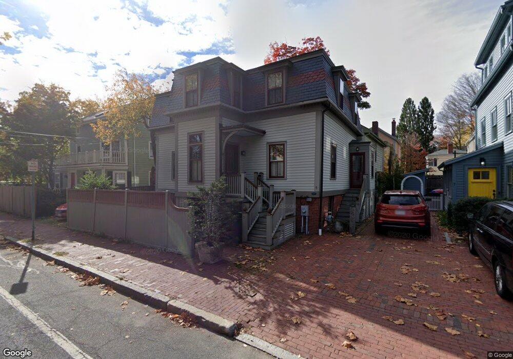
5 Sparks St Cambridge, MA 02138
West Cambridge NeighborhoodEstimated Value: $2,234,000 - $2,768,000
3
Beds
4
Baths
2,209
Sq Ft
$1,113/Sq Ft
Est. Value
About This Home
This home is located at 5 Sparks St, Cambridge, MA 02138 and is currently estimated at $2,459,239, approximately $1,113 per square foot. 5 Sparks St is a home located in Middlesex County with nearby schools including St Peter School, Buckingham Browne & Nichols School, and Shady Hill School.
Ownership History
Date
Name
Owned For
Owner Type
Purchase Details
Closed on
Mar 22, 2007
Sold by
Mann Charles K and Mann Susanne J
Bought by
Hurlbut Robert S and Hurlbut Ann G
Current Estimated Value
Home Financials for this Owner
Home Financials are based on the most recent Mortgage that was taken out on this home.
Original Mortgage
$350,000
Outstanding Balance
$212,661
Interest Rate
6.33%
Mortgage Type
Purchase Money Mortgage
Estimated Equity
$2,246,578
Purchase Details
Closed on
Jun 18, 2001
Sold by
Malcolm John A
Bought by
Mann Susanne J and Mann Charles K
Home Financials for this Owner
Home Financials are based on the most recent Mortgage that was taken out on this home.
Original Mortgage
$399,200
Interest Rate
7.15%
Mortgage Type
Purchase Money Mortgage
Purchase Details
Closed on
Jun 3, 1996
Sold by
Est Mayall Margaret W
Bought by
Malcolm John A
Create a Home Valuation Report for This Property
The Home Valuation Report is an in-depth analysis detailing your home's value as well as a comparison with similar homes in the area
Home Values in the Area
Average Home Value in this Area
Purchase History
| Date | Buyer | Sale Price | Title Company |
|---|---|---|---|
| Hurlbut Robert S | $1,200,000 | -- | |
| Mann Susanne J | $499,000 | -- | |
| Malcolm John A | $340,000 | -- |
Source: Public Records
Mortgage History
| Date | Status | Borrower | Loan Amount |
|---|---|---|---|
| Open | Hurlbut Robert S | $350,000 | |
| Previous Owner | Malcolm John A | $399,200 |
Source: Public Records
Tax History Compared to Growth
Tax History
| Year | Tax Paid | Tax Assessment Tax Assessment Total Assessment is a certain percentage of the fair market value that is determined by local assessors to be the total taxable value of land and additions on the property. | Land | Improvement |
|---|---|---|---|---|
| 2025 | $14,075 | $2,216,600 | $1,183,100 | $1,033,500 |
| 2024 | $13,003 | $2,196,400 | $1,206,500 | $989,900 |
| 2023 | $12,560 | $2,143,400 | $1,180,700 | $962,700 |
| 2022 | $12,157 | $2,053,500 | $1,200,300 | $853,200 |
| 2021 | $11,531 | $1,971,100 | $1,177,000 | $794,100 |
| 2020 | $10,866 | $1,889,700 | $1,136,200 | $753,500 |
| 2019 | $10,060 | $1,693,600 | $996,300 | $697,300 |
| 2018 | $10,421 | $1,656,700 | $990,500 | $666,200 |
| 2017 | $10,476 | $1,614,100 | $990,500 | $623,600 |
| 2016 | $10,079 | $1,441,900 | $871,100 | $570,800 |
| 2015 | $10,268 | $1,313,000 | $801,200 | $511,800 |
| 2014 | $10,336 | $1,233,400 | $728,300 | $505,100 |
Source: Public Records
Map
Nearby Homes
- 20 Maynard Place
- 1010 Memorial Dr Unit 6G
- 15 Hubbard Park Rd
- 48 Hubbard Park Rd
- 158 Brattle St
- 153 Brattle St
- 172 Brattle St
- 32 Hawthorn St
- 3 Berkeley Place
- 988 Memorial Dr Unit 386
- 12 Berkeley St
- 986 Memorial Dr Unit 404
- 984 Memorial Dr Unit 984-503
- 983 Memorial Dr Unit 502
- 130 Mount Auburn St Unit 108
- 22 Concord Ave Unit 10
- 234 Huron Ave
- 44 Garden St
- 52 Garden St Unit B2
- 975 Memorial Dr Unit 209
- 7 Sparks St
- 1 Sparks St
- 1 Sparks St Unit 1
- 239 Mount Auburn St
- 237 Mount Auburn St
- 237 Mount Auburn St Unit 237
- 237 Mount Auburn St Unit 1
- 9 Sparks St
- 247 Mount Auburn St Unit 249
- 247 Mount Auburn St Unit 249
- 247 Mount Auburn St Unit 1,247
- 6 Camden Place
- 8 Camden Place Unit A
- 8 Camden Place
- 8 Camden Place Unit 8
- 245 Mount Auburn St
- 11 Sparks St
- 1 Sparks Place
- 9 Camden Place
- 249 Mount Auburn St Unit 1