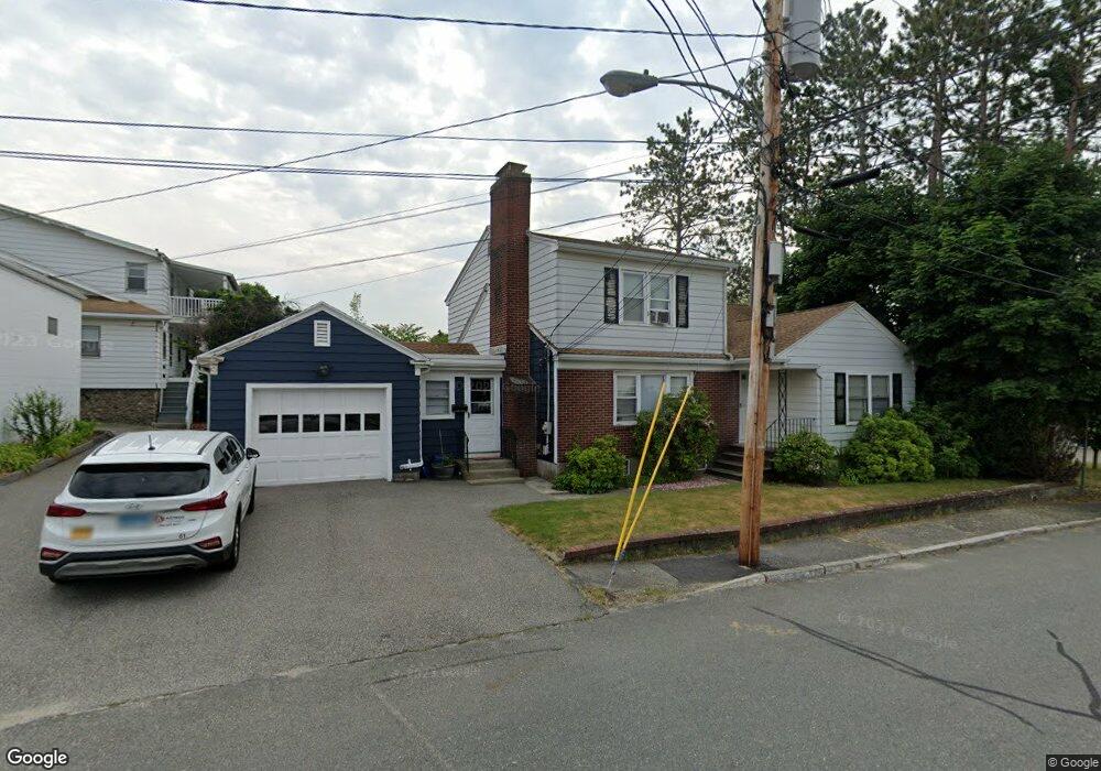
5 Stanley Rd Unit 1,1 Shrewsbury, MA 01545
Estimated Value: $556,000 - $714,083
5
Beds
2
Baths
2,058
Sq Ft
$297/Sq Ft
Est. Value
About This Home
This home is located at 5 Stanley Rd Unit 1,1, Shrewsbury, MA 01545 and is currently estimated at $611,771, approximately $297 per square foot. 5 Stanley Rd Unit 1,1 is a home located in Worcester County with nearby schools including Sherwood Middle School, Calvin Coolidge Elementary School, and Oak Middle School.
Ownership History
Date
Name
Owned For
Owner Type
Purchase Details
Closed on
May 13, 2025
Sold by
Colton Land Llc
Bought by
Huang Kai D and Chen Ling
Current Estimated Value
Home Financials for this Owner
Home Financials are based on the most recent Mortgage that was taken out on this home.
Original Mortgage
$324,500
Outstanding Balance
$323,351
Interest Rate
6.65%
Mortgage Type
Purchase Money Mortgage
Estimated Equity
$288,420
Purchase Details
Closed on
Jan 10, 2021
Sold by
Frank E Rossetti T E and Frank Reagan
Bought by
Colton Land Llc
Purchase Details
Closed on
Oct 1, 2012
Sold by
Rozak Benjamin C
Bought by
Frank E Rossetti T E and Frank Rossetti
Purchase Details
Closed on
Jun 6, 2008
Sold by
Frank E Rossetti T E and Frank Rossetti
Bought by
Rozak Benjamin C
Home Financials for this Owner
Home Financials are based on the most recent Mortgage that was taken out on this home.
Original Mortgage
$134,370
Interest Rate
6.11%
Mortgage Type
Purchase Money Mortgage
Create a Home Valuation Report for This Property
The Home Valuation Report is an in-depth analysis detailing your home's value as well as a comparison with similar homes in the area
Home Values in the Area
Average Home Value in this Area
Purchase History
| Date | Buyer | Sale Price | Title Company |
|---|---|---|---|
| Huang Kai D | $590,000 | None Available | |
| Huang Kai D | $590,000 | None Available | |
| Colton Land Llc | $950,000 | Metropolitan Title Of Indian | |
| Colton Land Llc | $950,000 | Metropolitan Title Of Indian | |
| Colton Land Llc | $950,000 | Metropolitan Title Of Indian | |
| Frank E Rossetti T E | $225,000 | -- | |
| Frank E Rossetti T | $225,000 | -- | |
| Frank E Rossetti T E | $225,000 | -- | |
| Rozak Benjamin C | $134,370 | -- | |
| Rozak Benjamin C | $134,370 | -- | |
| Rozak Benjamin C | $134,370 | -- |
Source: Public Records
Mortgage History
| Date | Status | Borrower | Loan Amount |
|---|---|---|---|
| Open | Huang Kai D | $324,500 | |
| Closed | Huang Kai D | $324,500 | |
| Previous Owner | Rozak Benjamin C | $134,370 |
Source: Public Records
Tax History Compared to Growth
Tax History
| Year | Tax Paid | Tax Assessment Tax Assessment Total Assessment is a certain percentage of the fair market value that is determined by local assessors to be the total taxable value of land and additions on the property. | Land | Improvement |
|---|---|---|---|---|
| 2025 | $5,330 | $442,700 | $196,400 | $246,300 |
| 2024 | $5,292 | $427,500 | $187,100 | $240,400 |
| 2023 | $5,702 | $434,600 | $187,100 | $247,500 |
| 2022 | $5,250 | $372,100 | $166,100 | $206,000 |
| 2021 | $4,598 | $348,600 | $157,400 | $191,200 |
| 2020 | $4,416 | $354,100 | $157,400 | $196,700 |
| 2019 | $4,298 | $341,900 | $151,700 | $190,200 |
| 2018 | $3,973 | $313,800 | $138,600 | $175,200 |
| 2017 | $3,749 | $292,200 | $122,800 | $169,400 |
| 2016 | $3,783 | $291,000 | $117,100 | $173,900 |
| 2015 | $3,745 | $283,700 | $109,800 | $173,900 |
Source: Public Records
Map
Nearby Homes
- 26 Browne Rd
- 10 Gleason Rd
- 6 Selina St
- 40 Shrewsbury Green Dr Unit A
- 22 Shrewsbury Green Dr Unit C
- 315 Maple Ave
- 73 S Quinsigamond Ave
- 175 Oak St
- 46 N Quinsigamond Ave
- 40 Phillips Ave
- 26 Williamsburg Ct Unit 22
- 7 Tern Dr
- 15 Eagle Dr
- 105 S Quinsigamond Ave
- 20 Williamsburg Ct Unit 21
- 67 N Quinsigamond Ave Unit 23
- 76 Hillside Dr
- 5 Fyrbeck Ave
- 10 Crane Cir
- 19 Eaglehead Terrace Unit 2
- 5 Stanley Rd Unit 1
- 258 Boston Turnpike
- 256 Boston Turnpike
- 9 Stanley Rd
- 262 Boston Turnpike
- 10 Browne Rd
- 12 Browne Rd
- 11 Stanley Rd
- 246 Boston Turnpike Unit 2,3,4
- 246 Boston Turnpike
- 246 Boston Turnpike Unit 5
- 13 Stanley Rd
- 257 Boston Turnpike Unit 261
- 261 Boston Turnpike Unit 2
- 261 Boston Turnpike Unit 3
- 261 Boston Turnpike
- 11 Sias Ave
- 5 Browne Rd
- 7 Browne Rd
- 15 Sias Ave