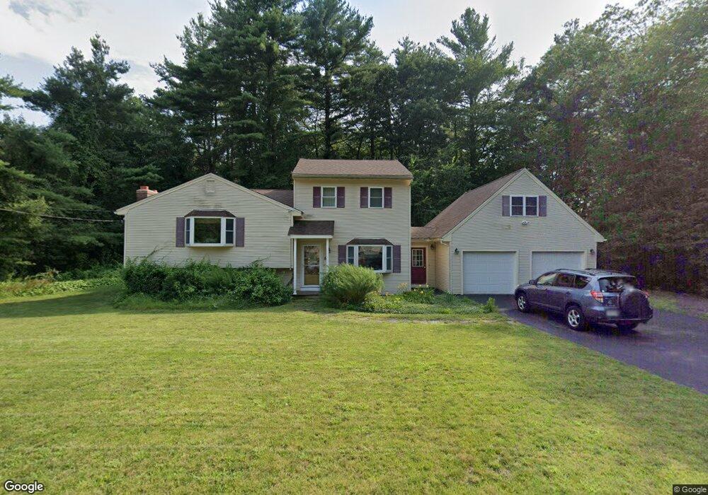
5 Starr Ave Tewksbury, MA 01876
Estimated Value: $669,000 - $827,000
3
Beds
1
Bath
1,738
Sq Ft
$426/Sq Ft
Est. Value
About This Home
This home is located at 5 Starr Ave, Tewksbury, MA 01876 and is currently estimated at $741,027, approximately $426 per square foot. 5 Starr Ave is a home located in Middlesex County with nearby schools including John F. Ryan Elementary School, John W. Wynn Middle School, and Tewksbury Memorial High School.
Ownership History
Date
Name
Owned For
Owner Type
Purchase Details
Closed on
Jul 15, 2011
Sold by
Carlsen Mark W and Carlsen Kathryn L
Bought by
Carlsen William L
Current Estimated Value
Home Financials for this Owner
Home Financials are based on the most recent Mortgage that was taken out on this home.
Original Mortgage
$220,000
Outstanding Balance
$16,570
Interest Rate
4.58%
Mortgage Type
Purchase Money Mortgage
Estimated Equity
$724,457
Create a Home Valuation Report for This Property
The Home Valuation Report is an in-depth analysis detailing your home's value as well as a comparison with similar homes in the area
Home Values in the Area
Average Home Value in this Area
Purchase History
| Date | Buyer | Sale Price | Title Company |
|---|---|---|---|
| Carlsen William L | $275,000 | -- |
Source: Public Records
Mortgage History
| Date | Status | Borrower | Loan Amount |
|---|---|---|---|
| Open | Carlsen William L | $220,000 |
Source: Public Records
Tax History
| Year | Tax Paid | Tax Assessment Tax Assessment Total Assessment is a certain percentage of the fair market value that is determined by local assessors to be the total taxable value of land and additions on the property. | Land | Improvement |
|---|---|---|---|---|
| 2025 | $8,199 | $620,200 | $304,700 | $315,500 |
| 2024 | $7,559 | $564,500 | $290,300 | $274,200 |
| 2023 | $7,377 | $523,200 | $263,700 | $259,500 |
| 2022 | $7,842 | $515,900 | $229,800 | $286,100 |
| 2021 | $7,533 | $479,200 | $208,900 | $270,300 |
| 2020 | $7,405 | $463,700 | $198,800 | $264,900 |
| 2019 | $6,730 | $424,900 | $189,300 | $235,600 |
| 2018 | $6,058 | $375,600 | $189,300 | $186,300 |
| 2017 | $5,987 | $367,100 | $189,300 | $177,800 |
| 2016 | $5,824 | $356,200 | $189,300 | $166,900 |
| 2015 | $5,556 | $339,400 | $180,100 | $159,300 |
| 2014 | $4,804 | $298,200 | $180,100 | $118,100 |
Source: Public Records
Map
Nearby Homes
- 84 Apache Way
- 72 Apache Way
- 16 Rockingham Dr Unit 131
- 20 Kensington Way Unit 20
- 6 Anthony Rd
- 258 Apache Way
- 127 Caddy Ct
- 107 Eagle Dr Unit 107
- 93 Fairway Dr
- 50 Nolan Ct Unit 50
- 1101 South St
- 16 Eagle Dr
- 26 Ironwood Ln
- 910 Livingston St
- 11 Orchard St
- 1455 Main St Unit 8
- 1325 Main
- 27 Villa Roma Dr
- 4 Villa Roma Dr
- 58 Blanchard St
Your Personal Tour Guide
Ask me questions while you tour the home.