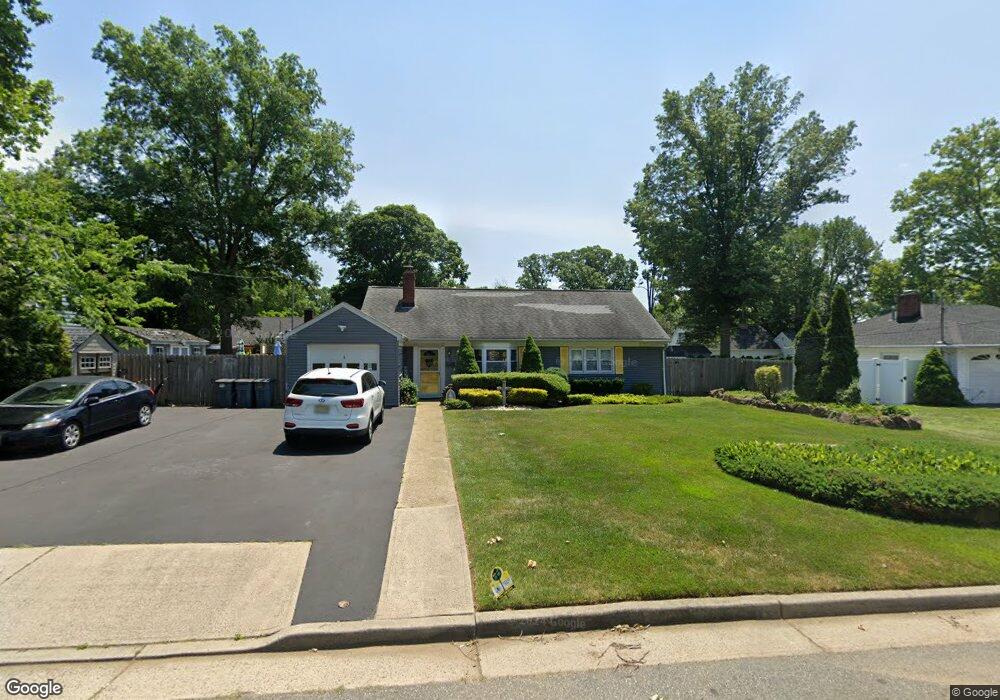
5 Taylor Rd Matawan, NJ 07747
Estimated Value: $581,207 - $661,000
3
Beds
2
Baths
1,660
Sq Ft
$364/Sq Ft
Est. Value
About This Home
This home is located at 5 Taylor Rd, Matawan, NJ 07747 and is currently estimated at $605,052, approximately $364 per square foot. 5 Taylor Rd is a home located in Monmouth County with nearby schools including Matawan Reg High School, Matawan Montessori Academy, and St. Joseph Elementary School.
Ownership History
Date
Name
Owned For
Owner Type
Purchase Details
Closed on
Jun 29, 2006
Sold by
Dane Stephen
Bought by
Burlew Darrin and Burlew Nancy
Current Estimated Value
Home Financials for this Owner
Home Financials are based on the most recent Mortgage that was taken out on this home.
Original Mortgage
$171,000
Outstanding Balance
$129,653
Interest Rate
12.5%
Mortgage Type
Adjustable Rate Mortgage/ARM
Estimated Equity
$475,399
Purchase Details
Closed on
Jun 27, 2003
Sold by
Snyder Michael
Bought by
Dane Stephen and Swatko Jaime
Home Financials for this Owner
Home Financials are based on the most recent Mortgage that was taken out on this home.
Original Mortgage
$207,920
Interest Rate
5.28%
Purchase Details
Closed on
Mar 17, 1995
Sold by
Kustka Sharon
Bought by
Snyder Michael and Snyder Janet
Home Financials for this Owner
Home Financials are based on the most recent Mortgage that was taken out on this home.
Original Mortgage
$80,000
Interest Rate
8.8%
Create a Home Valuation Report for This Property
The Home Valuation Report is an in-depth analysis detailing your home's value as well as a comparison with similar homes in the area
Home Values in the Area
Average Home Value in this Area
Purchase History
| Date | Buyer | Sale Price | Title Company |
|---|---|---|---|
| Burlew Darrin | $355,000 | -- | |
| Dane Stephen | $259,900 | -- | |
| Snyder Michael | $90,500 | -- |
Source: Public Records
Mortgage History
| Date | Status | Borrower | Loan Amount |
|---|---|---|---|
| Open | Burlew Darrin | $171,000 | |
| Previous Owner | Dane Stephen | $207,920 | |
| Previous Owner | Snyder Michael | $80,000 |
Source: Public Records
Tax History
| Year | Tax Paid | Tax Assessment Tax Assessment Total Assessment is a certain percentage of the fair market value that is determined by local assessors to be the total taxable value of land and additions on the property. | Land | Improvement |
|---|---|---|---|---|
| 2025 | $10,236 | $557,400 | $358,900 | $198,500 |
| 2024 | $9,940 | $468,900 | $310,900 | $158,000 |
Source: Public Records
Map
Nearby Homes
- 4377 Old Bridge Matawan Rd
- 9 Crabtree Rd
- 48 Charles St
- 45 Beechwood Terrace
- 27 Middlesex Rd
- 14 New Brunswick Ave
- 258 Jackson St
- 320 Main St
- 272 Main St
- 49 Middlesex Rd Unit B
- 49 Middlesex Rd Unit A
- 101 Ravine Dr
- 15 Walnut Ct
- 65 Ravine Dr
- 8 Sutphin Ave
- 33 Samantha Cir
- 190 Jackson St
- 255 Harding Blvd
- 43 Pemberton Dr
- 12 Coventry Ct
Your Personal Tour Guide
Ask me questions while you tour the home.