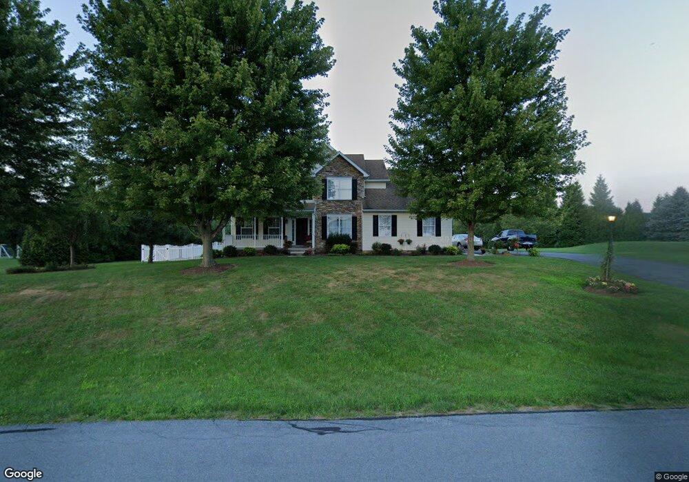
5 W Summit Dr Unit 44 Littlestown, PA 17340
Estimated Value: $459,294 - $547,000
4
Beds
3
Baths
2,470
Sq Ft
$207/Sq Ft
Est. Value
About This Home
This home is located at 5 W Summit Dr Unit 44, Littlestown, PA 17340 and is currently estimated at $512,324, approximately $207 per square foot. 5 W Summit Dr Unit 44 is a home located in Adams County with nearby schools including Rolling Acres El School, Maple Avenue Middle School, and Littlestown Senior High School.
Ownership History
Date
Name
Owned For
Owner Type
Purchase Details
Closed on
Jul 14, 2004
Bought by
Garber Clark and Garber Kelly
Current Estimated Value
Create a Home Valuation Report for This Property
The Home Valuation Report is an in-depth analysis detailing your home's value as well as a comparison with similar homes in the area
Home Values in the Area
Average Home Value in this Area
Purchase History
| Date | Buyer | Sale Price | Title Company |
|---|---|---|---|
| Garber Clark | $289,500 | -- |
Source: Public Records
Tax History Compared to Growth
Tax History
| Year | Tax Paid | Tax Assessment Tax Assessment Total Assessment is a certain percentage of the fair market value that is determined by local assessors to be the total taxable value of land and additions on the property. | Land | Improvement |
|---|---|---|---|---|
| 2025 | $6,080 | $321,200 | $80,100 | $241,100 |
| 2024 | $5,844 | $321,200 | $80,100 | $241,100 |
| 2023 | $5,697 | $321,200 | $80,100 | $241,100 |
| 2022 | $5,655 | $321,200 | $80,100 | $241,100 |
| 2021 | $5,454 | $321,200 | $80,100 | $241,100 |
| 2020 | $5,375 | $321,200 | $80,100 | $241,100 |
| 2019 | $5,260 | $321,200 | $80,100 | $241,100 |
| 2018 | $4,733 | $297,900 | $80,100 | $217,800 |
| 2017 | $4,585 | $297,900 | $80,100 | $217,800 |
| 2016 | -- | $297,900 | $80,100 | $217,800 |
| 2015 | -- | $297,900 | $80,100 | $217,800 |
| 2014 | -- | $297,900 | $80,100 | $217,800 |
Source: Public Records
Map
Nearby Homes
- 630 Mehring Rd Unit 4
- 241 M St
- 535 Lumber St
- 559 Lumber St
- 567 Lumber St
- 211 E King St
- LOT 9 Mehring Rd
- 893 Georgetown Rd
- 61 E King St
- 106 E King St
- 117 Charles St
- 115 Charles St
- 129 W King St
- 2100 Blacks School House Rd
- 22 Rita Marie Ave
- 41 Smith Cir
- 43 Ashfield Dr Unit 14
- 140 Apple Grove Ln Unit 425
- 162 Newark St
- 440 N Queen St
- 15 W Summit Dr Unit 43
- 20 W Summit Dr Unit 39
- 10 W Summit Dr Unit 40
- 140 E Summit Dr Unit 42
- 7 E Summit Dr Unit 2
- 22 E Summit Dr Unit 46
- 120 E Summit Dr Unit 54
- 28 W Summit Dr Unit 38B
- 19 E Summit Dr Unit 3
- 12 Mayers Blvd Unit 41
- 36 W Summit Dr
- 32 E Summit Dr Unit 47
- 110 E Summit Dr Unit 53
- 11 Mayers Blvd Unit 1
- 29 E Summit Dr Unit 4
- 141 W Summit Dr Unit 20
- 100 E Summit Dr Unit 52
- 135 E Summit Dr Unit 19
- 0 E Summit Dr Unit 17A ,17B 1000104844