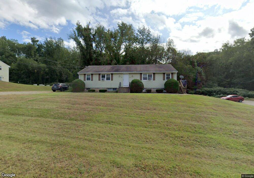
5 White Oak Condo Unit A Mansfield, CT 06250
Estimated Value: $126,000 - $148,000
2
Beds
1
Bath
810
Sq Ft
$166/Sq Ft
Est. Value
About This Home
This home is located at 5 White Oak Condo Unit A, Mansfield, CT 06250 and is currently estimated at $134,759, approximately $166 per square foot. 5 White Oak Condo Unit A is a home located in Tolland County with nearby schools including Annie E. Vinton School, Mansfield Elementary School, and Mansfield Middle School.
Ownership History
Date
Name
Owned For
Owner Type
Purchase Details
Closed on
Sep 10, 2025
Sold by
Owen Jonathan
Bought by
Crayton Wiktoria A
Current Estimated Value
Purchase Details
Closed on
Apr 28, 2022
Sold by
Ocampo Ana M and Ocampo Luis F
Bought by
Owen Jonathan
Purchase Details
Closed on
Nov 28, 2006
Sold by
Kurker Richard C and Kurker Deborah M
Bought by
Ocampo Ana Maria and Ocampo Luis F
Purchase Details
Closed on
Jun 28, 1995
Sold by
Emc Mtg
Bought by
Kurker Richard and Kurker Deborah
Create a Home Valuation Report for This Property
The Home Valuation Report is an in-depth analysis detailing your home's value as well as a comparison with similar homes in the area
Home Values in the Area
Average Home Value in this Area
Purchase History
| Date | Buyer | Sale Price | Title Company |
|---|---|---|---|
| Crayton Wiktoria A | $135,000 | -- | |
| Owen Jonathan | $102,000 | None Available | |
| Owen Jonathan | $102,000 | None Available | |
| Ocampo Ana Maria | $65,000 | -- | |
| Ocampo Ana Maria | $65,000 | -- | |
| Kurker Richard | $16,000 | -- | |
| Kurker Richard | $16,000 | -- |
Source: Public Records
Tax History Compared to Growth
Tax History
| Year | Tax Paid | Tax Assessment Tax Assessment Total Assessment is a certain percentage of the fair market value that is determined by local assessors to be the total taxable value of land and additions on the property. | Land | Improvement |
|---|---|---|---|---|
| 2025 | $1,494 | $74,700 | $0 | $74,700 |
| 2024 | $1,199 | $39,300 | $0 | $39,300 |
| 2023 | $1,239 | $39,300 | $0 | $39,300 |
| 2022 | $1,194 | $39,300 | $0 | $39,300 |
| 2021 | $1,233 | $39,300 | $0 | $39,300 |
| 2020 | $1,233 | $39,300 | $0 | $39,300 |
| 2019 | $1,299 | $41,400 | $0 | $41,400 |
| 2018 | $1,476 | $47,800 | $0 | $47,800 |
| 2017 | $1,464 | $47,800 | $0 | $47,800 |
| 2016 | $1,428 | $47,800 | $0 | $47,800 |
| 2015 | $1,428 | $47,800 | $0 | $47,800 |
| 2014 | $1,460 | $52,220 | $0 | $52,220 |
Source: Public Records
Map
Nearby Homes
- 30 Wyllys Farm Rd
- 29 Wyllys Farm Rd
- 37 Wyllys Farm Rd
- 43 Wyllys Farm Rd
- 31 Wyllys Farm Rd
- 35 Wyllys Farm Rd
- 124 Spring Hill Rd
- 48 Monticello Ln
- 21 Silo Rd W Unit 21
- 0 Mansfield City Rd Unit LOT 2
- 0 Mansfield City Rd Unit 24089164
- 58 Candide Ln
- 18 Spring Hill Rd
- 634 Stonehouse Rd
- 934 Storrs Rd
- 10 Hillside Cir
- 28 Armstrong Rd Unit D32
- 76 Highland Rd
- 36 Cooper Ln
- 329 N Eagleville Rd
- 5 White Oak Condo Unit B
- 7 Poplar La Unit A
- 5 White Oak Rd Unit A
- 9 White Oak Condo Rd Unit D
- 9 White Oak Condo Rd Unit A
- 3A Poplar Rd
- 16 College Park Unit B
- 16 College Park Unit D
- 16 College Park Unit C
- 16 College Park Unit A
- 16 College Park Unit 16A
- 14 College Park Unit B
- 14 College Park Unit D
- 14 College Park Unit C
- 14 College Park Unit A
- 14 College Park
- 15 College Park Unit A
- 15 College Park Unit B
- 15 College Park Unit D
- 15 College Park Unit C