Estimated Value: $214,239 - $284,000
3
Beds
2
Baths
1,586
Sq Ft
$159/Sq Ft
Est. Value
About This Home
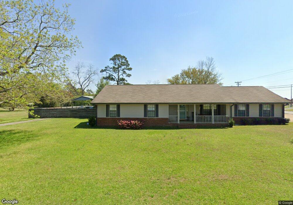
This home is located at 50 26th St NE, Cairo, GA 39828 and is currently estimated at $252,810, approximately $159 per square foot. 50 26th St NE is a home located in Grady County with nearby schools including Cairo High School.
Ownership History
Date
Name
Owned For
Owner Type
Purchase Details
Closed on
Feb 14, 2011
Sold by
Martin Kenneth W
Bought by
Schafer Mary D
Current Estimated Value
Home Financials for this Owner
Home Financials are based on the most recent Mortgage that was taken out on this home.
Original Mortgage
$103,500
Interest Rate
4.66%
Mortgage Type
New Conventional
Purchase Details
Closed on
Jun 15, 2006
Sold by
Cox Michael H
Bought by
St Angelo Jill M and Martin Kenneth W
Home Financials for this Owner
Home Financials are based on the most recent Mortgage that was taken out on this home.
Original Mortgage
$118,125
Interest Rate
7.75%
Mortgage Type
New Conventional
Purchase Details
Closed on
Apr 2, 2004
Sold by
Hill Eugene G
Bought by
Cox Michael H
Purchase Details
Closed on
Dec 12, 2003
Sold by
Robinson Glenn K
Bought by
Hill Eugene G
Purchase Details
Closed on
Feb 27, 1995
Bought by
Robinson Glenn K
Create a Home Valuation Report for This Property
The Home Valuation Report is an in-depth analysis detailing your home's value as well as a comparison with similar homes in the area
Home Values in the Area
Average Home Value in this Area
Purchase History
| Date | Buyer | Sale Price | Title Company |
|---|---|---|---|
| Schafer Mary D | $100,000 | -- | |
| St Angelo Jill M | $157,500 | -- | |
| Cox Michael H | $117,000 | -- | |
| Hill Eugene G | $110,700 | -- | |
| Robinson Glenn K | $79,500 | -- |
Source: Public Records
Mortgage History
| Date | Status | Borrower | Loan Amount |
|---|---|---|---|
| Closed | Schafer Mary D | $103,500 | |
| Previous Owner | St Angelo Jill M | $118,125 |
Source: Public Records
Tax History Compared to Growth
Tax History
| Year | Tax Paid | Tax Assessment Tax Assessment Total Assessment is a certain percentage of the fair market value that is determined by local assessors to be the total taxable value of land and additions on the property. | Land | Improvement |
|---|---|---|---|---|
| 2024 | $2,725 | $70,636 | $4,884 | $65,752 |
| 2023 | $2,040 | $56,788 | $6,400 | $50,388 |
| 2022 | $2,125 | $56,788 | $6,400 | $50,388 |
| 2021 | $2,131 | $56,788 | $6,400 | $50,388 |
| 2020 | $2,136 | $56,788 | $6,400 | $50,388 |
| 2019 | $2,136 | $56,788 | $6,400 | $50,388 |
| 2018 | $2,031 | $56,788 | $6,400 | $50,388 |
| 2017 | $1,954 | $56,788 | $6,400 | $50,388 |
| 2016 | $1,700 | $48,542 | $6,400 | $42,142 |
| 2015 | $1,684 | $48,542 | $6,400 | $42,142 |
| 2014 | $1,684 | $48,542 | $6,400 | $42,142 |
| 2013 | -- | $44,590 | $6,400 | $38,190 |
Source: Public Records
Map
Nearby Homes
- 78.6 Ac Strickland Rd
- 2600 U S 84
- 21 24th St NE
- 66 22nd St NE
- 0 NE Airport Rd Unit 145784
- 0 20th St NE
- 00 20th St NE
- 00 #10 Oak Bend Circle 4 38 Acres
- 3109 U S 84
- 3109 U S 84
- 236 Helton Ln
- 225 Helton Ln
- 00 NW 9th Ave
- 711 2nd Ave NE
- 530 6th St
- Lot #15, 3 64 Acres Oakbend Cir
- 530 6th Ave SE
- 471 4th St SE
- 481 4th St SE
- 00 State Route 188
- 2580 MacIvor Dr NE
- 2582 MacIvor Dr NE
- 58 26th St NE
- 65 27th St NE
- 63 26th St NE
- 67 27th St NE
- 66 26th St NE
- 25 26th St NE
- 69 26th St NE
- 2506 MacIvor Dr NE
- 2506 MacIvor Dr NE Unit 1
- 62 25th St NE
- 32 25th St NE
- 66 27th St NE
- 15 26th St NE
- 16 26th St NE
- 74 26th St NE
- 73 27th St NE
- 68 27th St NE
- 24 25th St NE