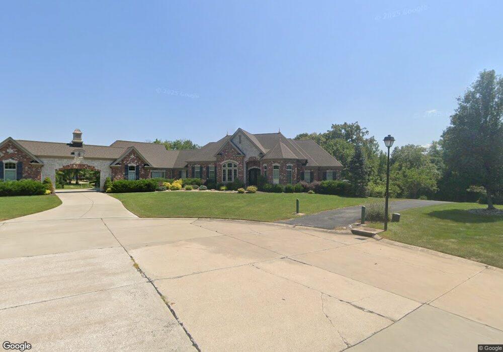
50 Agravaine Ct Weldon Spring, MO 63304
Estimated Value: $1,396,000 - $1,691,000
5
Beds
5
Baths
3,291
Sq Ft
$453/Sq Ft
Est. Value
About This Home
This home is located at 50 Agravaine Ct, Weldon Spring, MO 63304 and is currently estimated at $1,489,867, approximately $452 per square foot. 50 Agravaine Ct is a home located in St. Charles County with nearby schools including Independence Elementary School, Bryan Middle School, and Francis Howell Union High School.
Ownership History
Date
Name
Owned For
Owner Type
Purchase Details
Closed on
Mar 5, 2014
Sold by
James H Maurer Revocable Trust
Bought by
Kniest Kristen and Kniest Thomas
Current Estimated Value
Purchase Details
Closed on
Feb 11, 2008
Sold by
Maurer James H
Bought by
James H Maurer Revocable Trust
Purchase Details
Closed on
Dec 21, 2006
Sold by
Salmo Joseph and Salmo Laura
Bought by
Maurer James H
Purchase Details
Closed on
Nov 4, 2004
Sold by
Salant Sherry and Salant Gary
Bought by
Salmo Joseph and Salmo Laura
Home Financials for this Owner
Home Financials are based on the most recent Mortgage that was taken out on this home.
Original Mortgage
$143,200
Interest Rate
5.71%
Mortgage Type
Purchase Money Mortgage
Purchase Details
Closed on
Nov 29, 2001
Sold by
Whittaker Builders Inc
Bought by
Salant Gary and Salant Sherry
Create a Home Valuation Report for This Property
The Home Valuation Report is an in-depth analysis detailing your home's value as well as a comparison with similar homes in the area
Home Values in the Area
Average Home Value in this Area
Purchase History
| Date | Buyer | Sale Price | Title Company |
|---|---|---|---|
| Kniest Kristen | $176,000 | None Available | |
| James H Maurer Revocable Trust | -- | None Available | |
| Maurer James H | -- | Inv | |
| Salmo Joseph | -- | Multiple | |
| Salant Gary | -- | -- |
Source: Public Records
Mortgage History
| Date | Status | Borrower | Loan Amount |
|---|---|---|---|
| Previous Owner | Salmo Joseph | $143,200 |
Source: Public Records
Tax History Compared to Growth
Tax History
| Year | Tax Paid | Tax Assessment Tax Assessment Total Assessment is a certain percentage of the fair market value that is determined by local assessors to be the total taxable value of land and additions on the property. | Land | Improvement |
|---|---|---|---|---|
| 2025 | $13,030 | $244,074 | -- | -- |
| 2023 | $13,024 | $219,305 | $0 | $0 |
| 2022 | $12,151 | $190,080 | $0 | $0 |
| 2021 | $12,162 | $190,080 | $0 | $0 |
| 2020 | $12,599 | $190,647 | $0 | $0 |
| 2019 | $12,542 | $190,647 | $0 | $0 |
| 2018 | $11,442 | $166,267 | $0 | $0 |
| 2017 | $11,347 | $166,267 | $0 | $0 |
| 2016 | $11,753 | $165,903 | $0 | $0 |
| 2015 | $9,078 | $31,350 | $0 | $0 |
| 2014 | $2,279 | $31,350 | $0 | $0 |
Source: Public Records
Map
Nearby Homes
- 0 Unknown Unit MIS25045732
- 0 Unknown Unit MIS25045735
- 0 Unknown Unit MIS25045722
- 0 Unknown Unit MIS25045727
- 0 Unknown Unit MIS25045728
- 0 Unknown Unit MIS25045736
- 0 Unknown Unit MIS25045734
- 0 Unknown Unit MIS25045725
- 0 Unknown Unit MIS25045730
- 74 W Meath Ring
- 5425 Independence Rd
- 828 Nancy Ln
- 149 Shaelah Ct
- 32 Clarksburg Ct
- 263 Ashdown Forest Ct
- 220 Ella Rose Ln
- 5756 Westchester Farm Dr
- 1094 Whitmoor Dr
- 142 Newgrange Pass
- 5579 Westerfield Pkwy Unit 8B