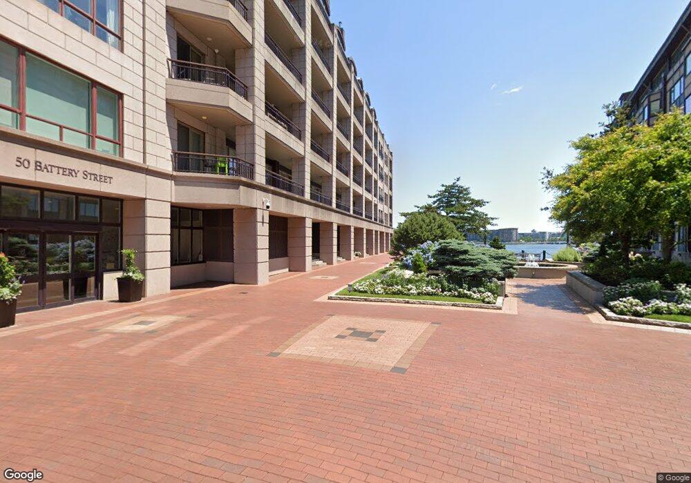
Burroughs Wharf 50 Battery St Unit 309 Boston, MA 02109
North End NeighborhoodEstimated Value: $2,625,000 - $2,866,000
3
Beds
3
Baths
2,700
Sq Ft
$1,017/Sq Ft
Est. Value
About This Home
This home is located at 50 Battery St Unit 309, Boston, MA 02109 and is currently estimated at $2,744,785, approximately $1,016 per square foot. 50 Battery St Unit 309 is a home located in Suffolk County with nearby schools including East Boston Central Catholic School.
Ownership History
Date
Name
Owned For
Owner Type
Purchase Details
Closed on
Jul 24, 2019
Sold by
Cucchiaro Stephen
Bought by
Cucchiaro Stephen and Samek Jama
Current Estimated Value
Purchase Details
Closed on
Jul 31, 2018
Sold by
Cucchiaro Stephen
Bought by
Cucchiaro Stephen and Samek Jama
Purchase Details
Closed on
Dec 19, 2017
Sold by
Good Neighbor Rt
Bought by
Cucchiaro Stephen
Purchase Details
Closed on
Apr 10, 2014
Sold by
T Y
Bought by
Good Neighbor Rt
Purchase Details
Closed on
Jul 3, 2008
Sold by
Benedict Therese B and Benedict Robert R
Bought by
Ting David T and Kaloosdian Robert A
Home Financials for this Owner
Home Financials are based on the most recent Mortgage that was taken out on this home.
Original Mortgage
$3,120,000
Interest Rate
6.01%
Mortgage Type
Purchase Money Mortgage
Purchase Details
Closed on
Mar 1, 1994
Sold by
Birmden Assocs
Bought by
Benedict Anne
Create a Home Valuation Report for This Property
The Home Valuation Report is an in-depth analysis detailing your home's value as well as a comparison with similar homes in the area
Home Values in the Area
Average Home Value in this Area
Purchase History
| Date | Buyer | Sale Price | Title Company |
|---|---|---|---|
| Cucchiaro Stephen | -- | -- | |
| Cucchiaro Stephen | -- | -- | |
| Cucchiaro Stephen | -- | -- | |
| Cucchiaro Stephen | -- | -- | |
| Good Neighbor Rt | $4,850,000 | -- | |
| Ting David T | $5,200,000 | -- | |
| Benedict Anne | $800,000 | -- |
Source: Public Records
Mortgage History
| Date | Status | Borrower | Loan Amount |
|---|---|---|---|
| Previous Owner | Ting David T | $3,120,000 |
Source: Public Records
Tax History Compared to Growth
Tax History
| Year | Tax Paid | Tax Assessment Tax Assessment Total Assessment is a certain percentage of the fair market value that is determined by local assessors to be the total taxable value of land and additions on the property. | Land | Improvement |
|---|---|---|---|---|
| 2025 | $28,439 | $2,455,900 | $0 | $2,455,900 |
| 2024 | $26,684 | $2,448,100 | $0 | $2,448,100 |
| 2023 | $26,032 | $2,423,800 | $0 | $2,423,800 |
| 2022 | $26,110 | $2,399,800 | $0 | $2,399,800 |
| 2021 | $25,606 | $2,399,800 | $0 | $2,399,800 |
| 2020 | $24,499 | $2,320,000 | $0 | $2,320,000 |
| 2019 | $23,740 | $2,252,404 | $0 | $2,252,404 |
| 2018 | $22,918 | $2,186,800 | $0 | $2,186,800 |
| 2017 | $22,055 | $2,082,646 | $0 | $2,082,646 |
| 2016 | $21,612 | $1,964,760 | $0 | $1,964,760 |
| 2015 | $18,291 | $1,510,380 | $0 | $1,510,380 |
| 2014 | $17,273 | $1,373,073 | $0 | $1,373,073 |
Source: Public Records
About Burroughs Wharf
Map
Nearby Homes
- 50 Battery St Unit 103-4
- 4 Battery Wharf Unit 4604
- 4 Battery Wharf Unit 4302
- 4 Battery Wharf Unit 4602
- 2.5 Battery Wharf Unit 4302
- 343 Commercial St Unit 212
- 3 Battery Wharf Unit 3309
- 386 Commercial St Unit 4E
- 19 Salutation St Unit 52
- 342-344 North St Unit 1A
- 0 Fairfield Unit 71812438
- 21 Moon St Unit 2
- 290 North St Unit 4
- 1 Lewis Wharf
- 28 Atlantic Ave Unit 638
- 28 Atlantic Ave Unit 424
- 28 Atlantic Ave Unit 534
- 220 Commercial St Unit 5A
- 7 Unity St Unit 3
- 4-6 Henchman St Unit 4-6
- 50 Battery St Unit PH10
- 50 Battery St Unit PH8
- 50 Battery St Unit PH7
- 50 Battery St Unit PH6
- 50 Battery St Unit PH5
- 50 Battery St Unit PH4
- 50 Battery St Unit PH2
- 50 Battery St Unit PH1
- 50 Battery St Unit 502
- 50 Battery St Unit 501
- 50 Battery St Unit 402
- 50 Battery St Unit 401
- 50 Battery St Unit 312
- 50 Battery St Unit 310
- 50 Battery St Unit 307
- 50 Battery St Unit 306
- 50 Battery St Unit 305
- 50 Battery St Unit 304
- 50 Battery St Unit 303
- 50 Battery St Unit 302