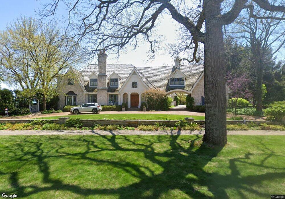
50 Beach Rd Glencoe, IL 60022
Estimated Value: $4,480,000 - $5,269,000
5
Beds
6
Baths
9,633
Sq Ft
$503/Sq Ft
Est. Value
About This Home
This home is located at 50 Beach Rd, Glencoe, IL 60022 and is currently estimated at $4,848,436, approximately $503 per square foot. 50 Beach Rd is a home located in Cook County with nearby schools including South Elementary School, Central School, and West School.
Ownership History
Date
Name
Owned For
Owner Type
Purchase Details
Closed on
Jan 23, 2024
Sold by
Tamara Lee Cooper 2002 Declaration Of Tr
Bought by
Chicago Title Land Trust Co
Current Estimated Value
Purchase Details
Closed on
Sep 2, 2022
Sold by
Cooper Tamara Lee
Bought by
Tamara Lee Cooper 2002 Declaration Of Trust
Purchase Details
Closed on
Jul 29, 2022
Sold by
Dempsey Jay
Bought by
Dempsey Tamara
Purchase Details
Closed on
May 1, 2003
Sold by
Dempsey Jay E and Dempsey Tamara
Bought by
Dempsey Jay E and Dempsey Tamara
Create a Home Valuation Report for This Property
The Home Valuation Report is an in-depth analysis detailing your home's value as well as a comparison with similar homes in the area
Home Values in the Area
Average Home Value in this Area
Purchase History
| Date | Buyer | Sale Price | Title Company |
|---|---|---|---|
| Chicago Title Land Trust Co | $8,200,000 | None Listed On Document | |
| Tamara Lee Cooper 2002 Declaration Of Trust | -- | None Listed On Document | |
| Dempsey Tamara | -- | None Listed On Document | |
| Dempsey Jay E | -- | -- | |
| Dempsey Jay E | -- | -- |
Source: Public Records
Tax History
| Year | Tax Paid | Tax Assessment Tax Assessment Total Assessment is a certain percentage of the fair market value that is determined by local assessors to be the total taxable value of land and additions on the property. | Land | Improvement |
|---|---|---|---|---|
| 2025 | $63,002 | $329,741 | $88,620 | $241,121 |
| 2024 | $63,002 | $258,194 | $59,080 | $199,114 |
| 2023 | $71,272 | $286,743 | $59,080 | $227,663 |
| 2022 | $71,272 | $312,675 | $59,080 | $253,595 |
| 2021 | $46,615 | $163,592 | $64,988 | $98,604 |
| 2020 | $45,275 | $163,592 | $64,988 | $98,604 |
| 2019 | $44,066 | $179,213 | $64,988 | $114,225 |
| 2018 | $43,824 | $173,424 | $51,990 | $121,434 |
| 2017 | $42,581 | $173,424 | $51,990 | $121,434 |
| 2016 | $40,040 | $173,424 | $51,990 | $121,434 |
| 2015 | $36,811 | $141,332 | $47,264 | $94,068 |
| 2014 | $35,905 | $141,332 | $47,264 | $94,068 |
| 2013 | $40,975 | $168,951 | $47,264 | $121,687 |
Source: Public Records
Map
Nearby Homes
- 677 Greenleaf Ave
- 130 Maple Hill Rd
- 130 Rockgate Ln
- 794 Greenwood Ave
- 735 Grove St
- 378 South Ave
- 410 Green Bay Rd
- 476 Park Ave
- 396 Forest Edge Dr
- 488 Park Ave
- 255 Harbor St
- 1076 Old Elm Ln
- 1077 Green Bay Rd
- 1020 Bluff Rd
- 1036 Elm Ridge Dr
- 908 Elm Place
- 55 S Deere Park Dr
- 808 Prairie Rd
- 1180 Oak Ridge Dr
- 1106 Hohlfelder Rd
Your Personal Tour Guide
Ask me questions while you tour the home.