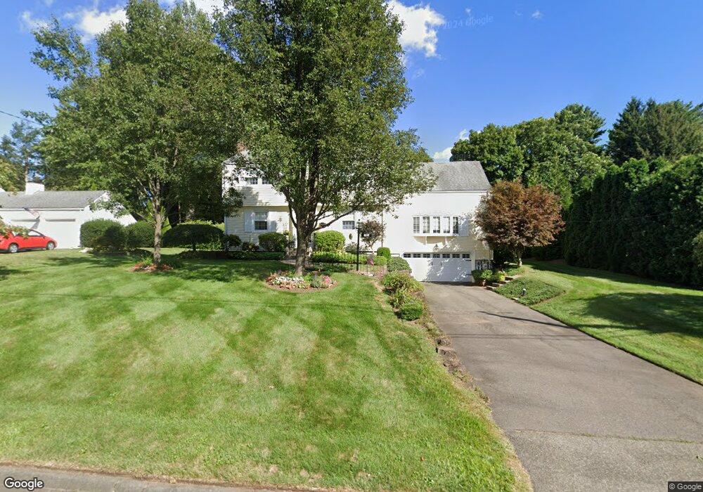
50 Boulter Rd Wethersfield, CT 06109
Estimated Value: $567,000 - $613,000
4
Beds
3
Baths
2,403
Sq Ft
$245/Sq Ft
Est. Value
About This Home
This home is located at 50 Boulter Rd, Wethersfield, CT 06109 and is currently estimated at $588,256, approximately $244 per square foot. 50 Boulter Rd is a home located in Hartford County with nearby schools including Highcrest School, Woodcrest Elementary School, and Silas Deane Middle School.
Ownership History
Date
Name
Owned For
Owner Type
Purchase Details
Closed on
Mar 1, 1995
Sold by
Wieder John W
Bought by
Amarucci Lawrence S and Amarucci Carolyn J
Current Estimated Value
Create a Home Valuation Report for This Property
The Home Valuation Report is an in-depth analysis detailing your home's value as well as a comparison with similar homes in the area
Home Values in the Area
Average Home Value in this Area
Purchase History
| Date | Buyer | Sale Price | Title Company |
|---|---|---|---|
| Amarucci Lawrence S | $240,000 | -- |
Source: Public Records
Mortgage History
| Date | Status | Borrower | Loan Amount |
|---|---|---|---|
| Open | Amarucci Lawrence S | $50,000 | |
| Closed | Amarucci Lawrence S | $178,000 | |
| Closed | Amarucci Lawrence S | $186,600 | |
| Closed | Amarucci Lawrence S | $188,500 |
Source: Public Records
Tax History Compared to Growth
Tax History
| Year | Tax Paid | Tax Assessment Tax Assessment Total Assessment is a certain percentage of the fair market value that is determined by local assessors to be the total taxable value of land and additions on the property. | Land | Improvement |
|---|---|---|---|---|
| 2025 | $13,693 | $332,190 | $107,590 | $224,600 |
| 2024 | $9,408 | $217,670 | $83,430 | $134,240 |
| 2023 | $9,094 | $217,670 | $83,430 | $134,240 |
| 2022 | $8,942 | $217,670 | $83,430 | $134,240 |
| 2021 | $8,853 | $217,670 | $83,430 | $134,240 |
| 2020 | $9,119 | $224,110 | $83,430 | $140,680 |
| 2019 | $8,868 | $217,670 | $83,420 | $134,250 |
| 2018 | $8,511 | $208,700 | $79,200 | $129,500 |
| 2017 | $8,300 | $208,700 | $79,200 | $129,500 |
| 2016 | $8,043 | $208,700 | $79,200 | $129,500 |
| 2015 | $7,970 | $208,700 | $79,200 | $129,500 |
| 2014 | $7,668 | $208,700 | $79,200 | $129,500 |
Source: Public Records
Map
Nearby Homes
- 650 Maple St
- 37 Two Stone Dr
- 231 Charter Rd
- 88 Highland St
- 211 Fairlane Dr
- 148 Raymond Rd
- 155 Prospect St
- 19 Jacob Dr
- 268 Fox Hill Rd
- 373 Prospect St
- 325 Fox Hill Rd
- 0 Old Post Rd
- 140 Edward St
- 1610 Silas Deane Hwy
- 0 Collier Rd
- 101 Collier Rd
- 43 Dudley Rd
- 45 Sandy Dr
- 177 Spring St Unit 177
- 155 Old Common Rd