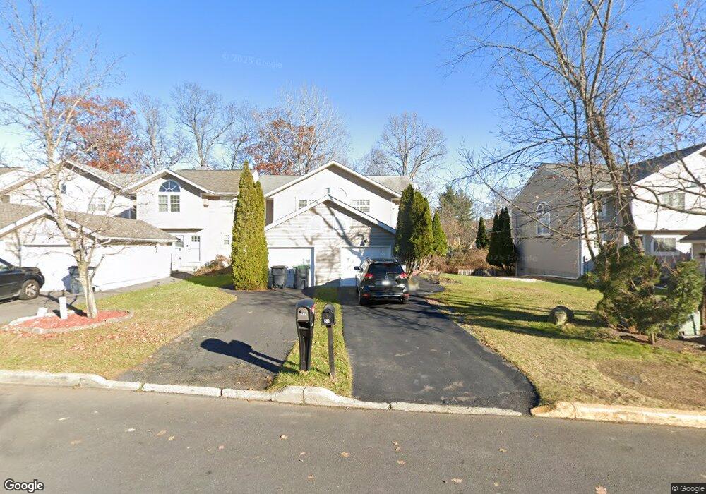
50 Brookside Dr W Harriman, NY 10926
Estimated Value: $369,000 - $442,000
3
Beds
3
Baths
1,588
Sq Ft
$256/Sq Ft
Est. Value
About This Home
This home is located at 50 Brookside Dr W, Harriman, NY 10926 and is currently estimated at $406,721, approximately $256 per square foot. 50 Brookside Dr W is a home located in Orange County with nearby schools including Monroe-Woodbury Middle School, Monroe-Woodbury High School, and Sheri Torah - V'Yoel Moshe.
Ownership History
Date
Name
Owned For
Owner Type
Purchase Details
Closed on
Jul 24, 2003
Sold by
Allen Keith A
Bought by
Choudhury Mokerram
Current Estimated Value
Purchase Details
Closed on
Mar 30, 2001
Sold by
Battista Robert
Bought by
Allen Keith A and Allen Tricia A
Home Financials for this Owner
Home Financials are based on the most recent Mortgage that was taken out on this home.
Original Mortgage
$140,000
Interest Rate
7.05%
Create a Home Valuation Report for This Property
The Home Valuation Report is an in-depth analysis detailing your home's value as well as a comparison with similar homes in the area
Home Values in the Area
Average Home Value in this Area
Purchase History
| Date | Buyer | Sale Price | Title Company |
|---|---|---|---|
| Choudhury Mokerram | $260,000 | Andrew Cohen | |
| Allen Keith A | $150,000 | Commonwealth Land Title Ins |
Source: Public Records
Mortgage History
| Date | Status | Borrower | Loan Amount |
|---|---|---|---|
| Previous Owner | Allen Keith A | $140,000 |
Source: Public Records
Tax History Compared to Growth
Tax History
| Year | Tax Paid | Tax Assessment Tax Assessment Total Assessment is a certain percentage of the fair market value that is determined by local assessors to be the total taxable value of land and additions on the property. | Land | Improvement |
|---|---|---|---|---|
| 2024 | $9,360 | $87,200 | $8,000 | $79,200 |
| 2023 | $9,360 | $87,200 | $8,000 | $79,200 |
| 2022 | $9,794 | $87,200 | $8,000 | $79,200 |
| 2021 | $9,711 | $87,200 | $8,000 | $79,200 |
| 2020 | $8,995 | $87,200 | $8,000 | $79,200 |
| 2019 | $8,831 | $87,200 | $8,000 | $79,200 |
| 2018 | $8,831 | $87,200 | $8,000 | $79,200 |
| 2017 | $8,185 | $87,200 | $8,000 | $79,200 |
| 2016 | $7,982 | $87,200 | $8,000 | $79,200 |
| 2015 | -- | $87,200 | $8,000 | $79,200 |
| 2014 | -- | $87,200 | $8,000 | $79,200 |
Source: Public Records
Map
Nearby Homes
- 9 Melody Ln
- 8 Haight Rd
- 5 Case Ct
- 12 Case Ct
- 18 Pullman Route
- 3 Webster Ct
- 22 Ford Ct
- 87 Barr Ln
- 12 Edgewood Dr
- 1 Heritage Dr Unit 1 H
- 2 Fawn Ridge Ct
- 26 Lexington Hill Unit 1
- 9 Heritage Dr Unit B
- 8 Heritage Dr Unit A
- 5 Heritage Dr Unit D
- 5 Heritage Dr Unit C
- 9 Woodland Rd
- 17 Arlington Dr
- 38 Buena Vista Terrace
- 5 Lexington Hill Unit 3
- 52 Brookside Dr W
- 54 Brookside Dr W
- 48 Brookside Dr W
- 48 Brookside Dr W Unit 48
- 56 Brookside Dr W
- 46 Brookside Dr W
- 58 Brookside Dr W
- 44 Brookside Dr W
- 42 Brookside Dr W
- 60 Brookside Dr W
- 40 Brookside Dr W
- 38 Brookside Dr W
- 57 Brookside Dr W
- 55 Brookside Dr W
- 53 Brookside Dr W
- 59 Brookside Dr W
- 36 Brookside Dr W
- 51 Brookside Dr W
- 49 Brookside Dr W
- 47 Brookside Dr W