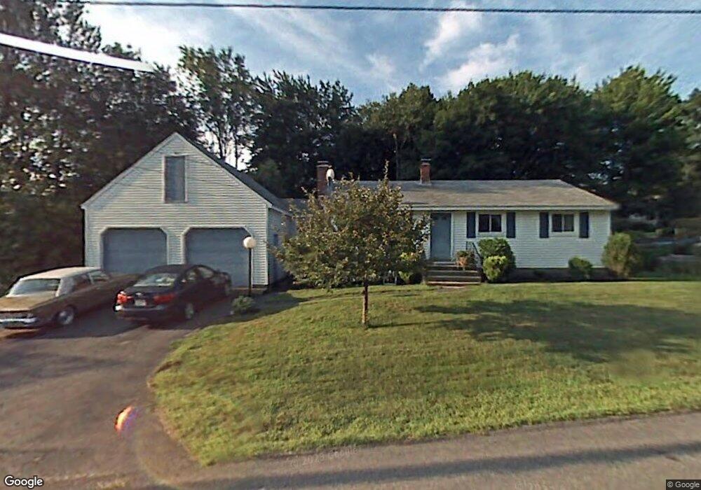
50 Cavour Cir West Boylston, MA 01583
Estimated Value: $439,000 - $456,000
3
Beds
1
Bath
1,251
Sq Ft
$360/Sq Ft
Est. Value
About This Home
This home is located at 50 Cavour Cir, West Boylston, MA 01583 and is currently estimated at $450,697, approximately $360 per square foot. 50 Cavour Cir is a home located in Worcester County with nearby schools including Major Edwards Elementary School, West Boylston Junior/Senior High School, and Abby Kelley Foster Charter Public School.
Ownership History
Date
Name
Owned For
Owner Type
Purchase Details
Closed on
Mar 9, 1987
Sold by
Kuczinski Donald E
Bought by
Chenard Mark
Current Estimated Value
Create a Home Valuation Report for This Property
The Home Valuation Report is an in-depth analysis detailing your home's value as well as a comparison with similar homes in the area
Home Values in the Area
Average Home Value in this Area
Purchase History
| Date | Buyer | Sale Price | Title Company |
|---|---|---|---|
| Chenard Mark | $105,000 | -- |
Source: Public Records
Mortgage History
| Date | Status | Borrower | Loan Amount |
|---|---|---|---|
| Open | Chenard Mark | $150,000 | |
| Closed | Chenard Mark | $150,000 | |
| Closed | Chenard Mark | $110,000 |
Source: Public Records
Tax History Compared to Growth
Tax History
| Year | Tax Paid | Tax Assessment Tax Assessment Total Assessment is a certain percentage of the fair market value that is determined by local assessors to be the total taxable value of land and additions on the property. | Land | Improvement |
|---|---|---|---|---|
| 2025 | $51 | $368,400 | $88,500 | $279,900 |
| 2024 | $4,996 | $338,000 | $88,500 | $249,500 |
| 2023 | $5,109 | $327,900 | $88,000 | $239,900 |
| 2022 | $4,809 | $272,000 | $88,000 | $184,000 |
| 2021 | $4,376 | $251,600 | $83,500 | $168,100 |
| 2020 | $4,561 | $245,500 | $83,500 | $162,000 |
| 2019 | $3,971 | $226,700 | $83,500 | $143,200 |
| 2018 | $4,081 | $218,000 | $83,500 | $134,500 |
| 2017 | $3,627 | $192,900 | $83,500 | $109,400 |
| 2016 | $3,552 | $192,500 | $77,600 | $114,900 |
| 2015 | $3,398 | $185,300 | $76,800 | $108,500 |
Source: Public Records
Map
Nearby Homes
- 39 Davidson Rd
- 1 Highland Ave
- 12 Birchbrush Ln
- 1 Juneberry Ln Unit 82
- 535 Prospect St
- 33 Isleboro St
- 29 Isleboro St
- 54 Maple St
- 23 Orono St
- 740 Burncoat St Unit B
- 1110 W Boylston St Unit A
- 15 Cumberland St
- 22 Danielles Way
- 26 Danielles Way
- 21 Wyoming Dr
- 31 Danielles Way
- 10 Beale St
- 9 Idalla Ave
- 93 Winfield Rd
- 156 Hillside Village Dr