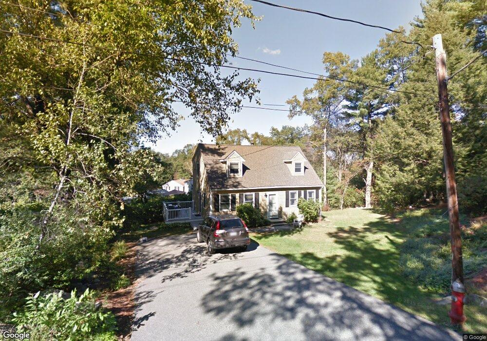
50 Dunmore Rd Wilmington, MA 01887
Estimated Value: $716,000 - $788,000
3
Beds
3
Baths
1,547
Sq Ft
$479/Sq Ft
Est. Value
About This Home
This home is located at 50 Dunmore Rd, Wilmington, MA 01887 and is currently estimated at $741,571, approximately $479 per square foot. 50 Dunmore Rd is a home located in Middlesex County with nearby schools including Wilmington Middle School, Wilmington High School, and Abundant Life Christian School and Childcare.
Ownership History
Date
Name
Owned For
Owner Type
Purchase Details
Closed on
Oct 21, 2008
Sold by
Gorman Edward S and Dorgan Nancy J
Bought by
Gorman Edward S
Current Estimated Value
Home Financials for this Owner
Home Financials are based on the most recent Mortgage that was taken out on this home.
Original Mortgage
$75,000
Outstanding Balance
$49,826
Interest Rate
6.41%
Estimated Equity
$691,745
Purchase Details
Closed on
Jul 21, 1989
Sold by
Gearty John
Bought by
Gorman Edw
Home Financials for this Owner
Home Financials are based on the most recent Mortgage that was taken out on this home.
Original Mortgage
$124,000
Interest Rate
10.07%
Mortgage Type
Purchase Money Mortgage
Create a Home Valuation Report for This Property
The Home Valuation Report is an in-depth analysis detailing your home's value as well as a comparison with similar homes in the area
Home Values in the Area
Average Home Value in this Area
Purchase History
| Date | Buyer | Sale Price | Title Company |
|---|---|---|---|
| Gorman Edward S | -- | -- | |
| Gorman Edw | $155,000 | -- |
Source: Public Records
Mortgage History
| Date | Status | Borrower | Loan Amount |
|---|---|---|---|
| Open | Gorman Edward S | $75,000 | |
| Previous Owner | Gorman Edw | $107,000 | |
| Previous Owner | Gorman Edw | $126,400 | |
| Previous Owner | Gorman Edw | $124,000 |
Source: Public Records
Tax History Compared to Growth
Tax History
| Year | Tax Paid | Tax Assessment Tax Assessment Total Assessment is a certain percentage of the fair market value that is determined by local assessors to be the total taxable value of land and additions on the property. | Land | Improvement |
|---|---|---|---|---|
| 2025 | $6,986 | $610,100 | $273,100 | $337,000 |
| 2024 | $6,664 | $583,000 | $273,100 | $309,900 |
| 2023 | $6,611 | $553,700 | $248,300 | $305,400 |
| 2022 | $6,419 | $492,600 | $206,900 | $285,700 |
| 2021 | $6,247 | $451,400 | $188,000 | $263,400 |
| 2020 | $6,054 | $445,800 | $188,000 | $257,800 |
| 2019 | $5,990 | $435,600 | $179,100 | $256,500 |
| 2018 | $5,673 | $393,700 | $170,600 | $223,100 |
| 2017 | $5,342 | $369,700 | $163,400 | $206,300 |
| 2016 | $5,003 | $342,000 | $155,700 | $186,300 |
| 2015 | $4,761 | $331,300 | $155,700 | $175,600 |
| 2014 | $4,531 | $318,200 | $148,200 | $170,000 |
Source: Public Records
Map
Nearby Homes
- 48 Brand Ave
- 142 Burlington Ave
- 14 Roberts Rd
- 11 Patchs Pond Ln
- 15 Forest St
- 3 Cochrane Rd
- 8 Cushing Dr
- 56 Grove Ave
- 27 Fairview Ave
- 2 Winston Ave
- 151 Grove Ave
- 9 Parker St
- 17 Lake St
- 7 Cross St Unit 306
- 7 Cross St Unit 304
- 7 Cross St Unit 205
- 7 Cross St (Units 201 & 202)
- 114 Lake St
- 20 Hopkins St
- 61 Lowell St