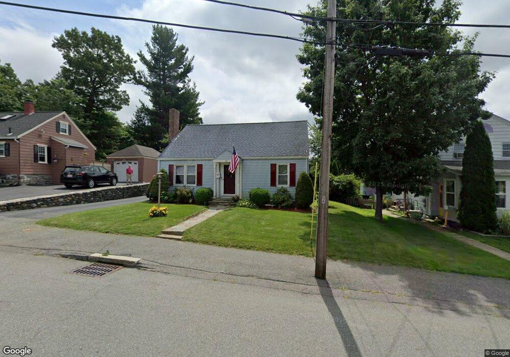
50 Fales St Worcester, MA 01606
Greendale NeighborhoodEstimated Value: $452,000 - $476,000
3
Beds
1
Bath
1,564
Sq Ft
$297/Sq Ft
Est. Value
About This Home
This home is located at 50 Fales St, Worcester, MA 01606 and is currently estimated at $464,467, approximately $296 per square foot. 50 Fales St is a home located in Worcester County with nearby schools including Jacob Hiatt Magnet School, Chandler Magnet, and Thorndyke Road School.
Ownership History
Date
Name
Owned For
Owner Type
Purchase Details
Closed on
Mar 20, 1992
Sold by
Atallah Monica and Atallah Camil
Bought by
Cousineau Irene R and Cousineau Robert
Current Estimated Value
Purchase Details
Closed on
Sep 22, 1989
Sold by
Forsman Wesson
Bought by
Atallah Monica
Create a Home Valuation Report for This Property
The Home Valuation Report is an in-depth analysis detailing your home's value as well as a comparison with similar homes in the area
Home Values in the Area
Average Home Value in this Area
Purchase History
| Date | Buyer | Sale Price | Title Company |
|---|---|---|---|
| Cousineau Irene R | $92,000 | -- | |
| Atallah Monica | $115,400 | -- |
Source: Public Records
Mortgage History
| Date | Status | Borrower | Loan Amount |
|---|---|---|---|
| Closed | Atallah Monica | $82,000 | |
| Closed | Atallah Monica | $82,950 |
Source: Public Records
Tax History Compared to Growth
Tax History
| Year | Tax Paid | Tax Assessment Tax Assessment Total Assessment is a certain percentage of the fair market value that is determined by local assessors to be the total taxable value of land and additions on the property. | Land | Improvement |
|---|---|---|---|---|
| 2025 | $5,389 | $408,600 | $118,700 | $289,900 |
| 2024 | $5,279 | $383,900 | $118,700 | $265,200 |
| 2023 | $5,073 | $353,800 | $103,200 | $250,600 |
| 2022 | $4,669 | $307,000 | $82,600 | $224,400 |
| 2021 | $4,581 | $281,400 | $66,100 | $215,300 |
| 2020 | $4,459 | $262,300 | $66,100 | $196,200 |
| 2019 | $4,252 | $236,200 | $59,500 | $176,700 |
| 2018 | $4,266 | $225,600 | $59,500 | $166,100 |
| 2017 | $4,080 | $212,300 | $59,500 | $152,800 |
| 2016 | $4,050 | $196,500 | $43,600 | $152,900 |
| 2015 | $3,944 | $196,500 | $43,600 | $152,900 |
| 2014 | $3,840 | $196,500 | $43,600 | $152,900 |
Source: Public Records
Map
Nearby Homes
- 40 Francis St
- 18 Claffey Ave
- 15 Inwood Rd
- 3 Granville Ave
- 29 E Mountain
- 28 Brooks St
- 134 Whitmarsh Ave
- 95 Saint Nicholas Ave
- 34 King Philip Rd
- 113 Bay State Rd
- 120 Bay State Rd
- 13 Fatima Ln
- 15 Ericsson St
- 2 Maria Ln Unit 2
- 14 Mary Ann Dr
- 276 Saint Nicholas Ave
- 49 E Mountain St
- 31 Enaya Cir Unit 31
- 11 Hockanum Way
- 304 Saint Nicholas Ave