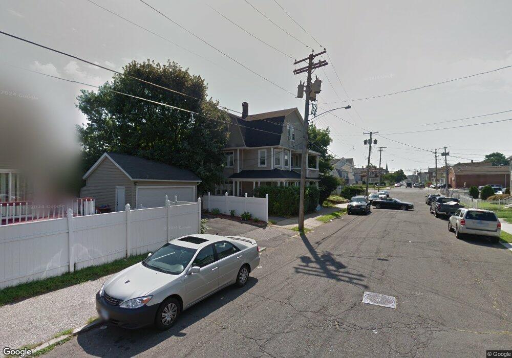
50 Hudson St Unit 52 Bridgeport, CT 06606
Brooklawn-Saint Vincent NeighborhoodEstimated Value: $464,319 - $803,000
6
Beds
3
Baths
3,308
Sq Ft
$184/Sq Ft
Est. Value
About This Home
This home is located at 50 Hudson St Unit 52, Bridgeport, CT 06606 and is currently estimated at $607,580, approximately $183 per square foot. 50 Hudson St Unit 52 is a home located in Fairfield County with nearby schools including Read School, Central High School, and Catholic Academy of Bridgeport-St. Raphael Academy.
Ownership History
Date
Name
Owned For
Owner Type
Purchase Details
Closed on
May 27, 2003
Sold by
Cogan Robert and Cogan Carol J
Bought by
Mcdougal James
Current Estimated Value
Home Financials for this Owner
Home Financials are based on the most recent Mortgage that was taken out on this home.
Original Mortgage
$246,000
Outstanding Balance
$108,385
Interest Rate
5.86%
Estimated Equity
$499,195
Purchase Details
Closed on
Apr 3, 1995
Sold by
Jacaruso William J and Zemeir Mark
Bought by
Cogan Carol J and Cogan Robert F
Create a Home Valuation Report for This Property
The Home Valuation Report is an in-depth analysis detailing your home's value as well as a comparison with similar homes in the area
Home Values in the Area
Average Home Value in this Area
Purchase History
| Date | Buyer | Sale Price | Title Company |
|---|---|---|---|
| Mcdougal James | $250,000 | -- | |
| Mcdougal James | $250,000 | -- | |
| Cogan Carol J | $88,000 | -- | |
| Cogan Carol J | $88,000 | -- |
Source: Public Records
Mortgage History
| Date | Status | Borrower | Loan Amount |
|---|---|---|---|
| Open | Cogan Carol J | $246,000 | |
| Closed | Cogan Carol J | $14,700 | |
| Closed | Cogan Carol J | $246,000 |
Source: Public Records
Tax History Compared to Growth
Tax History
| Year | Tax Paid | Tax Assessment Tax Assessment Total Assessment is a certain percentage of the fair market value that is determined by local assessors to be the total taxable value of land and additions on the property. | Land | Improvement |
|---|---|---|---|---|
| 2025 | $10,101 | $232,470 | $70,130 | $162,340 |
| 2024 | $10,101 | $232,470 | $70,130 | $162,340 |
| 2023 | $10,101 | $232,470 | $70,130 | $162,340 |
| 2022 | $10,101 | $232,470 | $70,130 | $162,340 |
| 2021 | $10,101 | $232,470 | $70,130 | $162,340 |
| 2020 | $9,125 | $169,010 | $42,490 | $126,520 |
| 2019 | $9,125 | $169,010 | $42,490 | $126,520 |
| 2018 | $9,189 | $169,010 | $42,490 | $126,520 |
| 2017 | $9,189 | $169,010 | $42,490 | $126,520 |
| 2016 | $9,189 | $169,010 | $42,490 | $126,520 |
| 2015 | $8,621 | $204,290 | $42,840 | $161,450 |
| 2014 | $8,621 | $204,290 | $42,840 | $161,450 |
Source: Public Records
Map
Nearby Homes
- 330 French St
- 2395 Main St Unit 2397
- 724 Capitol Ave Unit 726
- 390 Charles St Unit 106
- 119 Madison Terrace
- 76 Porter St
- 508 Hawley Ave
- 936 Lindley St
- 90 Tom Thumb St
- 106 Manhattan Ave Unit 108
- 78 Fairmount Ave
- 123 Harlem Ave
- 31 Taft Ave
- 203 Wayne St
- 926 Hart St
- 916 Hart St
- 178 Island Brook Ave
- 252 Harlem Ave Unit B6
- 252 Harlem Ave Unit B5
- 152 River St
- 40 Hudson St Unit 8
- 40 Hudson St Unit 7
- 40 Hudson St Unit 6
- 40 Hudson St Unit 5
- 40 Hudson St Unit 4
- 40 Hudson St Unit 3
- 40 Hudson St Unit 2
- 40 Hudson St Unit 1
- 337 Parrott Ave
- 339 Parrott Ave Unit 2flr
- 37 Hudson St Unit 39
- 395 French St
- 60 Hudson St
- 389 French St Unit 3
- 387 French St Unit 389
- 15 Hudson St Unit 2
- 15 Hudson St Unit 2ndFL
- 15 Hudson St
- 12 Hudson St Unit R3
- 12 Hudson St Unit R2