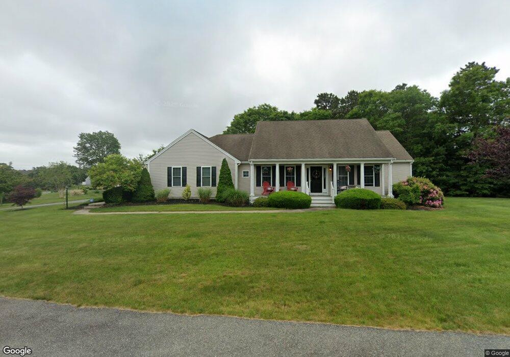
50 Mirasol Dr Bourne, MA 2532
Estimated Value: $681,000 - $767,000
3
Beds
3
Baths
1,871
Sq Ft
$387/Sq Ft
Est. Value
About This Home
This home is located at 50 Mirasol Dr, Bourne, MA 2532 and is currently estimated at $724,291, approximately $387 per square foot. 50 Mirasol Dr is a home located in Barnstable County with nearby schools including Bourne High School and St Margaret Regional School.
Ownership History
Date
Name
Owned For
Owner Type
Purchase Details
Closed on
Jun 25, 2020
Sold by
Toto Joseph C and Gouveia-Toto Marcia
Bought by
Howard Gary and Howard Sheila
Current Estimated Value
Purchase Details
Closed on
Jun 24, 2015
Sold by
Desisto David A and Desisto Dorothy K
Bought by
Toto Joseph C and Gouveia-Toto Marcia
Home Financials for this Owner
Home Financials are based on the most recent Mortgage that was taken out on this home.
Original Mortgage
$417,000
Interest Rate
3.84%
Mortgage Type
Purchase Money Mortgage
Purchase Details
Closed on
Apr 29, 2015
Sold by
Desisto David A and Desisto Dorothy K
Bought by
Desisto David A and Desisto Dorothy K
Home Financials for this Owner
Home Financials are based on the most recent Mortgage that was taken out on this home.
Original Mortgage
$417,000
Interest Rate
3.84%
Mortgage Type
Purchase Money Mortgage
Purchase Details
Closed on
Jul 20, 2011
Sold by
Desisto David A and Desisto Dorthy K
Bought by
Desisto David N and Desisto Christopher E
Purchase Details
Closed on
Dec 22, 2009
Sold by
Pilgrim Pines Ld Llc
Bought by
Desisto David A and Desisto Dorothy K
Home Financials for this Owner
Home Financials are based on the most recent Mortgage that was taken out on this home.
Original Mortgage
$270,000
Interest Rate
5%
Mortgage Type
Purchase Money Mortgage
Create a Home Valuation Report for This Property
The Home Valuation Report is an in-depth analysis detailing your home's value as well as a comparison with similar homes in the area
Home Values in the Area
Average Home Value in this Area
Purchase History
| Date | Buyer | Sale Price | Title Company |
|---|---|---|---|
| Howard Gary | $505,000 | None Available | |
| Howard Gary | $505,000 | None Available | |
| Toto Joseph C | $445,000 | -- | |
| Toto Joseph C | $445,000 | -- | |
| Desisto David A | -- | -- | |
| Desisto David A | -- | -- | |
| Desisto David N | -- | -- | |
| Desisto David N | -- | -- | |
| Desisto David A | $400,000 | -- | |
| Desisto David A | $400,000 | -- |
Source: Public Records
Mortgage History
| Date | Status | Borrower | Loan Amount |
|---|---|---|---|
| Previous Owner | Toto Joseph C | $417,000 | |
| Previous Owner | Desisto David A | $270,000 |
Source: Public Records
Tax History Compared to Growth
Tax History
| Year | Tax Paid | Tax Assessment Tax Assessment Total Assessment is a certain percentage of the fair market value that is determined by local assessors to be the total taxable value of land and additions on the property. | Land | Improvement |
|---|---|---|---|---|
| 2025 | $5,395 | $690,800 | $219,200 | $471,600 |
| 2024 | $5,316 | $662,800 | $208,800 | $454,000 |
| 2023 | $5,524 | $627,000 | $201,500 | $425,500 |
| 2022 | $5,245 | $519,800 | $178,400 | $341,400 |
| 2021 | $5,131 | $476,400 | $162,300 | $314,100 |
| 2020 | $4,988 | $464,400 | $160,800 | $303,600 |
| 2019 | $4,701 | $447,300 | $160,800 | $286,500 |
| 2018 | $4,375 | $415,100 | $153,100 | $262,000 |
| 2017 | $4,607 | $447,300 | $145,400 | $301,900 |
| 2016 | $4,302 | $423,400 | $132,700 | $290,700 |
| 2015 | -- | $364,600 | $126,400 | $238,200 |
Source: Public Records
Map
Nearby Homes
- 23 Settlers Way
- 18 Heather Hill Rd
- 4 Knob Ln
- 171 Puritan Rd
- 162 Puritan Rd
- 304 Main St
- 4 Mainstay Ln
- 17 Maple St
- 41 Lewis Point Rd
- 0 Lewis Point Rd
- 65 Lewis Point Rd
- 73 Lewis Point Rd
- 29 Weather Deck Rd
- 24 Ships View Terrace
- 27 Ships View Terrace
- 90-92 Sandwich Rd Unit 9C
- 38 Old Bridge Rd
- 810 Head of The Bay Rd
- 2 Dogwood Rd Unit 2
- 2 Dogwood Rd