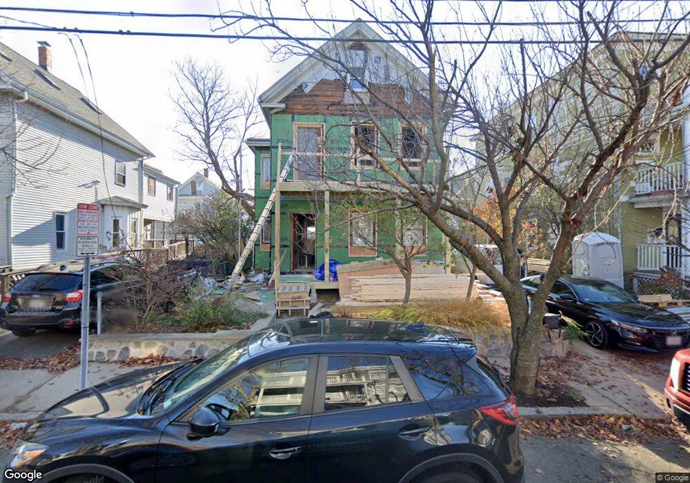
50 Moore St Somerville, MA 02144
Teele Square NeighborhoodEstimated Value: $1,253,000 - $1,844,521
4
Beds
3
Baths
2,753
Sq Ft
$521/Sq Ft
Est. Value
About This Home
This home is located at 50 Moore St, Somerville, MA 02144 and is currently estimated at $1,435,130, approximately $521 per square foot. 50 Moore St is a home located in Middlesex County with nearby schools including Somerville High School, Benjamin Banneker Charter Public School, and International School of Boston.
Create a Home Valuation Report for This Property
The Home Valuation Report is an in-depth analysis detailing your home's value as well as a comparison with similar homes in the area
Home Values in the Area
Average Home Value in this Area
Tax History
| Year | Tax Paid | Tax Assessment Tax Assessment Total Assessment is a certain percentage of the fair market value that is determined by local assessors to be the total taxable value of land and additions on the property. | Land | Improvement |
|---|---|---|---|---|
| 2025 | $16,502 | $1,512,600 | $760,000 | $752,600 |
| 2024 | $15,463 | $1,469,900 | $760,000 | $709,900 |
| 2023 | $15,073 | $1,457,700 | $760,000 | $697,700 |
| 2022 | $13,577 | $1,333,700 | $723,800 | $609,900 |
| 2021 | $2,326 | $1,148,600 | $702,600 | $446,000 |
| 2020 | $10,860 | $1,076,300 | $654,600 | $421,700 |
| 2019 | $10,443 | $970,500 | $582,000 | $388,500 |
| 2018 | $2,259 | $914,700 | $579,900 | $334,800 |
| 2017 | $9,978 | $855,000 | $547,100 | $307,900 |
| 2016 | $10,187 | $813,000 | $516,800 | $296,200 |
| 2015 | $9,133 | $724,300 | $473,200 | $251,100 |
Source: Public Records
Map
Nearby Homes
- 30 Clarendon Ave
- 5 Glendale Ave Unit 5
- 34 Elmwood St Unit 2
- 2 Gold Star Ct
- 69 Electric Ave Unit 3
- 69 Electric Ave Unit 1
- 14 Farragut Ave Unit 1
- 42 Packard Ave Unit 42
- 1004 Broadway Unit 3
- 55 Packard Ave Unit 1
- 97 Elmwood St Unit 313
- 97 Elmwood St Unit 110
- 97 Elmwood St Unit 310
- 9-11 Edmunds St
- 202 Powder House Blvd Unit 1
- 202 Powder House Blvd Unit 2
- 2353 Massachusetts Ave Unit 44
- 17 Holland St Unit 301
- 69 Harvey St Unit 1
- 38 Brookford St Unit 2
- 50 Moore St Unit 1
- 46 Moore St
- 54 Moore St
- 37 Claremon St
- 37 Claremon St
- 37 Claremon St Unit 37
- 37 Claremon St
- 37 Claremon St Unit 1
- 37 Claremon St Unit 2
- 42 Moore St
- 33 Claremon St
- 39 Claremon St
- 41 Claremon St
- 40 Moore St Unit 42
- 40 Moore St Unit 40
- 29 Claremon St
- 49 Moore St
- 21 Mead St
- 45 Moore St
- 53 Moore St
Your Personal Tour Guide
Ask me questions while you tour the home.