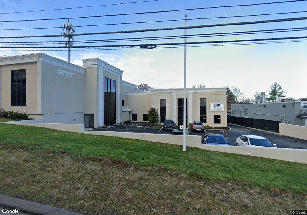
50 Newtown Rd Unit C-7 Danbury, CT 06810
Estimated Value: $2,911,500
--
Bed
1
Bath
470
Sq Ft
$6,195/Sq Ft
Est. Value
About This Home
This home is located at 50 Newtown Rd Unit C-7, Danbury, CT 06810 and is currently priced at $2,911,500, approximately $6,194 per square foot. 50 Newtown Rd Unit C-7 is a home located in Fairfield County with nearby schools including Stadley Rough School, Broadview Middle School, and Danbury High School.
Ownership History
Date
Name
Owned For
Owner Type
Purchase Details
Closed on
Sep 14, 2001
Sold by
Servadio Norma L
Bought by
Brt Benedict Llc
Current Estimated Value
Home Financials for this Owner
Home Financials are based on the most recent Mortgage that was taken out on this home.
Original Mortgage
$220,000
Interest Rate
6.99%
Mortgage Type
Commercial
Create a Home Valuation Report for This Property
The Home Valuation Report is an in-depth analysis detailing your home's value as well as a comparison with similar homes in the area
Home Values in the Area
Average Home Value in this Area
Purchase History
| Date | Buyer | Sale Price | Title Company |
|---|---|---|---|
| Brt Benedict Llc | $250,000 | -- | |
| Brt Benedict Llc | $250,000 | -- |
Source: Public Records
Mortgage History
| Date | Status | Borrower | Loan Amount |
|---|---|---|---|
| Closed | Brt Benedict Llc | $220,000 |
Source: Public Records
Tax History Compared to Growth
Tax History
| Year | Tax Paid | Tax Assessment Tax Assessment Total Assessment is a certain percentage of the fair market value that is determined by local assessors to be the total taxable value of land and additions on the property. | Land | Improvement |
|---|---|---|---|---|
| 2025 | $36,630 | $1,465,800 | $352,520 | $1,113,280 |
| 2024 | $35,824 | $1,465,800 | $352,520 | $1,113,280 |
| 2023 | $34,197 | $1,465,800 | $352,520 | $1,113,280 |
| 2022 | $36,181 | $1,282,100 | $352,700 | $929,400 |
| 2021 | $35,386 | $1,282,100 | $352,700 | $929,400 |
| 2020 | $35,386 | $1,282,100 | $352,700 | $929,400 |
| 2019 | $35,386 | $1,282,100 | $352,700 | $929,400 |
| 2018 | $35,386 | $1,282,100 | $352,700 | $929,400 |
| 2017 | $35,501 | $1,226,300 | $335,900 | $890,400 |
| 2016 | $35,170 | $1,226,300 | $335,900 | $890,400 |
| 2015 | $34,655 | $1,226,300 | $335,900 | $890,400 |
| 2014 | $33,846 | $1,226,300 | $335,900 | $890,400 |
Source: Public Records
Map
Nearby Homes
- 5 Woodside Ave Unit D-44
- 5 Woodside Ave Unit 41
- 6 Topstone Dr
- 2 Garry Knolls
- 151 Shelter Rock Rd Unit 87
- 55 Cross St Unit C9
- 157 Shelter Rock Rd Unit 37
- 157 Shelter Rock Rd Unit 4
- 39 Woodcrest Ln Unit 39
- 70 Woodcrest Ln Unit 70
- 8 Briarwood Dr
- 159 Triangle St
- 16 Springside Ave
- 23 Westview Dr
- 19 Somers St Unit D1
- 35 Briarwood Dr
- 30 Faith Ln
- 28 Homestead Ave Unit 2
- 24 Homestead Ave
- 24 Crestview Ln Unit 24
- 50 Newtown Rd Unit C-1
- 50 Newtown Rd Unit C-9
- 50 Newtown Rd Unit C-3
- 50 Newtown Rd
- 48 Newtown Rd
- 48 Newtown Rd Unit A07
- 9 E Broad St
- 3 Lyon St
- 7 E Broad St
- 15 Gallagher Ln Unit I
- 15 Gallagher Ln Unit H
- 15 Gallagher Ln Unit G
- 15 Gallagher Ln Unit F
- 15 Gallagher Ln Unit E
- 15 Gallagher Ln Unit D
- 15 Gallagher Ln Unit C
- 15 Gallagher Ln Unit B
- 15 Gallagher Ln Unit J
- 15 Gallagher Ln Unit A
- 15 Gallagher Ln Unit I-9