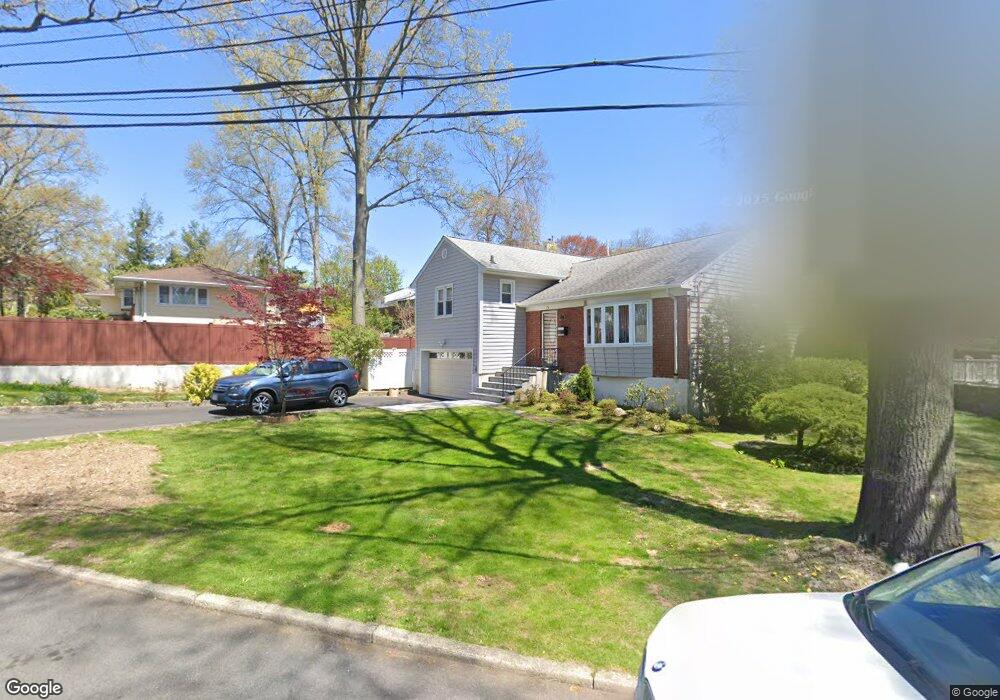
50 Nimitz Rd Yonkers, NY 10710
Crestwood NeighborhoodEstimated Value: $833,000 - $943,000
3
Beds
2
Baths
1,436
Sq Ft
$614/Sq Ft
Est. Value
About This Home
This home is located at 50 Nimitz Rd, Yonkers, NY 10710 and is currently estimated at $881,649, approximately $613 per square foot. 50 Nimitz Rd is a home located in Westchester County with nearby schools including Annunciation School.
Ownership History
Date
Name
Owned For
Owner Type
Purchase Details
Closed on
Jun 18, 2004
Sold by
Manning Keith and Forman Terry
Bought by
Ongsueng Alfredo and Ongsueng Jocelyn
Current Estimated Value
Create a Home Valuation Report for This Property
The Home Valuation Report is an in-depth analysis detailing your home's value as well as a comparison with similar homes in the area
Home Values in the Area
Average Home Value in this Area
Purchase History
| Date | Buyer | Sale Price | Title Company |
|---|---|---|---|
| Ongsueng Alfredo | $460,000 | -- |
Source: Public Records
Tax History Compared to Growth
Tax History
| Year | Tax Paid | Tax Assessment Tax Assessment Total Assessment is a certain percentage of the fair market value that is determined by local assessors to be the total taxable value of land and additions on the property. | Land | Improvement |
|---|---|---|---|---|
| 2024 | $2,352 | $13,201 | $5,100 | $8,101 |
| 2023 | $2,340 | $13,201 | $5,100 | $8,101 |
| 2022 | $2,325 | $13,201 | $5,100 | $8,101 |
| 2021 | $10,414 | $13,201 | $5,100 | $8,101 |
| 2020 | $10,321 | $13,201 | $5,100 | $8,101 |
| 2019 | $12,300 | $13,201 | $5,100 | $8,101 |
| 2018 | $9,570 | $13,201 | $5,100 | $8,101 |
| 2017 | $0 | $13,201 | $5,100 | $8,101 |
| 2016 | $10,928 | $13,201 | $5,100 | $8,101 |
| 2015 | -- | $13,500 | $5,100 | $8,400 |
| 2014 | -- | $13,500 | $5,100 | $8,400 |
| 2013 | -- | $13,500 | $5,100 | $8,400 |
Source: Public Records
Map
Nearby Homes
- 33 Eisenhower Dr
- 127 Crisfield St
- 12 Bacon Place
- 66 Crisfield St Unit 3Y
- 66 Crisfield St Unit 1D
- 66 Crisfield St Unit 3D
- 10 Alpha St
- 7 &13 Cambridge Ave
- 210 Wyndcliff Rd
- 20 Whistler Rd
- 49 Gail Rd
- 80 Dorset Rd
- 100 Woodford Rd
- 460 Westchester Ave
- 15 Bristol Place
- 281 Garth Rd Unit C5A
- 281 Garth Rd Unit A6D
- 281 Garth Rd Unit C3D
- 281 Garth Rd Unit B6D
- 253 Garth Rd Unit 1S