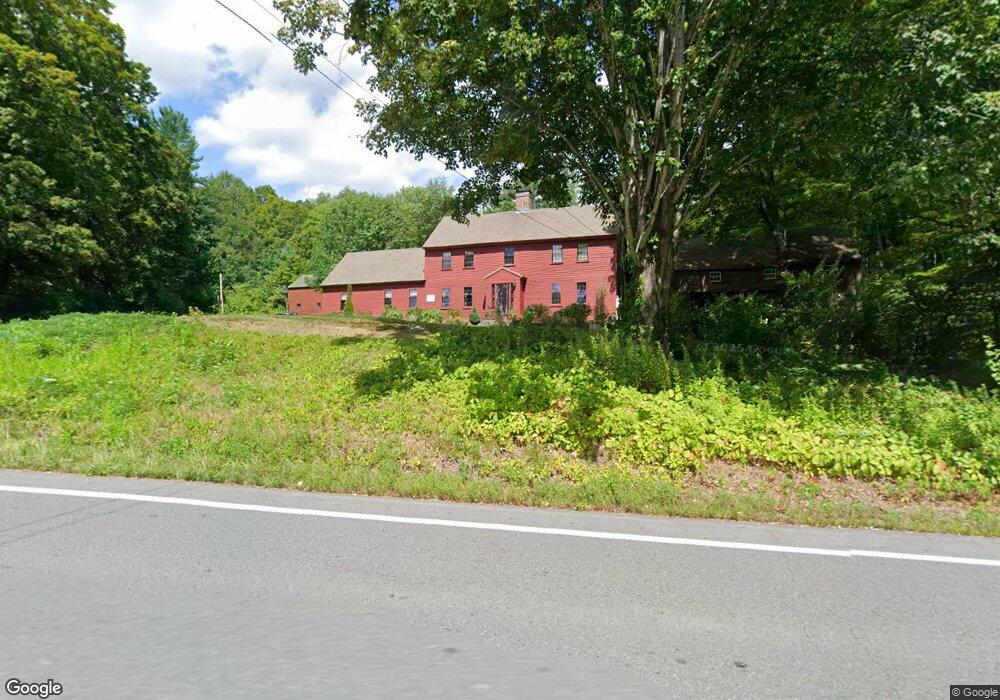
50 Pepperell Rd Brookline, NH 03033
Estimated Value: $503,000 - $651,000
3
Beds
1
Bath
2,827
Sq Ft
$204/Sq Ft
Est. Value
About This Home
This home is located at 50 Pepperell Rd, Brookline, NH 03033 and is currently estimated at $576,601, approximately $203 per square foot. 50 Pepperell Rd is a home with nearby schools including Richard Maghakian Memorial School, Captain Samuel Douglass Academy, and Hollis-Brookline Middle School.
Ownership History
Date
Name
Owned For
Owner Type
Purchase Details
Closed on
Nov 1, 1996
Sold by
Fessenden Sandra L
Bought by
Frugard John G and Frugard Mary K
Current Estimated Value
Home Financials for this Owner
Home Financials are based on the most recent Mortgage that was taken out on this home.
Original Mortgage
$139,500
Interest Rate
8.07%
Create a Home Valuation Report for This Property
The Home Valuation Report is an in-depth analysis detailing your home's value as well as a comparison with similar homes in the area
Home Values in the Area
Average Home Value in this Area
Purchase History
| Date | Buyer | Sale Price | Title Company |
|---|---|---|---|
| Frugard John G | $155,000 | -- |
Source: Public Records
Mortgage History
| Date | Status | Borrower | Loan Amount |
|---|---|---|---|
| Open | Frugard John G | $30,000 | |
| Open | Frugard John G | $138,000 | |
| Closed | Frugard John G | $140,000 | |
| Closed | Frugard John G | $139,500 |
Source: Public Records
Tax History Compared to Growth
Tax History
| Year | Tax Paid | Tax Assessment Tax Assessment Total Assessment is a certain percentage of the fair market value that is determined by local assessors to be the total taxable value of land and additions on the property. | Land | Improvement |
|---|---|---|---|---|
| 2024 | $11,904 | $526,500 | $184,300 | $342,200 |
| 2023 | $10,941 | $526,500 | $184,300 | $342,200 |
| 2022 | $10,069 | $338,800 | $111,000 | $227,800 |
| 2021 | $9,683 | $338,800 | $111,000 | $227,800 |
| 2020 | $9,419 | $338,800 | $111,000 | $227,800 |
| 2019 | $10,120 | $338,800 | $111,000 | $227,800 |
| 2018 | $9,920 | $335,600 | $111,000 | $224,600 |
| 2017 | $8,357 | $253,700 | $89,900 | $163,800 |
| 2016 | $8,260 | $253,700 | $89,900 | $163,800 |
| 2015 | $7,877 | $253,700 | $89,900 | $163,800 |
| 2014 | $8,334 | $253,700 | $89,900 | $163,800 |
| 2013 | $8,025 | $253,700 | $89,900 | $163,800 |
Source: Public Records
Map
Nearby Homes
- 6 Flint Meadow Dr
- 46 Oak Hill Rd
- 22 Hobart Hill Rd
- 6 High Oaks Path
- 28A Rocky Pond Rd
- 22 Austin Ln
- 143 Worcester Rd
- 5 Carons Way
- 179 Brookline St
- 167 Route 13
- 21 Cranberry St
- 7 Winterberry Rd
- 9 Winterberry Rd
- 93 Old Milford Rd
- 364 Townsend Hill Rd
- 15 N End Rd
- 10 Boynton St
- 3 Wood Ln
- 0 Brookline St
- 172 Hayden Rd