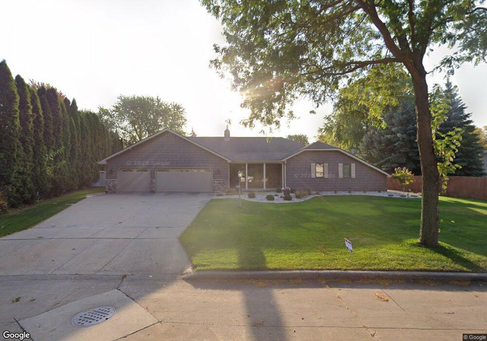
50 Pheasant Ct Appleton, WI 54915
South Appleton NeighborhoodEstimated Value: $352,000 - $412,000
3
Beds
2
Baths
1,712
Sq Ft
$227/Sq Ft
Est. Value
About This Home
This home is located at 50 Pheasant Ct, Appleton, WI 54915 and is currently estimated at $388,937, approximately $227 per square foot. 50 Pheasant Ct is a home located in Calumet County with nearby schools including Janet Berry Elementary School, James Madison Middle School, and Appleton East High School.
Ownership History
Date
Name
Owned For
Owner Type
Purchase Details
Closed on
Jul 19, 2018
Sold by
Kampo James and Kampo Nancy
Bought by
Kampo Living Trust
Current Estimated Value
Purchase Details
Closed on
Jul 28, 2016
Sold by
High Line Business Park Development
Bought by
P & J Kampo Enterprises Llc
Create a Home Valuation Report for This Property
The Home Valuation Report is an in-depth analysis detailing your home's value as well as a comparison with similar homes in the area
Home Values in the Area
Average Home Value in this Area
Purchase History
| Date | Buyer | Sale Price | Title Company |
|---|---|---|---|
| Kampo Living Trust | -- | None Available | |
| P & J Kampo Enterprises Llc | -- | -- |
Source: Public Records
Tax History
| Year | Tax Paid | Tax Assessment Tax Assessment Total Assessment is a certain percentage of the fair market value that is determined by local assessors to be the total taxable value of land and additions on the property. | Land | Improvement |
|---|---|---|---|---|
| 2024 | -- | $376,800 | $54,600 | $322,200 |
| 2023 | $6,001 | $376,800 | $54,600 | $322,200 |
| 2022 | $5,261 | $240,200 | $43,700 | $196,500 |
| 2021 | $5,151 | $240,200 | $43,700 | $196,500 |
| 2020 | $5,066 | $240,200 | $43,700 | $196,500 |
| 2019 | $4,832 | $240,200 | $43,700 | $196,500 |
| 2018 | $3,943 | $177,500 | $39,700 | $137,800 |
| 2017 | $3,914 | $177,500 | $39,700 | $137,800 |
| 2016 | $3,794 | $177,500 | $39,700 | $137,800 |
| 2015 | $3,796 | $177,500 | $39,700 | $137,800 |
| 2013 | $3,794 | $177,500 | $41,700 | $135,800 |
Source: Public Records
Map
Nearby Homes
- 3230 S Whip Poor Will Ln
- 3329 S Bob o Link Ln
- 600 E Woodcrest Dr
- 1548 Oneida St
- 1248 Deer Haven Dr
- 1700 E Midway Rd
- 1421 E Midway Rd
- 1367 Midway Rd
- 1827 Orchard Blossom Dr
- W6534 Manitowoc Rd
- 1819 E Sylvan Ave
- 1821 E Sylvan Ave
- 1764 Oakridge Ct
- 1831 E Sylvan Ave
- 2402 S Madison St
- 1327 Province Terrace
- 1718 Acorn Ct
- 1443 E Calumet St
- 1426 E Calumet St
- 1928 S Lawe St
- 64 Pheasant Ct
- 1014 E Meadow Grove Blvd
- 1006 E Meadow Grove Blvd
- 3235 S Whip Poor Will Ln
- 3241 S Whip Poor Will Ln
- 3235 Whippoorwill Ln
- 70 Pheasant Ct
- 53 Pheasant Ct
- 1026 E Meadow Grove Blvd
- 49 Pheasant Ct
- 57 Pheasant Ct
- 45 Pheasant Ct
- 1005 E Meadow Grove Blvd
- 1019 E Meadow Grove Blvd
- 3242 S Whip Poor Will Ln
- 1013 E Meadow Grove Blvd
- 3236 S Whip Poor Will Ln
- 1100 E Meadow Grove Blvd
- 44 Thistle Down Ct
- 1025 E Meadow Grove Blvd
Your Personal Tour Guide
Ask me questions while you tour the home.