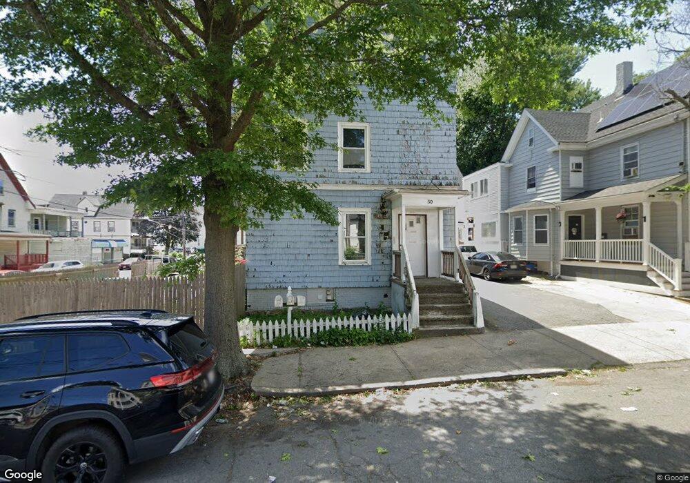
50 Rock Ave Lynn, MA 01902
Highlands NeighborhoodEstimated Value: $861,000 - $915,000
6
Beds
3
Baths
3,522
Sq Ft
$252/Sq Ft
Est. Value
About This Home
This home is located at 50 Rock Ave, Lynn, MA 01902 and is currently estimated at $886,000, approximately $251 per square foot. 50 Rock Ave is a home located in Essex County with nearby schools including Robert L. Ford Elementary School, William R. Fallon School, and Fecteau-Leary Junior/Senior High School.
Ownership History
Date
Name
Owned For
Owner Type
Purchase Details
Closed on
Apr 9, 2010
Sold by
Ellis Ronald E and Ellis Beverly M
Bought by
Pan Wesley W and Phung-Pan Camille
Current Estimated Value
Home Financials for this Owner
Home Financials are based on the most recent Mortgage that was taken out on this home.
Original Mortgage
$141,600
Interest Rate
5.12%
Mortgage Type
Purchase Money Mortgage
Purchase Details
Closed on
Oct 24, 1990
Sold by
Duda Louise
Bought by
Ellis Ronald E
Create a Home Valuation Report for This Property
The Home Valuation Report is an in-depth analysis detailing your home's value as well as a comparison with similar homes in the area
Home Values in the Area
Average Home Value in this Area
Purchase History
| Date | Buyer | Sale Price | Title Company |
|---|---|---|---|
| Pan Wesley W | $177,000 | -- | |
| Ellis Ronald E | $140,000 | -- |
Source: Public Records
Mortgage History
| Date | Status | Borrower | Loan Amount |
|---|---|---|---|
| Open | Ellis Ronald E | $1,376,250 | |
| Closed | Ellis Ronald E | $141,600 |
Source: Public Records
Tax History Compared to Growth
Tax History
| Year | Tax Paid | Tax Assessment Tax Assessment Total Assessment is a certain percentage of the fair market value that is determined by local assessors to be the total taxable value of land and additions on the property. | Land | Improvement |
|---|---|---|---|---|
| 2025 | $8,064 | $778,400 | $196,400 | $582,000 |
| 2024 | $7,928 | $752,900 | $177,300 | $575,600 |
| 2023 | $7,699 | $690,500 | $177,300 | $513,200 |
| 2022 | $7,499 | $603,300 | $145,000 | $458,300 |
| 2021 | $7,153 | $549,000 | $132,200 | $416,800 |
| 2020 | $6,512 | $486,000 | $103,300 | $382,700 |
| 2019 | $6,388 | $446,700 | $100,800 | $345,900 |
| 2018 | $5,909 | $390,000 | $97,400 | $292,600 |
| 2017 | $5,469 | $350,600 | $75,700 | $274,900 |
| 2016 | $4,996 | $308,800 | $63,800 | $245,000 |
| 2015 | $4,645 | $277,300 | $68,500 | $208,800 |
Source: Public Records
Map
Nearby Homes
- 69 Hawthorne St
- 16 Hollingsworth St
- 199 Allen Ave
- 6-8 Beede Ave
- 325 Western Ave
- 105 Lawton Ave
- 106 Goodridge St
- 94 Sheridan St
- 30 Adams St
- 200 Locust St Unit 302
- 14 Mount Pleasant Place
- 58 Laighton St
- 29 Ford St
- 440 Essex St
- 198 Locust St Unit 308
- 191-193 Washington St
- 0 High St
- 344 Essex St
- 5 Whittier St
- 12 Chestnut Ave
- 54 Rock Ave
- 52 Rock Ave
- 156 Beacon Hill Ave
- 58-60 Rock Ave
- 58 Rock Ave Unit 60
- 60 Rock Ave
- 40 Rock Ave
- 40 Rock Ave Unit 2
- 159 Beacon Hill Ave
- 152 Beacon Hill Ave
- 45 Rock Ave Unit 47
- 49-51 Rock Ave
- 49 Rock Ave Unit 51
- 38 Rock Ave
- 155 Beacon Hill Ave Unit 157
- 155-157 Beacon Hill Ave
- 39-41 Rock Ave
- 39 Rock Ave Unit 41
- 147 Beacon Hill Ave Unit 149
- 51 Bay View Ave