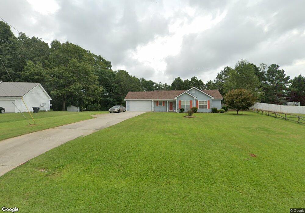
50 Sable Cir Unit 3 Covington, GA 30016
Estimated Value: $229,000 - $238,000
Studio
2
Baths
1,296
Sq Ft
$181/Sq Ft
Est. Value
About This Home
This home is located at 50 Sable Cir Unit 3, Covington, GA 30016 and is currently estimated at $233,968, approximately $180 per square foot. 50 Sable Cir Unit 3 is a home located in Newton County with nearby schools including South Salem Elementary School, Liberty Middle School, and Alcovy High School.
Ownership History
Date
Name
Owned For
Owner Type
Purchase Details
Closed on
May 10, 2006
Sold by
Alsup Steve and Alsup Brandy
Bought by
Perry Harriet
Current Estimated Value
Home Financials for this Owner
Home Financials are based on the most recent Mortgage that was taken out on this home.
Original Mortgage
$76,300
Outstanding Balance
$43,190
Interest Rate
6.39%
Mortgage Type
New Conventional
Estimated Equity
$190,778
Purchase Details
Closed on
Mar 7, 2002
Sold by
Hurst Ronald D
Bought by
Alsup Steve and Alsup Brandy
Home Financials for this Owner
Home Financials are based on the most recent Mortgage that was taken out on this home.
Original Mortgage
$103,085
Interest Rate
6.86%
Mortgage Type
New Conventional
Purchase Details
Closed on
Aug 25, 1995
Sold by
Thompson Bldrsinc
Bought by
Hurst Ronald D
Create a Home Valuation Report for This Property
The Home Valuation Report is an in-depth analysis detailing your home's value as well as a comparison with similar homes in the area
Home Values in the Area
Average Home Value in this Area
Purchase History
| Date | Buyer | Sale Price | Title Company |
|---|---|---|---|
| Perry Harriet | $109,000 | -- | |
| Alsup Steve | $103,900 | -- | |
| Hurst Ronald D | $79,900 | -- |
Source: Public Records
Mortgage History
| Date | Status | Borrower | Loan Amount |
|---|---|---|---|
| Open | Perry Harriet | $76,300 | |
| Previous Owner | Alsup Steve | $103,085 | |
| Closed | Hurst Ronald D | $0 |
Source: Public Records
Tax History
| Year | Tax Paid | Tax Assessment Tax Assessment Total Assessment is a certain percentage of the fair market value that is determined by local assessors to be the total taxable value of land and additions on the property. | Land | Improvement |
|---|---|---|---|---|
| 2025 | $2,032 | $87,640 | $14,000 | $73,640 |
| 2024 | $1,960 | $81,240 | $14,000 | $67,240 |
| 2023 | $2,058 | $79,720 | $6,000 | $73,720 |
| 2022 | $1,642 | $64,400 | $6,000 | $58,400 |
| 2021 | $1,419 | $50,680 | $6,000 | $44,680 |
| 2020 | $1,393 | $45,360 | $6,000 | $39,360 |
| 2019 | $1,207 | $39,280 | $6,000 | $33,280 |
| 2018 | $1,171 | $38,000 | $6,000 | $32,000 |
| 2017 | $1,091 | $35,680 | $6,000 | $29,680 |
| 2016 | $929 | $30,960 | $3,800 | $27,160 |
| 2015 | $819 | $27,760 | $3,200 | $24,560 |
| 2014 | $575 | $20,640 | $0 | $0 |
Source: Public Records
Map
Nearby Homes
- 415 Rosser Rd
- 275 Roberts Rd
- 417 Rosser Rd
- 75 Tulip Dr
- 615 St Annes Place
- 7 Glynnshire Ct
- 800 Mills Dr
- 50 Freedom Ct
- 40 Freebia Walk
- 165 Tulip Dr
- 115 Branchwood Dr
- 70 Countryside Ln
- 35 Charity Chase
- 113 St Annes Place
- 149 St Annes Place
- 161 Geranium Ln
- 45 Geranium Ln
- 50 Trinity Ln
- 10 Logans Run
- 80 Barge Ln
- 60 Sable Cir
- 40 Sable Cir
- 70 Sable Cir
- 55 Sable Cir Unit 3
- 215 Falcon Ridge Dr
- 205 Falcon Ridge Dr Unit 1
- 15 Falcons Crossing
- 30 Sable Cir
- 80 Sable Cir Unit 3
- 85 Sable Cir Unit 3
- 35 Falcons Crossing
- 195 Falcon Ridge Dr Unit UN 1
- 195 Falcon Ridge Dr
- 55 Falcons Crossing
- 305 Sable Cir Unit 3
- 90 Sable Cir
- 220 Falcon Ridge Dr
- 80 Falcons Crossing
- 65 Falcons Crossing
- 15 Sable Cir Unit 1
Your Personal Tour Guide
Ask me questions while you tour the home.