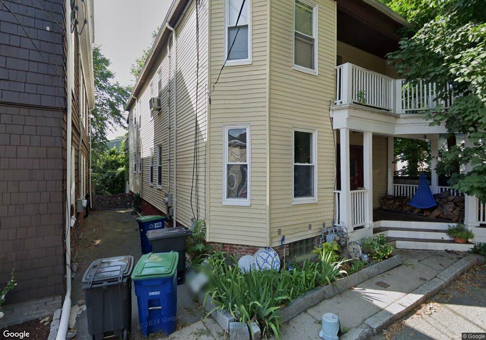
50 Saint James Ave Somerville, MA 02144
Porter Square NeighborhoodEstimated Value: $1,121,000 - $1,423,075
6
Beds
2
Baths
2,670
Sq Ft
$477/Sq Ft
Est. Value
About This Home
This home is located at 50 Saint James Ave, Somerville, MA 02144 and is currently estimated at $1,272,519, approximately $476 per square foot. 50 Saint James Ave is a home located in Middlesex County with nearby schools including Somerville High School, Benjamin Banneker Charter Public School, and Saint Theresa School.
Ownership History
Date
Name
Owned For
Owner Type
Purchase Details
Closed on
Aug 5, 2025
Sold by
Cooper Mark
Bought by
Mark F Cooper Ret and Cooper
Current Estimated Value
Purchase Details
Closed on
Jan 18, 2005
Sold by
English Danette and Cooper Mark F
Bought by
Cooper Mark
Home Financials for this Owner
Home Financials are based on the most recent Mortgage that was taken out on this home.
Original Mortgage
$382,000
Interest Rate
5.81%
Mortgage Type
Purchase Money Mortgage
Create a Home Valuation Report for This Property
The Home Valuation Report is an in-depth analysis detailing your home's value as well as a comparison with similar homes in the area
Home Values in the Area
Average Home Value in this Area
Purchase History
| Date | Buyer | Sale Price | Title Company |
|---|---|---|---|
| Mark F Cooper Ret | -- | -- | |
| Mark F Cooper Ret | -- | -- | |
| Cooper Mark | -- | -- | |
| Cooper Mark | -- | -- | |
| Cooper Mark | -- | -- |
Source: Public Records
Mortgage History
| Date | Status | Borrower | Loan Amount |
|---|---|---|---|
| Previous Owner | Cooper Mark | $382,000 | |
| Previous Owner | Cooper Mark | $204,300 |
Source: Public Records
Tax History Compared to Growth
Tax History
| Year | Tax Paid | Tax Assessment Tax Assessment Total Assessment is a certain percentage of the fair market value that is determined by local assessors to be the total taxable value of land and additions on the property. | Land | Improvement |
|---|---|---|---|---|
| 2025 | $12,112 | $1,110,200 | $721,200 | $389,000 |
| 2024 | $11,466 | $1,089,900 | $721,200 | $368,700 |
| 2023 | $11,206 | $1,083,800 | $721,200 | $362,600 |
| 2022 | $10,372 | $1,018,900 | $686,900 | $332,000 |
| 2021 | $10,145 | $995,600 | $681,900 | $313,700 |
| 2020 | $9,988 | $989,900 | $682,300 | $307,600 |
| 2019 | $9,447 | $878,000 | $621,200 | $256,800 |
| 2018 | $9,086 | $803,400 | $564,700 | $238,700 |
| 2017 | $8,768 | $751,300 | $532,800 | $218,500 |
| 2016 | $8,850 | $706,300 | $475,700 | $230,600 |
| 2015 | $8,398 | $666,000 | $439,400 | $226,600 |
Source: Public Records
Map
Nearby Homes
- 353 Summer St Unit 310
- 79 Willow Ave
- 18 Windom St
- 371 Highland Ave
- 12 Windsor Rd Unit 1
- 3 Fairlee St
- 7 Beech St Unit 319
- 7 Beech St Unit 211
- 23 Highland Rd
- 34 Day St
- 114 Cedar St
- 32-40 White St
- 31 Rogers Ave
- 39 Rogers Ave
- 8 Cogswell Ave
- 9 Morrison Ave
- 12 Rindge Ave Unit 1
- 1 Richdale Ave Unit 2
- 60 Pearson Ave Unit 60
- 13 Warwick St
- 46 Saint James Ave
- 22 Hawthorne St
- 26 Hawthorne St
- 16 Hawthorne St
- 335 Summer St
- 49 Saint James Ave Unit 49
- 337 Summer St
- 337 Summer St Unit 337
- 337 Summer St Unit 3
- 51 Saint James Ave
- 47 Saint James Ave
- 47 Saint James Ave
- 47 Saint James Ave Unit 1
- 30 Hawthorne St Unit 30
- 30 Hawthorne St Unit 2
- 30 Hawthorne St
- 12 Hawthorne St
- 339 Summer St Unit 1
- 28 Hawthorne St
- 341 Summer St Unit 2