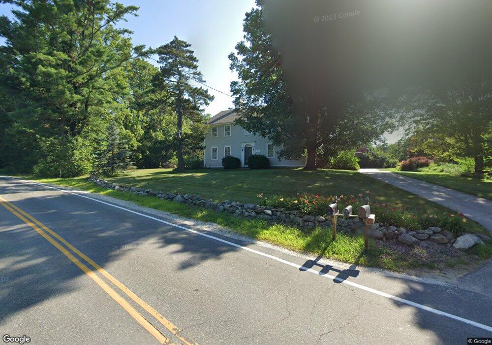
50 Stark Hwy S Dunbarton, NH 03046
Estimated Value: $768,000 - $1,032,000
4
Beds
4
Baths
4,102
Sq Ft
$226/Sq Ft
Est. Value
About This Home
This home is located at 50 Stark Hwy S, Dunbarton, NH 03046 and is currently estimated at $929,005, approximately $226 per square foot. 50 Stark Hwy S is a home with nearby schools including Dunbarton Elementary School, Bow Memorial School, and Bow High School.
Create a Home Valuation Report for This Property
The Home Valuation Report is an in-depth analysis detailing your home's value as well as a comparison with similar homes in the area
Home Values in the Area
Average Home Value in this Area
Tax History Compared to Growth
Tax History
| Year | Tax Paid | Tax Assessment Tax Assessment Total Assessment is a certain percentage of the fair market value that is determined by local assessors to be the total taxable value of land and additions on the property. | Land | Improvement |
|---|---|---|---|---|
| 2024 | $14,084 | $533,901 | $79,501 | $454,400 |
| 2023 | $13,652 | $533,901 | $79,501 | $454,400 |
| 2022 | $12,269 | $533,901 | $79,501 | $454,400 |
| 2021 | $12,499 | $533,901 | $79,501 | $454,400 |
| 2020 | $11,903 | $534,255 | $79,855 | $454,400 |
| 2018 | $10,524 | $467,099 | $71,099 | $396,000 |
| 2017 | $11,957 | $466,903 | $70,903 | $396,000 |
| 2016 | $11,205 | $467,271 | $71,271 | $396,000 |
| 2015 | $11,016 | $466,977 | $70,977 | $396,000 |
| 2014 | $9,406 | $444,929 | $70,929 | $374,000 |
| 2013 | $9,359 | $445,473 | $71,473 | $374,000 |
Source: Public Records
Map
Nearby Homes
- 15 Robert Rogers Rd
- 1003 School St
- 49 Stark Hwy N
- 78 Rangeway Rd
- 3 Stephanie Rd
- 0 Fairway Dr Unit 11
- 22 Fairway Dr
- 43 Sterling Place
- 1 Hop Kiln Rd
- 849 River Rd
- 70 Gile Hill Rd
- 104 Brown Hill Rd
- 250 Grapevine Rd
- 0 Brown Hill Rd Unit 5032600
- 5 Longview Dr
- 8 Longview Dr
- 0 Huntington Hill Rd Unit 69
- 602 Black Brook Rd
- 40 N Woods Rd
- 490 Page Rd