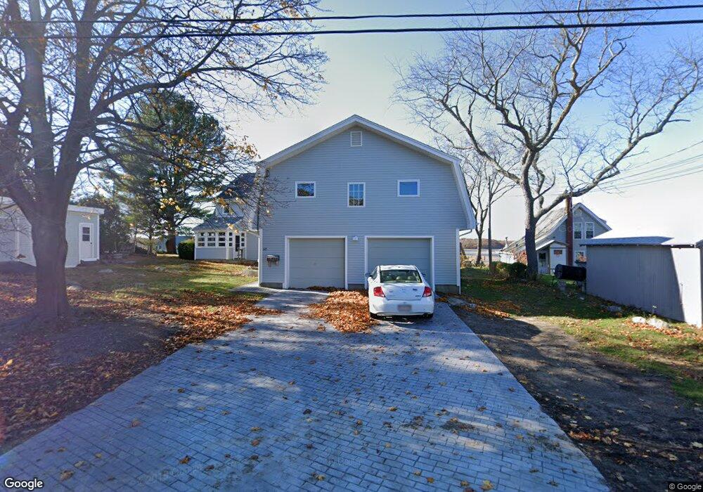
50 Thurston Point Rd Gloucester, MA 01930
Riverview NeighborhoodEstimated Value: $1,280,000 - $3,786,000
4
Beds
3
Baths
2,791
Sq Ft
$879/Sq Ft
Est. Value
About This Home
This home is located at 50 Thurston Point Rd, Gloucester, MA 01930 and is currently estimated at $2,453,993, approximately $879 per square foot. 50 Thurston Point Rd is a home located in Essex County with nearby schools including Beeman Memorial, Ralph B O'maley Middle School, and Gloucester High School.
Ownership History
Date
Name
Owned For
Owner Type
Purchase Details
Closed on
Jan 30, 2009
Sold by
Austin Thurston Point
Bought by
Austin Charles
Current Estimated Value
Purchase Details
Closed on
Aug 3, 2007
Sold by
Austin Thurston Point
Bought by
Austin Charles R
Purchase Details
Closed on
Jul 2, 2003
Sold by
Austin Charles R and Seavey Martha N
Bought by
Austin Thurston Point
Create a Home Valuation Report for This Property
The Home Valuation Report is an in-depth analysis detailing your home's value as well as a comparison with similar homes in the area
Home Values in the Area
Average Home Value in this Area
Purchase History
| Date | Buyer | Sale Price | Title Company |
|---|---|---|---|
| Austin Charles | -- | -- | |
| Austin Charles R | -- | -- | |
| Austin Thurston Point | -- | -- | |
| Austin Charles R | -- | -- |
Source: Public Records
Mortgage History
| Date | Status | Borrower | Loan Amount |
|---|---|---|---|
| Open | Austin Charles R | $350,750 | |
| Closed | Austin Charles R | $389,000 |
Source: Public Records
Tax History
| Year | Tax Paid | Tax Assessment Tax Assessment Total Assessment is a certain percentage of the fair market value that is determined by local assessors to be the total taxable value of land and additions on the property. | Land | Improvement |
|---|---|---|---|---|
| 2025 | $23,269 | $2,393,900 | $1,784,300 | $609,600 |
| 2024 | $21,942 | $2,255,100 | $1,651,000 | $604,100 |
| 2023 | $20,586 | $1,943,900 | $1,408,300 | $535,600 |
| 2022 | $19,968 | $1,702,300 | $1,225,400 | $476,900 |
| 2021 | $16,747 | $1,346,200 | $907,500 | $438,700 |
| 2020 | $16,641 | $1,349,600 | $907,500 | $442,100 |
| 2019 | $16,159 | $1,273,400 | $865,300 | $408,100 |
| 2018 | $15,881 | $1,228,200 | $844,200 | $384,000 |
| 2017 | $15,505 | $1,175,500 | $803,700 | $371,800 |
| 2016 | $15,093 | $1,109,000 | $768,200 | $340,800 |
| 2015 | $14,604 | $1,069,900 | $750,700 | $319,200 |
Source: Public Records
Map
Nearby Homes
- 13 Honeysuckle Rd
- 2 Breezy Point Rd
- 3 Deacon Farm Ln
- 31 Echo Ave
- 167 Atlantic St
- 178 Atlantic St
- 672 Washington St
- 226 Atlantic St
- 13 Mystic Ave
- 8 Mystic Ave
- 6 Monroe Ct
- 98 Maplewood Ave
- 5 Samoset Rd Unit B
- 145 Essex Ave Unit 402
- 9 Cleveland Place
- 12 Arthur St
- 15 Harvard St
- 24 Cobblestone Ln Unit 603
- 40 Sargent St
- 5 Lepage Ln
- 52 Thurston Point Rd
- 48 Thurston Point Rd
- 54 Thurston Point Rd
- 44 Thurston Point Rd
- 46 Thurston Point Rd
- 41 Thurston Point Rd
- 41 Thurston Point Rd
- 42 Thurston Point Rd
- 56 Thurston Point Rd
- 37 Thurston Point Rd
- 3 Mako Dr
- 1 Mako Dr Unit 1
- 1 Mako Dr
- 40 Thurston Point Rd
- 1 Cedar Ln
- 35 Thurston Point Rd
- 13 Cedar Ln
- 11 Cedar Ln
- 11 Cedar Ln
- 38 Thurston Point Rd
Your Personal Tour Guide
Ask me questions while you tour the home.