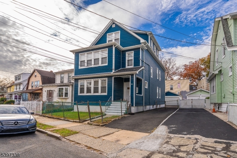
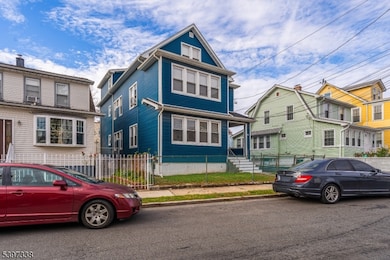
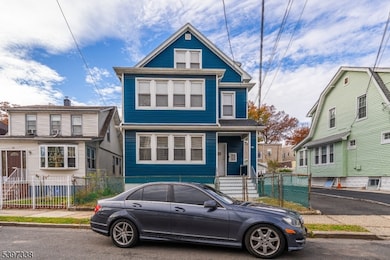
50 Unity Ave Newark, NJ 07106
Lower Vailsburg NeighborhoodEstimated payment $4,042/month
Highlights
- Separate Outdoor Workshop
- Privacy Fence
- Level Lot
About This Home
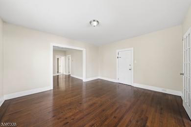
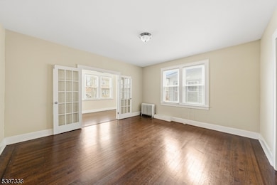
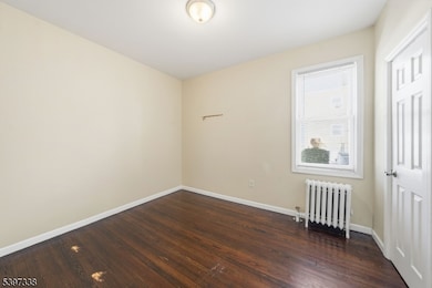
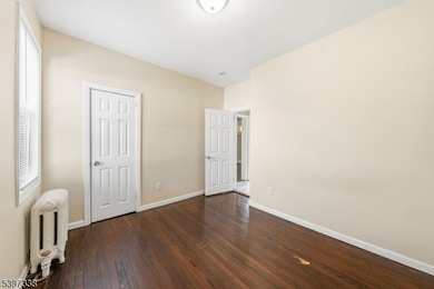
Wow!! Don't miss this fantastic opportunity to own a spacious 3-family home in the sought-after Vailsburg section of Newark. Fully remodeled in 2019, the property features large 2-bedroom units on the 1st and 2nd floors, each with a living room, formal dining room, and eat-in kitchen, with the potential to be used as 3-bedroom units. The 3rd floor offers a well-maintained 1-bedroom unit with a comfortable living room and eat-in kitchen, ideal for added rental income. Additional highlights include parking for 4"5 cars and separate utilities for all units. Conveniently located near schools, parks, shopping, and public transportation, this property is perfect for investors or owner-occupants looking for a move in ready multi-family home in a prime Newark location.
Listing Agent
FLOROSTONE REALTY INC. Brokerage Phone: 908-445-5339 Listed on: 11/17/2025
Property Details
Home Type
- Multi-Family
Est. Annual Taxes
- $6,784
Year Built
- Built in 1925
Lot Details
- 41 Sq Ft Lot
- Privacy Fence
- Level Lot
Parking
- 2 Car Garage
Home Design
- Vinyl Siding
Bedrooms and Bathrooms
- 5 Bedrooms
- 3 Full Bathrooms
Schools
- West Side High School
Utilities
- Cooling System Mounted In Outer Wall Opening
- Multiple Heating Units
Additional Features
- Basement Fills Entire Space Under The House
- Separate Outdoor Workshop
Community Details
- Net Operating Income $9,999
Listing and Financial Details
- Assessor Parcel Number 1614-04077-0000-00055-0000-
Map
Home Values in the Area
Average Home Value in this Area
Tax History
| Year | Tax Paid | Tax Assessment Tax Assessment Total Assessment is a certain percentage of the fair market value that is determined by local assessors to be the total taxable value of land and additions on the property. | Land | Improvement |
|---|---|---|---|---|
| 2025 | $6,651 | $178,400 | $22,300 | $156,100 |
| 2024 | $6,651 | $178,400 | $22,300 | $156,100 |
| 2022 | $6,665 | $178,400 | $22,300 | $156,100 |
| 2021 | $6,661 | $178,400 | $22,300 | $156,100 |
| 2020 | $6,779 | $178,400 | $22,300 | $156,100 |
| 2019 | $6,710 | $178,400 | $22,300 | $156,100 |
| 2018 | $6,588 | $178,400 | $22,300 | $156,100 |
| 2017 | $6,351 | $178,400 | $22,300 | $156,100 |
| 2016 | $6,137 | $178,400 | $22,300 | $156,100 |
| 2015 | $5,903 | $178,400 | $22,300 | $156,100 |
| 2014 | $5,532 | $178,400 | $22,300 | $156,100 |
Property History
| Date | Event | Price | List to Sale | Price per Sq Ft |
|---|---|---|---|---|
| 01/19/2026 01/19/26 | Pending | -- | -- | -- |
| 11/17/2025 11/17/25 | For Sale | $674,900 | -- | -- |
Purchase History
| Date | Type | Sale Price | Title Company |
|---|---|---|---|
| Deed | $380,000 | -- | |
| Sheriffs Deed | $136,000 | -- | |
| Deed | $61,900 | -- |
Mortgage History
| Date | Status | Loan Amount | Loan Type |
|---|---|---|---|
| Previous Owner | $373,117 | FHA | |
| Previous Owner | $196,400 | New Conventional |
Source: Garden State MLS
MLS Number: 3998235
APN: 14-04077-0000-00055
Disclaimer: Certain information contained herein is derived from information provided by parties other than Homes.com. All information provided is deemed reliable, but is not guaranteed to be accurate and should be independently verified.
![]() The data relating to real estate for sale on this website comes in part from the IDX Program of Garden State Multiple Listing Service, L.L.C. Real estate listings held by other brokerage firms are marked as IDX Listing.
The data relating to real estate for sale on this website comes in part from the IDX Program of Garden State Multiple Listing Service, L.L.C. Real estate listings held by other brokerage firms are marked as IDX Listing.
Information deemed reliable but not guaranteed.
Copyright © 2026 Garden State Multiple Listing Service, L.L.C. All rights reserved.
Notice: The dissemination of listings on this website does not constitute the consent required by N.J.A.C. 11:5.6.1 (n) for the advertisement of listings exclusively for sale by another broker. Any such consent must be obtained in writing from the listing broker.
This information is being provided for Consumers’ personal, non-commercial use and may not be used for any purpose other than to identify prospective properties Consumers may be interested in purchasing.
- 15-17 Valley St
- 15 Valley St Unit 17
- 284 W End Ave
- 5 Colleen St
- 973-975 18th Ave
- 973 18th Ave Unit 975
- 46 Lenox Ave
- 197-199 Sunset Ave
- 199 Sunset Ave
- 240 W End Ave
- 223 W End Ave Unit 225
- 48 Adams St
- 232-236 W End Ave
- 1044 18th Ave
- 168 Carolina Ave
- 86 Mead St
- 184 Sunset Ave
- 15 Walter Place
- 142 Delmar Place
- 164 Stuyvesant Ave

Ask me questions while you tour the home.