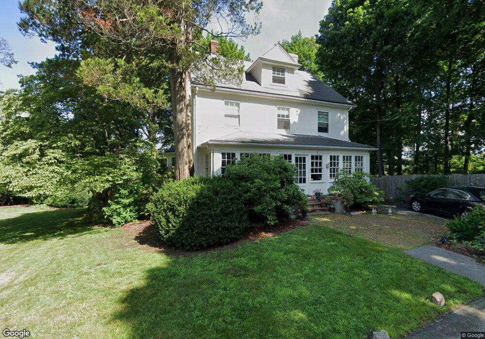
50 W Side Rd Milton, MA 02186
Columbine Cliffs NeighborhoodEstimated Value: $1,079,000 - $1,966,000
4
Beds
4
Baths
2,620
Sq Ft
$609/Sq Ft
Est. Value
About This Home
This home is located at 50 W Side Rd, Milton, MA 02186 and is currently estimated at $1,595,503, approximately $608 per square foot. 50 W Side Rd is a home located in Norfolk County with nearby schools including Milton High School, Conservatory Lab Upper School, and Saint John Paul II Catholic Academy.
Ownership History
Date
Name
Owned For
Owner Type
Purchase Details
Closed on
Oct 21, 2025
Sold by
Goltz Thomas A and Goltz Joan B
Bought by
Goltz Ft and Goltz
Current Estimated Value
Home Financials for this Owner
Home Financials are based on the most recent Mortgage that was taken out on this home.
Original Mortgage
$500,000
Outstanding Balance
$499,535
Interest Rate
6.35%
Mortgage Type
Credit Line Revolving
Estimated Equity
$1,095,968
Purchase Details
Closed on
Dec 12, 1997
Sold by
Dechler Joanne B and Dechler Hugh M
Bought by
Goltz Thomas A and Goltz Joan B
Create a Home Valuation Report for This Property
The Home Valuation Report is an in-depth analysis detailing your home's value as well as a comparison with similar homes in the area
Home Values in the Area
Average Home Value in this Area
Purchase History
| Date | Buyer | Sale Price | Title Company |
|---|---|---|---|
| Goltz Ft | -- | -- | |
| Goltz Thomas A | $283,000 | -- | |
| Goltz Thomas A | $283,000 | -- |
Source: Public Records
Mortgage History
| Date | Status | Borrower | Loan Amount |
|---|---|---|---|
| Open | Goltz Ft | $500,000 | |
| Previous Owner | Goltz Thomas A | $368,000 | |
| Previous Owner | Goltz Thomas A | $262,000 |
Source: Public Records
Tax History
| Year | Tax Paid | Tax Assessment Tax Assessment Total Assessment is a certain percentage of the fair market value that is determined by local assessors to be the total taxable value of land and additions on the property. | Land | Improvement |
|---|---|---|---|---|
| 2025 | $15,371 | $1,386,000 | $647,500 | $738,500 |
| 2024 | $14,800 | $1,355,300 | $616,800 | $738,500 |
| 2023 | $13,987 | $1,226,900 | $587,300 | $639,600 |
| 2022 | $13,526 | $1,084,700 | $587,300 | $497,400 |
| 2021 | $13,101 | $997,800 | $524,000 | $473,800 |
| 2020 | $12,974 | $988,900 | $523,900 | $465,000 |
| 2019 | $12,653 | $960,000 | $508,600 | $451,400 |
| 2018 | $11,671 | $845,100 | $401,300 | $443,800 |
| 2017 | $10,923 | $805,500 | $382,200 | $423,300 |
| 2016 | $10,754 | $796,600 | $382,200 | $414,400 |
| 2015 | $10,714 | $768,600 | $370,400 | $398,200 |
Source: Public Records
Map
Nearby Homes
- 36 Central Ave Unit 4
- 88 Wharf St Unit 105
- 32-32R Temple St
- 30 Sanford St
- 14 Avondale St
- 67 Idaho St
- 30 Pleasant Hill Ave Unit 32
- 1076 Adams St
- 14 Valley Rd
- 72 Columbine Rd
- 23 Maryknoll St
- 57 Columbine Rd
- 86-88 Gallivan Blvd
- 84-86 Codman Hill Ave
- 2089 Dorchester Ave Unit 1
- 27-29 Brookvale St
- 56 Fairmount St Unit 2
- 20 Fairmount St
- 2 Ogden St Unit 1
- 147 Fairmount St
- 15 Morton Terrace
- 11 Morton Terrace
- 48 W Side Rd
- 45 W Side Rd
- 9 Morton Terrace
- 9 Morton Terrace Unit 1
- 40 W Side Rd
- 56 Morton Rd
- 10 Morton Terrace
- 58 Eliot St Unit 60
- 36 Eliot St Unit 23
- 36 Eliot St Unit 47
- 36 Eliot St Unit 17
- 36 Eliot St Unit 31
- 36 Eliot St Unit 11
- 36 Eliot St Unit 41
- 36 Eliot St Unit 10
- 36 Eliot St Unit 21
- 36 Eliot St Unit 30
- 36 Eliot St Unit 20