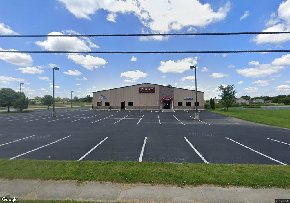
50 W Westgate Dr Wheatfield, IN 46392
--
Bed
--
Bath
19,712
Sq Ft
1.49
Acres
About This Home
This home is located at 50 W Westgate Dr, Wheatfield, IN 46392. 50 W Westgate Dr is a home located in Jasper County with nearby schools including Kankakee Valley High School.
Ownership History
Date
Name
Owned For
Owner Type
Purchase Details
Closed on
Mar 17, 2025
Sold by
Hlf Holdings Llc
Bought by
Dbcb Property Llc
Purchase Details
Closed on
Dec 11, 2017
Sold by
Lafayette Bank & Trust Company
Bought by
Hlf Holdings Llc
Home Financials for this Owner
Home Financials are based on the most recent Mortgage that was taken out on this home.
Original Mortgage
$341,275
Interest Rate
3.94%
Mortgage Type
Commercial
Purchase Details
Closed on
Nov 30, 2016
Sold by
Myers Donald E
Bought by
Lafayette Bank And Trust Co
Create a Home Valuation Report for This Property
The Home Valuation Report is an in-depth analysis detailing your home's value as well as a comparison with similar homes in the area
Home Values in the Area
Average Home Value in this Area
Purchase History
| Date | Buyer | Sale Price | Title Company |
|---|---|---|---|
| Dbcb Property Llc | $540,000 | None Listed On Document | |
| Hlf Holdings Llc | $386,000 | -- | |
| Hlf Holdings Llc | $386,000 | First American Title | |
| Lafayette Bank And Trust Co | $382,000 | None Available |
Source: Public Records
Mortgage History
| Date | Status | Borrower | Loan Amount |
|---|---|---|---|
| Previous Owner | Hlf Holdings Llc | $341,275 |
Source: Public Records
Tax History Compared to Growth
Tax History
| Year | Tax Paid | Tax Assessment Tax Assessment Total Assessment is a certain percentage of the fair market value that is determined by local assessors to be the total taxable value of land and additions on the property. | Land | Improvement |
|---|---|---|---|---|
| 2024 | $11,664 | $874,500 | $45,900 | $828,600 |
| 2023 | $7,885 | $651,700 | $45,900 | $605,800 |
| 2022 | $8,143 | $635,500 | $45,900 | $589,600 |
| 2021 | $8,539 | $631,100 | $45,900 | $585,200 |
| 2020 | $8,996 | $631,100 | $45,900 | $585,200 |
| 2019 | $9,015 | $1,021,800 | $45,900 | $975,900 |
| 2018 | $14,075 | $997,800 | $45,900 | $951,900 |
| 2017 | $13,048 | $966,800 | $45,900 | $920,900 |
| 2016 | $12,787 | $968,100 | $45,900 | $922,200 |
| 2014 | $12,355 | $1,159,100 | $45,900 | $1,113,200 |
Source: Public Records
Map
Nearby Homes
- 160-162 W Mcneil St
- 298 W Central St
- 178 E High St
- 106 E Trett St
- 203 E Pine St
- 227 E Pine St
- 70 N Pearl St
- 0 W State Rd 10 Unit NRA825352
- 0 Indiana 49
- 12501 Indiana 49
- 11180 Woodcrest Dr
- 670 W 1100 N
- 647 W 1100 N
- 25 W 1100 N
- 99 E Carter St
- 298 E 1100 N
- 10610 N 100 W
- 293 E 1350 N
- 12716 N 100 E
- 2025 Cardinal Dr
- 1100 W Westgate Dr
- South S Main St
- 130 W Myers St
- 427 S Bierma St
- 445 S Bierma St
- 500 S Bierma St
- 492 S Bierma St
- 493 S Bierma St
- 169-175 W Mcneil St
- 397 S Bierma St
- 169 W Mcneil St
- 394 S Center St
- 351 S Bierma St
- 175 W Mcneil St
- 160 W Mcneil St
- 162 W Mcneil St
- 351 S Main St
- 181 W Mcneil St
- 422 S Center St
- 3654 State Road 10