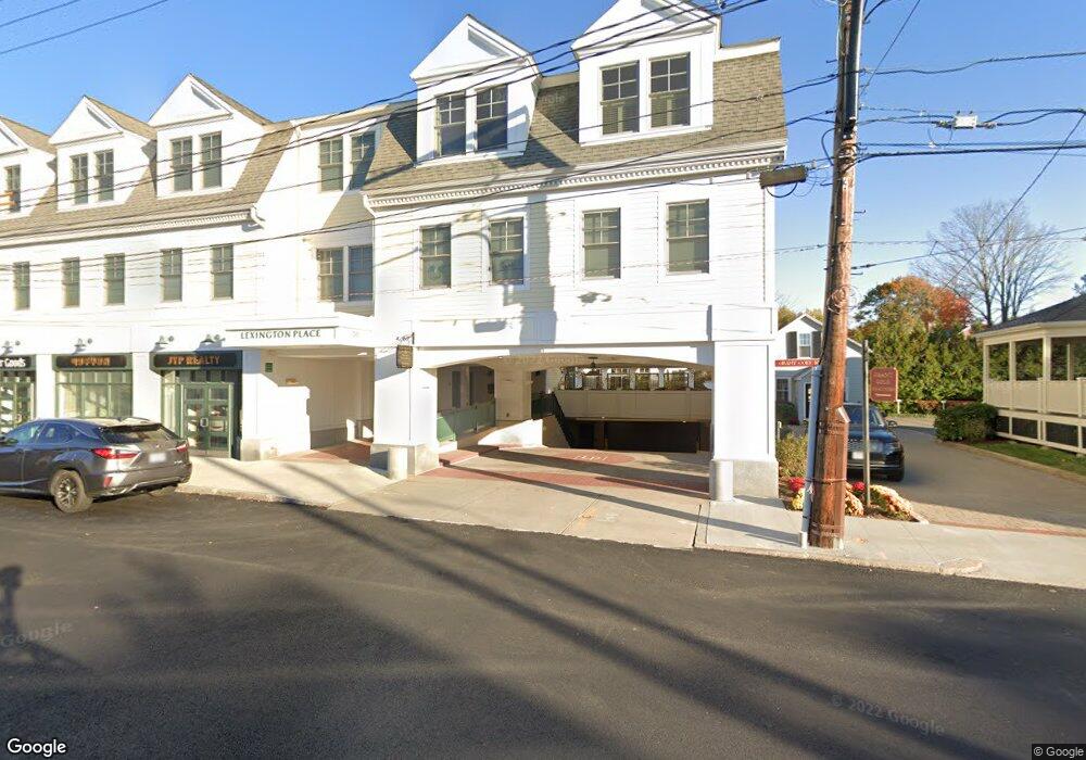
50 Waltham St Unit 210 Lexington, MA 02421
Munroe Hill NeighborhoodEstimated Value: $356,651 - $1,048,000
2
Beds
2
Baths
1,543
Sq Ft
$508/Sq Ft
Est. Value
About This Home
This home is located at 50 Waltham St Unit 210, Lexington, MA 02421 and is currently estimated at $783,413, approximately $507 per square foot. 50 Waltham St Unit 210 is a home located in Middlesex County with nearby schools including Harrington Elementary School, Jonas Clarke Middle School, and Lexington High School.
Ownership History
Date
Name
Owned For
Owner Type
Purchase Details
Closed on
Mar 3, 2010
Sold by
Lexington Commons Llc
Bought by
Hai-Li Margaret Yu
Current Estimated Value
Home Financials for this Owner
Home Financials are based on the most recent Mortgage that was taken out on this home.
Original Mortgage
$132,440
Outstanding Balance
$87,866
Interest Rate
5%
Mortgage Type
Purchase Money Mortgage
Estimated Equity
$695,547
Create a Home Valuation Report for This Property
The Home Valuation Report is an in-depth analysis detailing your home's value as well as a comparison with similar homes in the area
Home Values in the Area
Average Home Value in this Area
Purchase History
| Date | Buyer | Sale Price | Title Company |
|---|---|---|---|
| Hai-Li Margaret Yu | $172,000 | -- |
Source: Public Records
Mortgage History
| Date | Status | Borrower | Loan Amount |
|---|---|---|---|
| Open | Hai-Li Margaret Yu | $132,440 |
Source: Public Records
Tax History Compared to Growth
Tax History
| Year | Tax Paid | Tax Assessment Tax Assessment Total Assessment is a certain percentage of the fair market value that is determined by local assessors to be the total taxable value of land and additions on the property. | Land | Improvement |
|---|---|---|---|---|
| 2025 | $3,119 | $255,000 | $0 | $255,000 |
| 2024 | $2,989 | $244,000 | $0 | $244,000 |
| 2023 | $2,995 | $230,350 | $0 | $230,350 |
| 2022 | $3,131 | $226,918 | $0 | $226,918 |
| 2021 | $2,791 | $193,980 | $0 | $193,980 |
| 2020 | $2,725 | $193,980 | $0 | $193,980 |
| 2019 | $2,584 | $183,000 | $0 | $183,000 |
| 2018 | $2,617 | $183,000 | $0 | $183,000 |
| 2017 | $2,652 | $183,000 | $0 | $183,000 |
| 2016 | $2,672 | $183,000 | $0 | $183,000 |
| 2015 | $2,719 | $183,000 | $0 | $183,000 |
| 2014 | $2,838 | $183,000 | $0 | $183,000 |
Source: Public Records
Map
Nearby Homes
- 1894 Massachusetts Ave
- 1900 Massachusetts Ave
- 32 Forest St
- 42 Winthrop Rd
- 223 Waltham St
- 30 Meriam St Unit 30
- 32 Edgewood Rd Unit 1
- 1437 Massachusetts Ave
- 45 Hancock St
- 20 Loring Rd
- 93 Bedford St Unit 201
- 93 Bedford St Unit 308
- 93 Bedford St Unit 101
- 10 Eliot Rd
- 24 Grapevine Ave
- 12 Coolidge Ave
- 36 Adams St
- 21 Valleyfield St
- 17 Prospect Hill Rd
- 1 Tricorne Rd
- 50 Waltham St Unit 311
- 50 Waltham St Unit 310
- 50 Waltham St Unit 309
- 50 Waltham St Unit 308
- 50 Waltham St Unit 307
- 50 Waltham St Unit 306
- 50 Waltham St Unit 305
- 50 Waltham St Unit 304
- 50 Waltham St Unit 303
- 50 Waltham St Unit 302
- 50 Waltham St Unit 301
- 50 Waltham St Unit 212
- 50 Waltham St Unit 211
- 50 Waltham St Unit 209
- 50 Waltham St Unit 208
- 50 Waltham St Unit 207
- 50 Waltham St Unit 206
- 50 Waltham St Unit 205
- 50 Waltham St Unit 204
- 50 Waltham St Unit 203