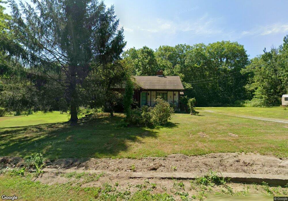
50 White Rd Warwick, MA 01378
Warwick NeighborhoodEstimated Value: $271,000 - $335,000
3
Beds
2
Baths
1,120
Sq Ft
$277/Sq Ft
Est. Value
About This Home
This home is located at 50 White Rd, Warwick, MA 01378 and is currently estimated at $310,556, approximately $277 per square foot. 50 White Rd is a home located in Franklin County with nearby schools including Pioneer Valley Regional.
Ownership History
Date
Name
Owned For
Owner Type
Purchase Details
Closed on
Aug 23, 2024
Sold by
Perkins Clyde W
Bought by
Perkins Int and Perkins P
Current Estimated Value
Purchase Details
Closed on
Nov 16, 1977
Bought by
Perkins Clyde W and Perkins Helen R
Create a Home Valuation Report for This Property
The Home Valuation Report is an in-depth analysis detailing your home's value as well as a comparison with similar homes in the area
Home Values in the Area
Average Home Value in this Area
Purchase History
| Date | Buyer | Sale Price | Title Company |
|---|---|---|---|
| Perkins Int | -- | None Available | |
| Perkins Int | -- | None Available | |
| Perkins Clyde W | $9,500 | -- |
Source: Public Records
Mortgage History
| Date | Status | Borrower | Loan Amount |
|---|---|---|---|
| Previous Owner | Perkins Clyde W | $61,000 | |
| Previous Owner | Perkins Clyde W | $95,000 | |
| Previous Owner | Perkins Clyde W | $10,000 |
Source: Public Records
Tax History
| Year | Tax Paid | Tax Assessment Tax Assessment Total Assessment is a certain percentage of the fair market value that is determined by local assessors to be the total taxable value of land and additions on the property. | Land | Improvement |
|---|---|---|---|---|
| 2025 | $4,326 | $243,300 | $32,500 | $210,800 |
| 2024 | $4,055 | $245,000 | $32,500 | $212,500 |
| 2023 | $3,600 | $179,000 | $32,500 | $146,500 |
| 2022 | $3,586 | $170,200 | $34,400 | $135,800 |
| 2021 | $3,051 | $155,400 | $30,900 | $124,500 |
| 2020 | $3,163 | $155,300 | $31,100 | $124,200 |
| 2019 | $3,101 | $146,000 | $31,100 | $114,900 |
| 2018 | $3,159 | $146,000 | $31,100 | $114,900 |
| 2017 | $2,936 | $146,000 | $31,100 | $114,900 |
| 2016 | $2,989 | $146,000 | $31,100 | $114,900 |
| 2015 | $3,018 | $151,500 | $36,600 | $114,900 |
Source: Public Records
Map
Nearby Homes
- 0 Northfield Rd Unit 73441997
- Lot 14 Northfield Rd
- 0 Sears St Unit 23759828
- 0, Lot 2 Flower Hill Rd
- 0, Lot 1 Flower Hill Rd
- 22 Old Turnpike Rd
- 14 Wood Way
- 583 Burt Hill Rd
- 181 Main St
- 12A Parker Ave Unit A
- 15 A-B Tully Rd
- 9 Scotland Rd
- 292 Richmond Rd
- 525 Richmond Rd
- 10 E Prospect St
- M409 L66-1 Old Turnpike Rd
- M409 L66-2 Old Turnpike Rd
- M409 L66 Old Turnpike Rd
- 12 Wetherby Dr
- 0 State Rd Lot 0
- 77 White Rd
- 22 White Rd
- 80 White Rd
- 0 White Rd
- 140 White Rd
- 295 Shepardson Rd
- 111 Northfield Rd
- Parcel 1 Off Robbins Rd
- Parcel 6B Orange Rd
- 85 Spooner Rd
- 0 E Wilson Rd Unit 71831092
- Lots 1 & 2 Wendell Rd
- 172 White Rd
- 175 White Rd
- 33 Wendell Rd
- 99 Northfield Rd
- 14 Winchester Rd
- Lot 2 Wendell Rd
- Lot 1 Wendell Rd
- 1 Wendell Rd
Your Personal Tour Guide
Ask me questions while you tour the home.