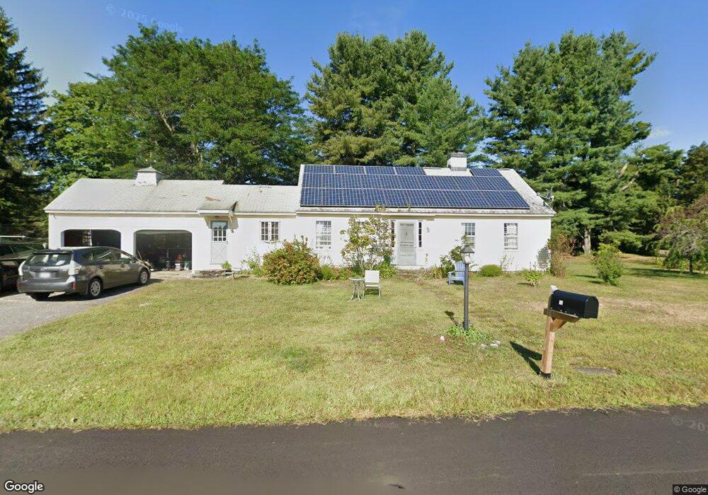
50 Whitney Acres Ashfield, MA 01330
Ashfield NeighborhoodEstimated Value: $316,000 - $397,313
2
Beds
2
Baths
1,340
Sq Ft
$278/Sq Ft
Est. Value
About This Home
This home is located at 50 Whitney Acres, Ashfield, MA 01330 and is currently estimated at $372,078, approximately $277 per square foot. 50 Whitney Acres is a home with nearby schools including Mohawk Trail Regional High School.
Ownership History
Date
Name
Owned For
Owner Type
Purchase Details
Closed on
Nov 8, 2013
Sold by
Es Whitney Walter A Jr
Bought by
Lesure Scott G and Rice Sally J
Current Estimated Value
Home Financials for this Owner
Home Financials are based on the most recent Mortgage that was taken out on this home.
Original Mortgage
$160,000
Outstanding Balance
$119,571
Interest Rate
4.36%
Mortgage Type
New Conventional
Estimated Equity
$252,507
Create a Home Valuation Report for This Property
The Home Valuation Report is an in-depth analysis detailing your home's value as well as a comparison with similar homes in the area
Home Values in the Area
Average Home Value in this Area
Purchase History
| Date | Buyer | Sale Price | Title Company |
|---|---|---|---|
| Lesure Scott G | $180,000 | -- |
Source: Public Records
Mortgage History
| Date | Status | Borrower | Loan Amount |
|---|---|---|---|
| Open | Lesure Scott G | $160,000 |
Source: Public Records
Tax History Compared to Growth
Tax History
| Year | Tax Paid | Tax Assessment Tax Assessment Total Assessment is a certain percentage of the fair market value that is determined by local assessors to be the total taxable value of land and additions on the property. | Land | Improvement |
|---|---|---|---|---|
| 2025 | $4,723 | $350,900 | $89,800 | $261,100 |
| 2024 | $4,862 | $332,800 | $89,800 | $243,000 |
| 2023 | $4,341 | $246,500 | $71,900 | $174,600 |
| 2022 | $4,074 | $234,400 | $68,300 | $166,100 |
| 2021 | $3,879 | $234,400 | $68,300 | $166,100 |
| 2020 | $3,905 | $234,400 | $68,300 | $166,100 |
| 2019 | $3,768 | $219,600 | $65,700 | $153,900 |
| 2018 | $3,630 | $211,300 | $65,700 | $145,600 |
| 2017 | $3,458 | $213,200 | $64,800 | $148,400 |
| 2016 | $3,318 | $201,800 | $64,800 | $137,000 |
| 2015 | $3,223 | $201,800 | $64,800 | $137,000 |
| 2014 | $3,345 | $207,000 | $60,800 | $146,200 |
Source: Public Records
Map
Nearby Homes
- 240 Beldingville Rd
- 220 Hawley Rd
- 473 N Poland Rd
- 0 Ashfield Rd
- 374 Watson Spruce Corner Rd
- lot 1 Shelburne Falls Rd
- 0 Sears Rd Unit 73373850
- 85 Dacey Rd
- 0 Old Stage Rd Unit 73326639
- 1531 Williamsburg Rd
- 0 John Ford Rd Unit 73403157
- 0 John Ford Rd Unit 73403156
- 0 Upper St
- 7 Hog Hollow Rd
- 230 S Ashfield Rd
- 0 Spruce Corner Rd Unit 73244975
- 156 Ashfield Rd
- 333 Ranney Corner Rd
- 0 Pleasant St
- 14 River St
- 19 Whitney Acres
- 82 Baptist Corner Rd
- 103 Baptist Corner Rd
- 108 Baptist Corner Rd
- 110 Baptist Corner Rd
- 62 Baptist Corner Rd
- 81 Baptist Corner Rd
- 68 Baptist Corner Rd
- 50 Baptist Corner Rd
- 57 Baptist Corner Rd
- 37 Baptist Corner Rd
- 24 Baptist Corner Rd
- 29 Baptist Corner Rd
- 153 Baptist Corner Rd
- 154 Baptist Corner Rd
- 449 Main St
- 171 Baptist Corner Rd
- 515 Main St
- 174 Baptist Corner Rd
- 535 Main St