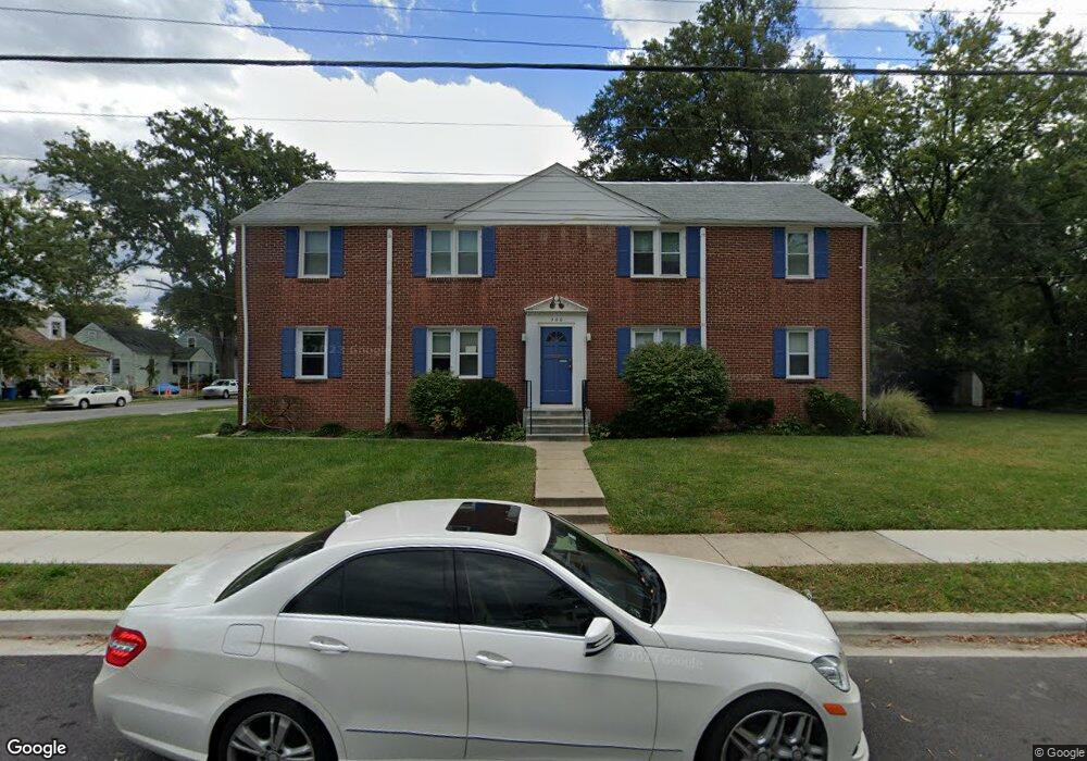
500 5th St Unit A Laurel, MD 20707
Estimated Value: $669,404 - $909,000
2
Beds
1
Bath
3,722
Sq Ft
$204/Sq Ft
Est. Value
About This Home
This home is located at 500 5th St Unit A, Laurel, MD 20707 and is currently estimated at $758,851, approximately $203 per square foot. 500 5th St Unit A is a home located in Prince George's County with nearby schools including Laurel Elementary School, Laurel High School, and Julia Brown Montessori Schools.
Ownership History
Date
Name
Owned For
Owner Type
Purchase Details
Closed on
Jun 3, 2025
Sold by
Nwankwo Uzoma C and Nwankwo Ozodimma Y
Bought by
Ozodimma Yvonne Nwankwo And Uzoma Chidiugwu N and Nwankwo
Current Estimated Value
Purchase Details
Closed on
Dec 8, 2016
Sold by
Angelastro Deana
Bought by
Nwankwo Uzoma C and Nwankwo Ozodimma Y
Home Financials for this Owner
Home Financials are based on the most recent Mortgage that was taken out on this home.
Original Mortgage
$540,038
Interest Rate
3.5%
Mortgage Type
FHA
Purchase Details
Closed on
Dec 5, 2001
Sold by
Holmes George A
Bought by
Holmes Lillian M and Apt B
Purchase Details
Closed on
Dec 22, 1976
Sold by
Shaffrey Edwin M
Bought by
Holmes George A and Holmes Lillian M
Create a Home Valuation Report for This Property
The Home Valuation Report is an in-depth analysis detailing your home's value as well as a comparison with similar homes in the area
Home Values in the Area
Average Home Value in this Area
Purchase History
| Date | Buyer | Sale Price | Title Company |
|---|---|---|---|
| Ozodimma Yvonne Nwankwo And Uzoma Chidiugwu N | -- | None Listed On Document | |
| Ozodimma Yvonne Nwankwo And Uzoma Chidiugwu N | -- | None Listed On Document | |
| Nwankwo Uzoma C | $550,000 | Associated Title Group Inc | |
| Holmes Lillian M | -- | -- | |
| Holmes George A | $69,500 | -- |
Source: Public Records
Mortgage History
| Date | Status | Borrower | Loan Amount |
|---|---|---|---|
| Previous Owner | Nwankwo Uzoma C | $540,038 |
Source: Public Records
Tax History Compared to Growth
Tax History
| Year | Tax Paid | Tax Assessment Tax Assessment Total Assessment is a certain percentage of the fair market value that is determined by local assessors to be the total taxable value of land and additions on the property. | Land | Improvement |
|---|---|---|---|---|
| 2025 | $8,864 | $514,400 | $101,800 | $412,600 |
| 2024 | $8,864 | $473,033 | $0 | $0 |
| 2023 | $8,053 | $431,667 | $0 | $0 |
| 2022 | $7,232 | $390,300 | $101,800 | $288,500 |
| 2021 | $7,185 | $390,300 | $101,800 | $288,500 |
| 2020 | $7,181 | $390,300 | $101,800 | $288,500 |
| 2019 | $8,363 | $455,400 | $75,900 | $379,500 |
| 2018 | $8,067 | $438,467 | $0 | $0 |
| 2017 | $7,784 | $421,533 | $0 | $0 |
| 2016 | -- | $404,600 | $0 | $0 |
| 2015 | $5,568 | $389,100 | $0 | $0 |
| 2014 | $5,568 | $373,600 | $0 | $0 |
Source: Public Records
Map
Nearby Homes
- 410 Carroll Ave
- 413 Montgomery St
- 610 Main St Unit 413
- 19 Post Office Ave Unit 203
- 612 9th St
- 1000 8th St
- 1002 7th St
- 120 2nd St
- 1004 Marton St
- 103 Irving St
- 1002 West Ct
- 1003 Ward St
- 9560 Cissell Ave
- 9401 Riverbrink Ct
- 200 1/2 11th St
- Lot 5 Cissell Ave
- 1103 Montgomery St
- 1106 Snowden Place
- 9351 Cabot Ct
- 1210 Westview Terrace