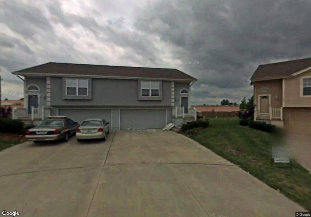
500 Andypaul Ct Unit 501 Raymore, MO 64083
Estimated Value: $329,000 - $393,000
4
Beds
6
Baths
2,192
Sq Ft
$162/Sq Ft
Est. Value
About This Home
This home is located at 500 Andypaul Ct Unit 501, Raymore, MO 64083 and is currently estimated at $355,470, approximately $162 per square foot. 500 Andypaul Ct Unit 501 is a home located in Cass County with nearby schools including Creekmoor Elementary School, Raymore-Peculiar East Middle School, and Raymore-Peculiar Senior High School.
Ownership History
Date
Name
Owned For
Owner Type
Purchase Details
Closed on
Dec 2, 2010
Sold by
Edmonds Scott B
Bought by
Edmonds Scott B and Edmonds Sheryl D
Current Estimated Value
Purchase Details
Closed on
May 18, 2009
Sold by
Edmonds Sheryl D
Bought by
Edmonds Scott B
Home Financials for this Owner
Home Financials are based on the most recent Mortgage that was taken out on this home.
Original Mortgage
$150,000
Outstanding Balance
$93,904
Interest Rate
4.84%
Mortgage Type
New Conventional
Estimated Equity
$261,566
Create a Home Valuation Report for This Property
The Home Valuation Report is an in-depth analysis detailing your home's value as well as a comparison with similar homes in the area
Home Values in the Area
Average Home Value in this Area
Purchase History
| Date | Buyer | Sale Price | Title Company |
|---|---|---|---|
| Edmonds Scott B | -- | -- | |
| Edmonds Scott B | -- | None Available |
Source: Public Records
Mortgage History
| Date | Status | Borrower | Loan Amount |
|---|---|---|---|
| Open | Edmonds Scott B | $150,000 |
Source: Public Records
Tax History Compared to Growth
Tax History
| Year | Tax Paid | Tax Assessment Tax Assessment Total Assessment is a certain percentage of the fair market value that is determined by local assessors to be the total taxable value of land and additions on the property. | Land | Improvement |
|---|---|---|---|---|
| 2025 | $3,768 | $52,420 | $5,780 | $46,640 |
| 2024 | $3,768 | $46,300 | $5,250 | $41,050 |
| 2023 | $3,763 | $46,300 | $5,250 | $41,050 |
| 2022 | $3,296 | $40,290 | $5,250 | $35,040 |
| 2021 | $3,297 | $40,290 | $5,250 | $35,040 |
| 2020 | $2,878 | $34,550 | $5,250 | $29,300 |
| 2019 | $2,778 | $34,550 | $5,250 | $29,300 |
| 2018 | $2,571 | $30,870 | $4,500 | $26,370 |
| 2017 | $2,104 | $30,870 | $4,500 | $26,370 |
| 2016 | $2,104 | $26,220 | $4,500 | $21,720 |
| 2015 | $2,105 | $26,220 | $4,500 | $21,720 |
| 2014 | $2,106 | $26,220 | $4,500 | $21,720 |
| 2013 | -- | $26,220 | $4,500 | $21,720 |
Source: Public Records
Map
Nearby Homes
- 600 Andypaul Ct Unit 602
- 503 N Jenkins Blvd
- 1205 Wiltshire Blvd
- 1412 W Stone Blvd
- 1025 Kaycee Dr
- 701 Hampstead Dr
- 1010 Wiltshire Blvd
- 215 Scott Dr
- 1704 W Long Blvd
- 0 Scott Dr
- 608 Johnston Pkwy
- 1105 Brookside Place
- 806 Creekmoor Pond Ln
- The Westridge Plan at Madison Valley
- The Stratford Plan at Madison Valley
- The Aspen Plan at Madison Valley
- The Lexington Plan at Madison Valley
- 1705 W Pelham Path
- 109 N Eastglen Dr
- 205 Johnston Pkwy
- 503 Andypaul Ct
- 505 Andypaul Ct
- 502 Andypaul Ct Unit 504
- 506 Andypaul Ct Unit 508
- 507 Andypaul Ct
- 509 Andypaul Ct
- 510 Andypaul Ct Unit 512
- 502 Regina Ct Unit 504
- 506 Regina Ct
- 511 Andypaul Ct
- 500 Regina Ct Unit 501
- 508 Regina Ct
- 513 Andypaul Ct
- 514 Andypaul Ct
- 1303 W Jenkins Blvd
- 515 Andypaul Ct
- 1302 W Campbell Blvd
- 510 Regina Ct
- 516 Andypaul Ct
- 1305 W Jenkins Blvd