Estimated Value: $211,000 - $269,000
--
Bed
--
Bath
2,794
Sq Ft
$85/Sq Ft
Est. Value
About This Home
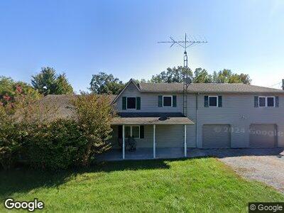
This home is located at 500 John Lansden Rd, Nebo, KY 42441 and is currently estimated at $238,424, approximately $85 per square foot. 500 John Lansden Rd is a home located in Hopkins County with nearby schools including West Hopkins School and Madisonville North Hopkins High School.
Ownership History
Date
Name
Owned For
Owner Type
Purchase Details
Closed on
Dec 14, 2018
Sold by
Pryor Harland and Pryor Barbara
Bought by
Pryor Jaime D and Pryor Shaun A
Current Estimated Value
Purchase Details
Closed on
Jun 7, 2013
Sold by
Giardinella Raymond E and Giardinella Ashley
Bought by
Pryor Harland and Pryor Barbara
Home Financials for this Owner
Home Financials are based on the most recent Mortgage that was taken out on this home.
Original Mortgage
$3,282
Interest Rate
3.37%
Mortgage Type
Purchase Money Mortgage
Create a Home Valuation Report for This Property
The Home Valuation Report is an in-depth analysis detailing your home's value as well as a comparison with similar homes in the area
Home Values in the Area
Average Home Value in this Area
Purchase History
| Date | Buyer | Sale Price | Title Company |
|---|---|---|---|
| Pryor Jaime D | -- | None Available | |
| Pryor Harland | $2,500 | None Available |
Source: Public Records
Mortgage History
| Date | Status | Borrower | Loan Amount |
|---|---|---|---|
| Closed | Pryor Harland | $3,282 | |
| Previous Owner | Pryor Harland | $25,100 |
Source: Public Records
Tax History Compared to Growth
Tax History
| Year | Tax Paid | Tax Assessment Tax Assessment Total Assessment is a certain percentage of the fair market value that is determined by local assessors to be the total taxable value of land and additions on the property. | Land | Improvement |
|---|---|---|---|---|
| 2024 | $1,277 | $174,800 | $0 | $0 |
| 2023 | $1,293 | $174,800 | $0 | $0 |
| 2022 | $1,333 | $172,900 | $0 | $0 |
| 2021 | $1,339 | $172,900 | $0 | $0 |
| 2020 | $1,355 | $172,900 | $0 | $0 |
| 2019 | $1,355 | $172,900 | $0 | $0 |
| 2018 | $929 | $128,600 | $0 | $0 |
| 2017 | $924 | $128,600 | $0 | $0 |
| 2016 | $902 | $128,600 | $0 | $0 |
| 2015 | $676 | $128,600 | $12,800 | $115,800 |
| 2014 | $676 | $107,500 | $0 | $0 |
Source: Public Records
Map
Nearby Homes
- 7170 Rose Creek Rd
- 350 Hobgood Ln
- 3333 Coiltown Rd
- 1285 John Lansden Rd
- 0 Coiltown Rd
- 120 N Bernard St
- 0 High Glory Rd
- 1740 Rabbit Ridge Rd
- 1610 Rabbit Ridge Rd
- 7440 Coiltown Rd
- 0 High Glory Road Map 31-16
- 1201 Duncan Ln
- 515 Beeny Ln
- 00000 Manitou-Richland Rd
- 00 Manitou-Richland Rd
- 112 Jeanetta Ct
- 10 Webster St
- 715 Givens St
- 615 Barnes St
- 3880 Dalton Rd
- 500 John Lansden Rd
- 555 John Lansden Rd
- 615 John Lansden Rd
- 390 John Lansden Rd
- 630 John Lansden Rd
- 350 John Lansden Rd
- 570 John Lansden Rd
- 210 Rd
- 148 Johnson Island Cem Rd
- 210 Johnson Island Cem Rd
- 1111 John Lansden Rd
- 44 Johnson Island Cem Rd
- 7381 Rose Creek Rd
- 7646 Rose Creek Rd
- 7881 Rose Creek Rd
- 7269 Rose Creek Rd
- 7269 Rose Creek Rd
- 7790 Rose Creek Rd
- 7271 Rose Creek Rd
- 7971 Rose Creek Rd