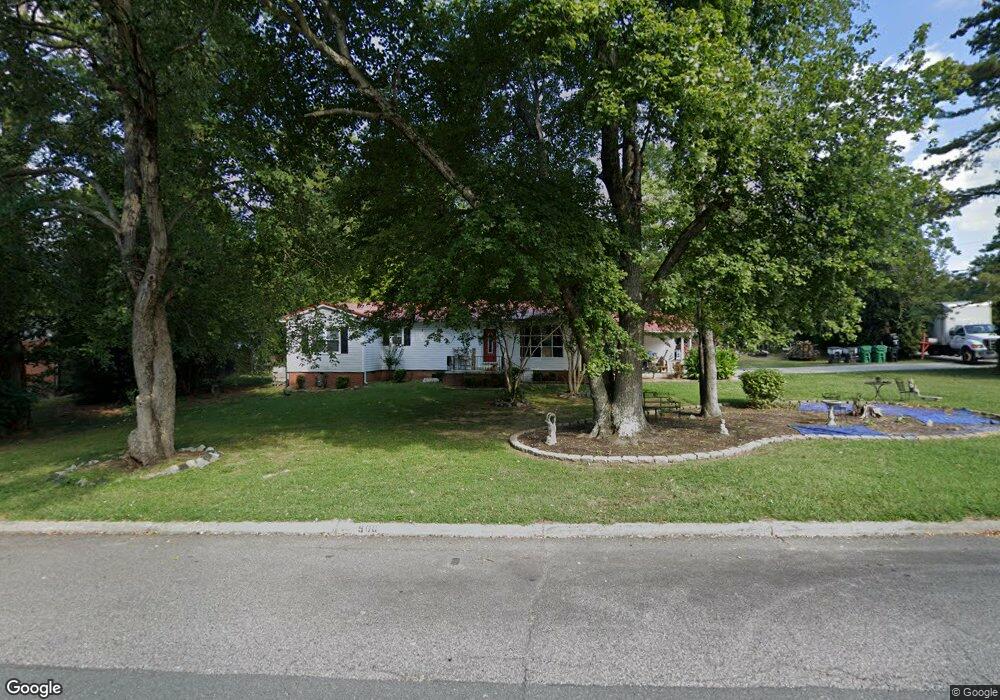
500 Rockspring Rd High Point, NC 27262
Greater High Point NeighborhoodEstimated Value: $241,409 - $410,000
3
Beds
3
Baths
2,000
Sq Ft
$153/Sq Ft
Est. Value
About This Home
This home is located at 500 Rockspring Rd, High Point, NC 27262 and is currently estimated at $305,102, approximately $152 per square foot. 500 Rockspring Rd is a home located in Guilford County with nearby schools including Oak View Elementary School, Ferndale Middle School, and High Point Central High School.
Ownership History
Date
Name
Owned For
Owner Type
Purchase Details
Closed on
May 9, 2012
Sold by
Denny Cleo and Denny Joyce
Bought by
Withers Lemont and Dockery Withers Alkeisha
Current Estimated Value
Purchase Details
Closed on
Jun 7, 2005
Sold by
Campagna Joseph M
Bought by
Denny Cleo
Purchase Details
Closed on
Mar 15, 2001
Sold by
Jurney Riaz Anthony
Bought by
Campagna Joseph M
Home Financials for this Owner
Home Financials are based on the most recent Mortgage that was taken out on this home.
Original Mortgage
$107,996
Interest Rate
7.09%
Mortgage Type
FHA
Create a Home Valuation Report for This Property
The Home Valuation Report is an in-depth analysis detailing your home's value as well as a comparison with similar homes in the area
Home Values in the Area
Average Home Value in this Area
Purchase History
| Date | Buyer | Sale Price | Title Company |
|---|---|---|---|
| Withers Lemont | $150,000 | None Available | |
| Denny Cleo | $93,712 | -- | |
| Campagna Joseph M | $112,000 | -- |
Source: Public Records
Mortgage History
| Date | Status | Borrower | Loan Amount |
|---|---|---|---|
| Previous Owner | Campagna Joseph M | $107,996 |
Source: Public Records
Tax History
| Year | Tax Paid | Tax Assessment Tax Assessment Total Assessment is a certain percentage of the fair market value that is determined by local assessors to be the total taxable value of land and additions on the property. | Land | Improvement |
|---|---|---|---|---|
| 2025 | $1,820 | $132,100 | $38,000 | $94,100 |
| 2024 | $1,820 | $132,100 | $38,000 | $94,100 |
| 2023 | $1,820 | $132,100 | $38,000 | $94,100 |
| 2022 | $2,056 | $132,100 | $38,000 | $94,100 |
| 2021 | $1,520 | $110,300 | $37,500 | $72,800 |
| 2020 | $1,520 | $110,300 | $37,500 | $72,800 |
| 2019 | $1,520 | $110,300 | $0 | $0 |
| 2018 | $1,512 | $110,300 | $0 | $0 |
| 2017 | $1,520 | $110,300 | $0 | $0 |
| 2016 | $1,827 | $130,300 | $0 | $0 |
| 2015 | $1,837 | $130,300 | $0 | $0 |
| 2014 | $1,869 | $130,300 | $0 | $0 |
Source: Public Records
Map
Nearby Homes
- 607 Rockspring Rd
- 1508 Wendover Dr
- 443 W Lexington Ave
- 417 Hillcrest Dr
- 1311 Prescott Place
- 1700 Long St
- 427 Woodbrook Dr
- 708 Rockspring Rd
- 510 Otteray Ave
- 207 Hillcrest Dr
- 914 Flicker Ln
- 1101 Robin Hood Rd
- 1507 Larkin St
- 630 Colonial Dr
- 1001 Nuthatch Ct
- 416 Greenwood Dr
- 1607 Larkin St
- 1602 Larkin St
- 1310 Madison St
- 803 Sunset Dr
- 504 Rockspring Rd
- 1407 Wendover Dr
- 416 Rockspring Rd
- 1409 Wendover Dr
- 508 Rockspring Rd
- 503 Rockspring Rd
- 501 Rockspring Rd
- 505 Rockspring Rd
- 511 Rockspring Rd
- 1410 Emerywood Dr
- 417 Rockspring Rd
- 1408 Wendover Dr
- 1408 Emerywood Dr
- 414 Rockspring Rd
- 1412 Emerywood Dr
- 415 Rockspring Rd
- 1415 Wendover Dr
- 1406 Emerywood Dr
- 1309 Wendover Dr
- 1410 Wendover Dr
Your Personal Tour Guide
Ask me questions while you tour the home.