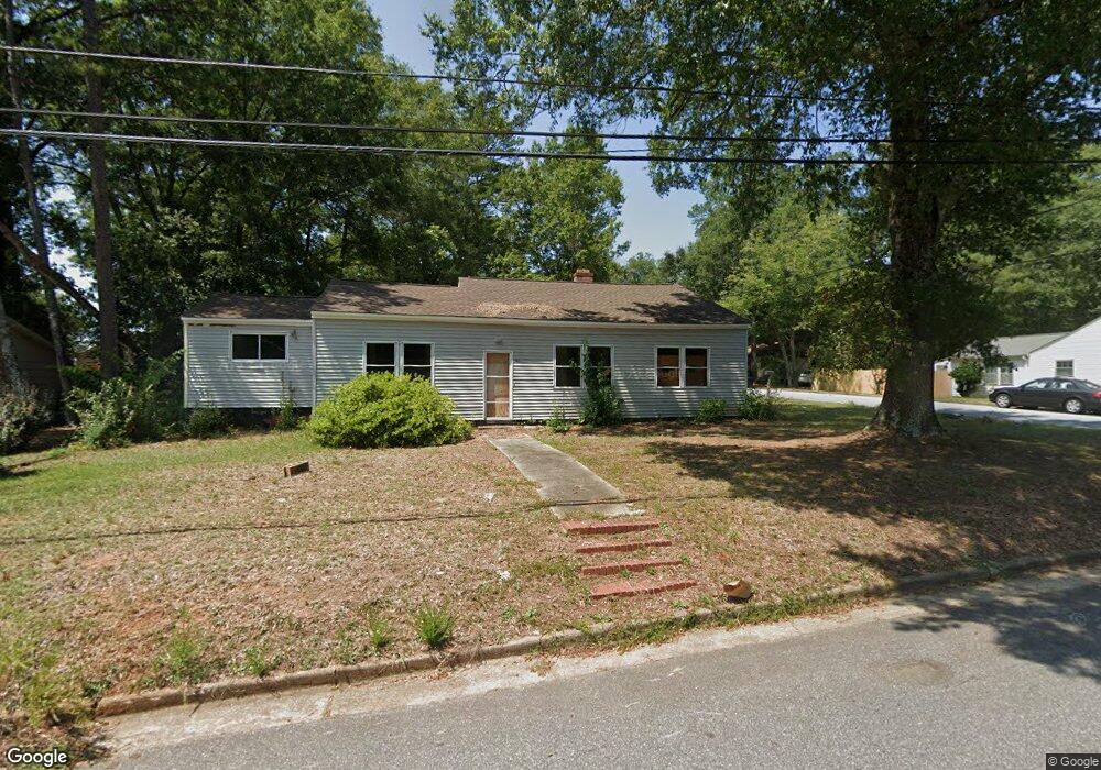
500 Rose Hill Anderson, SC 29624
Estimated Value: $66,277 - $164,000
--
Bed
--
Bath
1,561
Sq Ft
$78/Sq Ft
Est. Value
About This Home
This home is located at 500 Rose Hill, Anderson, SC 29624 and is currently estimated at $121,319, approximately $77 per square foot. 500 Rose Hill is a home with nearby schools including New Prospect Elementary School, Robert Anderson Middle School, and Westside High School.
Ownership History
Date
Name
Owned For
Owner Type
Purchase Details
Closed on
Jun 14, 2017
Sold by
Phillips Jason P and Hunter Jacky
Bought by
Wright Reginald R and Wrights Mary H
Current Estimated Value
Purchase Details
Closed on
Apr 19, 2017
Sold by
Anderson County
Bought by
Anderson County Forfeited Land Commissio
Purchase Details
Closed on
Oct 28, 2010
Sold by
Anderson County Forfeited Land Commissio
Bought by
County Of Anderson
Purchase Details
Closed on
Nov 30, 2009
Sold by
Snowden Matthew and Hunt Stacardo L
Bought by
Anderson County Forfeited Land Commissio
Purchase Details
Closed on
Jun 1, 2009
Sold by
Snowden William and Snowden Estelle
Bought by
Snowden Matthew
Create a Home Valuation Report for This Property
The Home Valuation Report is an in-depth analysis detailing your home's value as well as a comparison with similar homes in the area
Home Values in the Area
Average Home Value in this Area
Purchase History
| Date | Buyer | Sale Price | Title Company |
|---|---|---|---|
| Wright Reginald R | $100,000 | None Available | |
| Anderson County Forfeited Land Commissio | -- | None Available | |
| County Of Anderson | -- | -- | |
| Anderson County Forfeited Land Commissio | $5,867 | -- | |
| Snowden Matthew | -- | -- |
Source: Public Records
Tax History Compared to Growth
Tax History
| Year | Tax Paid | Tax Assessment Tax Assessment Total Assessment is a certain percentage of the fair market value that is determined by local assessors to be the total taxable value of land and additions on the property. | Land | Improvement |
|---|---|---|---|---|
| 2024 | $565 | $1,200 | $300 | $900 |
| 2023 | $565 | $1,200 | $300 | $900 |
| 2022 | $527 | $1,200 | $300 | $900 |
| 2021 | $499 | $1,000 | $300 | $700 |
| 2020 | $499 | $1,000 | $300 | $700 |
| 2019 | $499 | $1,000 | $300 | $700 |
| 2018 | $1,671 | $3,780 | $300 | $3,480 |
| 2017 | -- | $3,780 | $300 | $3,480 |
| 2016 | -- | $3,890 | $240 | $3,650 |
| 2015 | -- | $3,890 | $240 | $3,650 |
| 2014 | -- | $3,890 | $240 | $3,650 |
Source: Public Records
Map
Nearby Homes
- 404 Montague St
- 00 W Franklin St
- 0 W Franklin St
- 0 W Reed St
- 720 722 Gary St
- 902 W Market St
- 00 Ila St
- 1105 W Franklin St
- 111 Maxwell Ave
- 1103 Scott Dr
- 701 Delia St
- 701 Delia St Unit B
- 701 Delia St Unit A
- 413 W Market St
- 719 Dora Dr
- Lot 1 & 2 W Market St
- 107 Brown St
- 310 W Hampton St
- 308 W Hampton St
- 504 Rose Hill
- 414 Rose Hill
- 503 Rose Hill St
- 501 Cathcart Dr
- 503 Cathcart Dr
- 704 Armstrong St
- 503 Rose Hill
- 501 Rose Hill
- 505 Rose Hill St
- 505 Rose Hill
- 505 Cathcart Dr
- 506 Rose Hill
- 412 Rose Hill St
- 412 Rose Hill
- 413 Rose Hill
- 507 Rose Hill
- 412 Rose Hill
- 413 Cathcart Dr
- 507 Cathcart Dr
- 509 Rose Hill