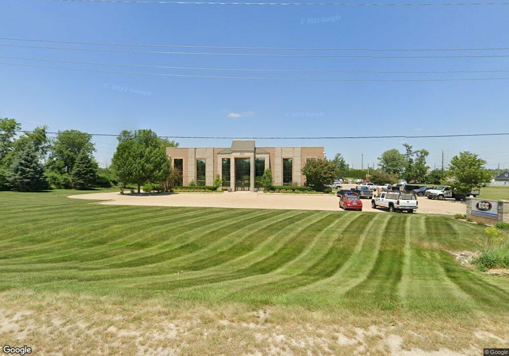
500 Tower Terrace Rd Unit C Cedar Rapids, IA 52411
--
Bed
4
Baths
33,243
Sq Ft
2.97
Acres
About This Home
This home is located at 500 Tower Terrace Rd Unit C, Cedar Rapids, IA 52411. 500 Tower Terrace Rd Unit C is a home located in Linn County with nearby schools including Hiawatha Elementary School, Harding Middle School, and John F. Kennedy High School.
Ownership History
Date
Name
Owned For
Owner Type
Purchase Details
Closed on
Apr 4, 2016
Sold by
Coeru Lc
Bought by
Eggleston Properties Llc
Purchase Details
Closed on
Sep 8, 2011
Sold by
Phantom Holdings Llc
Bought by
Coeru Lc
Home Financials for this Owner
Home Financials are based on the most recent Mortgage that was taken out on this home.
Original Mortgage
$1,760,000
Interest Rate
4.59%
Mortgage Type
Commercial
Create a Home Valuation Report for This Property
The Home Valuation Report is an in-depth analysis detailing your home's value as well as a comparison with similar homes in the area
Home Values in the Area
Average Home Value in this Area
Purchase History
| Date | Buyer | Sale Price | Title Company |
|---|---|---|---|
| Eggleston Properties Llc | -- | None Available | |
| Coeru Lc | $2,199,500 | None Available |
Source: Public Records
Mortgage History
| Date | Status | Borrower | Loan Amount |
|---|---|---|---|
| Previous Owner | Coeru Lc | $1,760,000 |
Source: Public Records
Tax History Compared to Growth
Tax History
| Year | Tax Paid | Tax Assessment Tax Assessment Total Assessment is a certain percentage of the fair market value that is determined by local assessors to be the total taxable value of land and additions on the property. | Land | Improvement |
|---|---|---|---|---|
| 2025 | $55,626 | $3,459,000 | $282,100 | $3,176,900 |
| 2024 | $46,730 | $2,189,300 | $282,100 | $1,907,200 |
| 2023 | $46,730 | $2,189,300 | $282,100 | $1,907,200 |
| 2022 | $49,644 | $1,916,800 | $217,000 | $1,699,800 |
| 2021 | $53,114 | $1,916,800 | $217,000 | $1,699,800 |
| 2020 | $53,114 | $1,984,700 | $217,000 | $1,767,700 |
| 2019 | $49,762 | $1,918,300 | $217,000 | $1,701,300 |
| 2018 | $50,108 | $1,918,300 | $217,000 | $1,701,300 |
| 2017 | $35,082 | $1,358,400 | $217,000 | $1,141,400 |
| 2016 | $36,850 | $1,323,600 | $217,000 | $1,106,600 |
| 2015 | $34,392 | $1,323,600 | $217,000 | $1,106,600 |
| 2014 | $35,126 | $1,323,600 | $217,000 | $1,106,600 |
| 2013 | $38,348 | $1,323,600 | $217,000 | $1,106,600 |
Source: Public Records
Map
Nearby Homes
- 2315 Hawkeye Dr
- 2905 Hawkeye Dr
- 2900 Hawkeye Dr
- 2910 Hawkeye Dr
- 560 Ryker St
- 2417 Fox Trail Dr NE
- 535 Hampton St
- 545 Hampton St
- 515 Hampton St
- 620 Hampton St
- 610 Hampton St
- 600 Hampton St
- 590 Hampton St
- 580 Hampton St
- 570 Hampton St
- 560 Hampton St
- 550 Hampton St
- 540 Hampton St
- 530 Hampton St
- 520 Hampton St
- 2722 Robins Rd
- 1725 Hawkeye Dr
- 2700 Stonegate Ct Unit 3
- 2700 Stonegate Ct Unit 2
- 2700 Stonegate Ct Unit 1
- 1719 Hawkeye Dr
- 1723 Hawkeye Dr
- 1711 Hawkeye Dr
- 1711 Hawkeye Dr
- 1711 Hawkeye Dr
- 2740 Stonegate Ct
- 2701 Robins Rd
- 2765 Stonegate Ct
- 2769 Stonegate Ct
- 2915 Hawkeye Dr
- 2756 Stonegate Ct
- 2760 Stonegate Ct
- 1705 Hawkeye Dr
- 2310 Robins Rd
- 1731 Hawkeye Dr