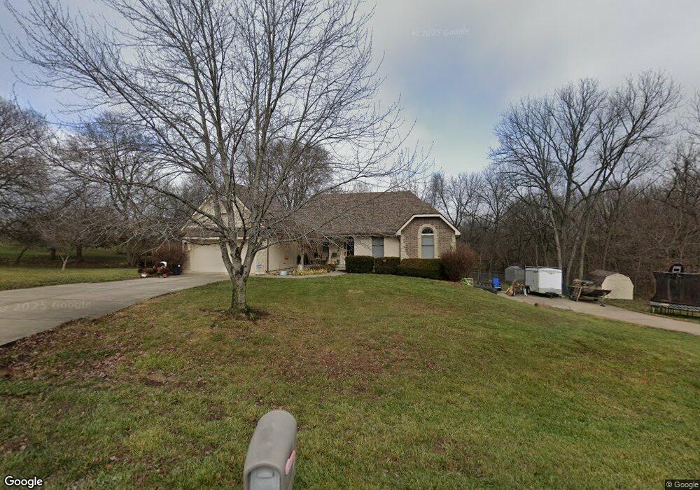
5000 Lisas Ln Smithville, MO 64089
Estimated Value: $473,000 - $538,000
3
Beds
4
Baths
1,840
Sq Ft
$271/Sq Ft
Est. Value
About This Home
This home is located at 5000 Lisas Ln, Smithville, MO 64089 and is currently estimated at $499,190, approximately $271 per square foot. 5000 Lisas Ln is a home located in Platte County with nearby schools including Maple Elementary School, Smithville Middle School, and Smithville High School.
Ownership History
Date
Name
Owned For
Owner Type
Purchase Details
Closed on
Mar 16, 2023
Sold by
Vansandt Lawrence Wayne and Vansandt Michelle
Bought by
Burris James M and Burris Tiffany N
Current Estimated Value
Home Financials for this Owner
Home Financials are based on the most recent Mortgage that was taken out on this home.
Original Mortgage
$296,432
Outstanding Balance
$260,901
Interest Rate
5.9%
Estimated Equity
$238,289
Create a Home Valuation Report for This Property
The Home Valuation Report is an in-depth analysis detailing your home's value as well as a comparison with similar homes in the area
Purchase History
| Date | Buyer | Sale Price | Title Company |
|---|---|---|---|
| Burris James M | -- | -- |
Source: Public Records
Mortgage History
| Date | Status | Borrower | Loan Amount |
|---|---|---|---|
| Open | Burris James M | $296,432 |
Source: Public Records
Tax History
| Year | Tax Paid | Tax Assessment Tax Assessment Total Assessment is a certain percentage of the fair market value that is determined by local assessors to be the total taxable value of land and additions on the property. | Land | Improvement |
|---|---|---|---|---|
| 2025 | $4,703 | $66,120 | $14,668 | $51,452 |
| 2024 | $4,508 | $66,120 | $14,668 | $51,452 |
| 2023 | $4,508 | $66,120 | $14,668 | $51,452 |
| 2022 | $4,312 | $61,222 | $14,668 | $46,554 |
| 2021 | $4,337 | $61,222 | $14,668 | $46,554 |
| 2020 | $3,873 | $54,323 | $9,500 | $44,823 |
| 2019 | $3,873 | $54,323 | $9,500 | $44,823 |
| 2018 | $3,945 | $54,323 | $9,500 | $44,823 |
| 2017 | $3,961 | $54,323 | $9,500 | $44,823 |
| 2016 | $3,500 | $54,323 | $9,500 | $44,823 |
| 2015 | $3,483 | $54,323 | $9,500 | $44,823 |
| 2013 | $3,476 | $55,515 | $0 | $0 |
Source: Public Records
Map
Nearby Homes
- 15145 Lakeport Ln
- 14655 Gale Rd
- 3910 Carter Dr
- 7610 Hoover Rd
- 205 Double Tree Ln
- 4905 NW 140th St
- 6620 NW 136th St
- 205 S Prairie Rose Cir
- 104 S Prairie Rose Cir
- 0 Smith Rd
- 92nd Smithville Rd
- 169 County Road F
- 4 State Route 92
- 0 169 & Commercial Ave N A Unit HMS2563488
- 0 Highway 169
- 205 Ashmont Dr
- 14838 Ashmont Ln
- 709 Ridge Dr
- 706 Woodland St
- 704 Woodland St
- 5000 Lisa's Ln
- 4894 Lisas Ln
- 5080 Lisas Ln
- 4995 Lisas Ln
- 5045 Lisas Ln
- 5080 Lisa's Ln
- 4945 Lisas Ln
- 15215 Terra Pulchra Dr
- 4890 Lisas Ln
- 4885 Lisas Ln
- 15260 Terra Pulchra Dr
- 5201 NW State Route 92
- 4830 Lisas Ln
- 15220 Terra Pulchra Dr
- 4835 Lisas Ln
- 15170 Lakeport Ln
- 4995 NW State Route 92
- 0 92 Hwy Unit 2127358
- 0 92 Hwy Unit 2090664
- 15175 Lakeport Ln
Your Personal Tour Guide
Ask me questions while you tour the home.